Kruszewiec-Kolonia is a village in the administrative district of Gmina Opoczno, within Opoczno County, Łódź Voivodeship, in central Poland.
Jawor is a village in the administrative district of Gmina Mniszków, within Opoczno County, Łódź Voivodeship, in central Poland.

Klew is a village in the administrative district of Gmina Żarnów, within Opoczno County, Łódź Voivodeship, in central Poland. It lies approximately 10 kilometres (6 mi) west of Żarnów, 25 km (16 mi) south-west of Opoczno, and 75 km (47 mi) south-east of the regional capital Łódź.
Ławki is a village in the administrative district of Gmina Żarnów, within Opoczno County, Łódź Voivodeship, in central Poland.
Ruszenice-Kolonia is a village in the administrative district of Gmina Żarnów, within Opoczno County, Łódź Voivodeship, in central Poland.
Brenik is a village in the administrative district of Gmina Żelechlinek, within Tomaszów Mazowiecki County, Łódź Voivodeship, in central Poland.
Gawerków is a village in the administrative district of Gmina Żelechlinek, within Tomaszów Mazowiecki County, Łódź Voivodeship, in central Poland. It lies approximately 3 kilometres (2 mi) east of Żelechlinek, 23 km (14 mi) north of Tomaszów Mazowiecki, and 42 km (26 mi) east of the regional capital Łódź.
Józefin is a village in the administrative district of Gmina Żelechlinek, within Tomaszów Mazowiecki County, Łódź Voivodeship, in central Poland. It lies approximately 5 kilometres (3 mi) north-east of Żelechlinek, 27 km (17 mi) north of Tomaszów Mazowiecki, and 42 km (26 mi) east of the regional capital Łódź.
Julianów is a village in the administrative district of Gmina Żelechlinek, within Tomaszów Mazowiecki County, Łódź Voivodeship, in central Poland. It lies approximately 4 kilometres (2 mi) south-east of Żelechlinek, 21 km (13 mi) north of Tomaszów Mazowiecki, and 44 km (27 mi) east of the regional capital Łódź.
Budy-Dobry Widok is a village in the administrative district of Gmina Fałków, within Końskie County, Świętokrzyskie Voivodeship, in south-central Poland.
Budy-Szpinek is a village in the administrative district of Gmina Fałków, within Końskie County, Świętokrzyskie Voivodeship, in south-central Poland.
Budy-Szreniawa is a village in the administrative district of Gmina Fałków, within Końskie County, Świętokrzyskie Voivodeship, in south-central Poland.
Zakrzewska Wola is a village in the administrative district of Gmina Grójec, within Grójec County, Masovian Voivodeship, in east-central Poland.
Rosochów is a village in the administrative district of Gmina Belsk Duży, within Grójec County, Masovian Voivodeship, in east-central Poland.
Lasopole is a village in the administrative district of Gmina Chynów, within Grójec County, Masovian Voivodeship, in east-central Poland.
Józefów is a village in the administrative district of Gmina Nowe Miasto nad Pilicą, within Grójec County, Masovian Voivodeship, in east-central Poland.
Wólka Załęska is a village in the administrative district of Gmina Pniewy, within Grójec County, Masovian Voivodeship, in east-central Poland.
Podlindowo is a village in the administrative district of Gmina Mszczonów, within Żyrardów County, Masovian Voivodeship, in east-central Poland.
Stary Łajszczew is a village in the administrative district of Gmina Puszcza Mariańska, within Żyrardów County, Masovian Voivodeship, in east-central Poland.
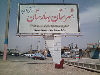
Baharestan County is a county in Tehran Province in Iran. The capital of the county is Nasim Shahr. The county has one district: the Central District. The county has three cities: Nasimshahr, Golestan and Salehieh. The county was formed in 2011 from the Baharestan District and parts of Golestan District, from Robat Karim County.


