Górki is a village in the administrative district of Gmina Borowa, within Mielec County, Subcarpathian Voivodeship, in south-eastern Poland. It lies approximately 7 kilometres (4 mi) west of Borowa, 16 km (10 mi) north-west of Mielec, and 65 km (40 mi) north-west of the regional capital Rzeszów.
Breń Osuchowski is a village in the administrative district of Gmina Czermin, within Mielec County, Subcarpathian Voivodeship, in south-eastern Poland. It lies approximately 6 kilometres (4 mi) west of Czermin, 13 km (8 mi) west of Mielec, and 62 km (39 mi) north-west of the regional capital Rzeszów.

Gawłuszowice is a village in Mielec County, Subcarpathian Voivodeship, in south-eastern Poland. It is the seat of the gmina called Gmina Gawłuszowice. It lies approximately 16 kilometres (10 mi) north of Mielec and 62 km (39 mi) north-west of the regional capital Rzeszów.
Młodochów is a village in the administrative district of Gmina Gawłuszowice, within Mielec County, Subcarpathian Voivodeship, in south-eastern Poland. It lies approximately 4 kilometres (2 mi) south-east of Gawłuszowice, 13 km (8 mi) north of Mielec, and 59 km (37 mi) north-west of the regional capital Rzeszów.
Ostrówek is a village in the administrative district of Gmina Gawłuszowice, within Mielec County, Subcarpathian Voivodeship, in south-eastern Poland. It lies approximately 3 kilometres (2 mi) west of Gawłuszowice, 16 km (10 mi) north of Mielec, and 64 km (40 mi) north-west of the regional capital Rzeszów.
Wola Zdakowska is a village in the administrative district of Gmina Gawłuszowice, within Mielec County, Subcarpathian Voivodeship, in south-eastern Poland. It lies approximately 3 kilometres (2 mi) east of Gawłuszowice, 15 km (9 mi) north of Mielec, and 60 km (37 mi) north-west of the regional capital Rzeszów.
Boża Wola is a village in the administrative district of Gmina Mielec, within Mielec County, Subcarpathian Voivodeship, in south-eastern Poland. It lies approximately 4 kilometres (2 mi) south of Mielec and 48 km (30 mi) north-west of the regional capital Rzeszów.
Goleszów is a village in the administrative district of Gmina Mielec, within Mielec County, Subcarpathian Voivodeship, in south-eastern Poland. It lies approximately 6 kilometres (4 mi) south of Mielec and 47 km (29 mi) north-west of the regional capital Rzeszów.
Książnice is a village in the administrative district of Gmina Mielec, within Mielec County, Subcarpathian Voivodeship, in south-eastern Poland. It lies approximately 4 kilometres (2 mi) south of Mielec and 49 km (30 mi) north-west of the regional capital Rzeszów.
Rydzów is a village in the administrative district of Gmina Mielec, within Mielec County, Subcarpathian Voivodeship, in south-eastern Poland. It lies approximately 9 kilometres (6 mi) south-west of Mielec and 52 km (32 mi) north-west of the regional capital Rzeszów.
Pierzchne is a village in the administrative district of Gmina Padew Narodowa, within Mielec County, Subcarpathian Voivodeship, in south-eastern Poland. It lies approximately 3 kilometres (2 mi) south-west of Padew Narodowa, 16 km (10 mi) north of Mielec, and 57 km (35 mi) north-west of the regional capital Rzeszów.
Zachwiejów is a village in the administrative district of Gmina Padew Narodowa, within Mielec County, Subcarpathian Voivodeship, in south-eastern Poland. It lies approximately 4 kilometres (2 mi) south-east of Padew Narodowa, 17 km (11 mi) north-east of Mielec, and 54 km (34 mi) north-west of the regional capital Rzeszów.
Zarównie is a village in the administrative district of Gmina Padew Narodowa, within Mielec County, Subcarpathian Voivodeship, in south-eastern Poland. It lies approximately 4 kilometres (2 mi) south-east of Padew Narodowa, 17 km (11 mi) north-east of Mielec, and 55 km (34 mi) north-west of the regional capital Rzeszów.
Żarówka is a village in the administrative district of Gmina Radomyśl Wielki, within Mielec County, Subcarpathian Voivodeship, in south-eastern Poland. It lies approximately 5 kilometres (3 mi) south-west of Radomyśl Wielki, 20 km (12 mi) south-west of Mielec, and 58 km (36 mi) west of the regional capital Rzeszów.
Zdziarzec is a village in the administrative district of Gmina Radomyśl Wielki, within Mielec County, Subcarpathian Voivodeship, in south-eastern Poland. It lies approximately 4 kilometres (2 mi) south of Radomyśl Wielki, 18 km (11 mi) south-west of Mielec, and 55 km (34 mi) west of the regional capital Rzeszów.
Kawęczyn is a village in the administrative district of Gmina Wadowice Górne, within Mielec County, Subcarpathian Voivodeship, in south-eastern Poland. It lies approximately 4 kilometres (2 mi) north of Wadowice Górne, 12 km (7 mi) west of Mielec, and 61 km (38 mi) north-west of the regional capital Rzeszów.
Piątkowiec is a village in the administrative district of Gmina Wadowice Górne, within Mielec County, Subcarpathian Voivodeship, in south-eastern Poland. It lies approximately 5 kilometres (3 mi) east of Wadowice Górne, 7 km (4 mi) west of Mielec, and 54 km (34 mi) north-west of the regional capital Rzeszów.

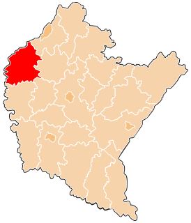
Wadowice Górne is a village in Mielec County, Subcarpathian Voivodeship, in south-eastern Poland. It is the seat of the gmina called Gmina Wadowice Górne. It lies approximately 11 kilometres (7 mi) west of Mielec and 58 km (36 mi) north-west of the regional capital Rzeszów.
Wampierzów is a village in the administrative district of Gmina Wadowice Górne, within Mielec County, Subcarpathian Voivodeship, in south-eastern Poland. It lies approximately 4 kilometres (2 mi) north of Wadowice Górne, 12 km (7 mi) west of Mielec, and 61 km (38 mi) north-west of the regional capital Rzeszów.
Wola Wadowska is a village in the administrative district of Gmina Wadowice Górne, within Mielec County, Subcarpathian Voivodeship, in south-eastern Poland. It lies approximately 8 kilometres (5 mi) west of Wadowice Górne, 18 km (11 mi) west of Mielec, and 65 km (40 mi) north-west of the regional capital Rzeszów.