Point Hannon

Last updated

Point Hannon, also known as Whiskey Spit, is a 7.7-acre (31,000 m2) sand spit with 1,775 feet (541 m) of no-bank shoreline, jutting out from the eastern edge of Hood Head, in the Hood Canal of the state of Washington. For surface navigation, Point Hannon is marked by a light. The low sandy spit with shoal water extends about 600 feet (180 m) east of the light. The open waters to the North of the spit, are among the deepest in Puget Sound. Local magnetic disturbances of more than 2° from normal variation have been observed in Hood Canal at Point Hannon.

Spit (landform) A coastal bar or beach landform deposited by longshore drift

A spit or sandspit is a deposition bar or beach landform off coasts or lake shores. It develops in places where re-entrance occurs, such as at a cove's headlands, by the process of longshore drift by longshore currents. The drift occurs due to waves meeting the beach at an oblique angle, moving sediment down the beach in a zigzag pattern. This is complemented by longshore currents, which further transport sediment through the water alongside the beach. These currents are caused by the same waves that cause the drift.

Hood Canal fjord

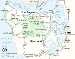
Hood Canal is a fjord forming the western lobe, and one of the four main basins, of Puget Sound in the state of Washington. It is one of the minor bodies of water that constitute the Salish Sea. Hood Canal is not a canal in the sense of being a man-made waterway—it is a natural waterway.

Washington (state) State of the United States of America

Washington, officially the State of Washington, is a state in the Pacific Northwest region of the United States. Named for George Washington, the first president of the United States, the state was made out of the western part of the Washington Territory, which was ceded by Britain in 1846 in accordance with the Oregon Treaty in the settlement of the Oregon boundary dispute. It was admitted to the Union as the 42nd state in 1889. Olympia is the state capital; the state's largest city is Seattle. Washington is sometimes referred to as Washington State to distinguish it from Washington, D.C., the capital of the United States.

Whiskey Spit has been a meeting point for native peoples, mariners, fishers, and loggers for hundreds of years. Port Gamble S'Klallum and Lower Elwha S'Klallum members tell of Tribal Gatherings, ceremonies, and ancestral canoe burials, as well as regular trapping, hunting, and fishing endeavors going back far beyond the first documented visits made by European explorers to Point Hannon in the 1790s, and continuing to the present day. Shanghaied crew aboard inbound clippers, loggers, and other freighters were waylaid at Whiskey Spit so that they would not escape, and they were replaced by Native crews for the remainder of the sail into Puget Sound and back. At peaks in logging and wartime military activity, Whiskey Spit has functioned as billet, brothel, speakeasy, and casino. Artifacts and relics should not be removed from the site.

Puget Sound sound along the northwestern coast of the U.S. state of Washington

Puget Sound is a sound along the northwestern coast of the U.S. state of Washington, an inlet of the Pacific Ocean, and part of the Salish Sea. It is a complex estuarine system of interconnected marine waterways and basins, with one major and two minor connections to the open Pacific Ocean via the Strait of Juan de Fuca—Admiralty Inlet being the major connection and Deception Pass and Swinomish Channel being the minor.

Whiskey Spit offers panoramic views of the Cascade Mountains, stretching from Mount Baker to Mount Rainier. With its sand dollar colony, moon snails, food sources for threatened salmon, and sea lion, harbor seal, gray whale, orca whale, harbor porpoise, bottlenose dolphin, muskrat, and river otter visitors, the spit is one of Washington's most special protected shorelines. The delicate freshwater marsh on the point provides the unique habitat requirements for the unusually wide range of nesting shore birds, migrating waterfowl, reptiles and amphibians, prey for the osprey, eagle, heron, and raven populations, and the essential foods for the plentiful sand lance and surf smelt.

Mount Baker Stratovolcano in Washington state, United States

Mount Baker, also known as Koma Kulshan or simply Kulshan, is a 10,781 ft (3,286 m) active glaciated andesitic stratovolcano in the Cascade Volcanic Arc and the North Cascades of Washington in the United States. Mount Baker has the second-most thermally active crater in the Cascade Range after Mount Saint Helens. About 31 miles (50 km) due east of the city of Bellingham, Whatcom County, Mount Baker is the youngest volcano in the Mount Baker volcanic field. While volcanism has persisted here for some 1.5 million years, the current glaciated cone is likely no more than 140,000 years old, and possibly no older than 80–90,000 years. Older volcanic edifices have mostly eroded away due to glaciation.

Mount Rainier stratovolcano in the U.S. state of Washington

Mount Rainier, also known as Tahoma or Tacoma, is a large active stratovolcano located 59 miles (95 km) south-southeast of Seattle, in the Mount Rainier National Park. With a summit elevation of 14,411 ft (4,392 m), it is the highest mountain in the U.S. state of Washington, and of the Cascade Range of the Pacific Northwest, it is the most topographically prominent mountain in the continental United States and the first in the Cascade Volcanic Arc.

Sand dollar Order of irregular sea urchins

The term sand dollar refers to species of extremely flattened, burrowing sea urchins belonging to the order Clypeasteroida. Some species within the order, not quite as flat, are known as sea biscuits.

In May 2002, The Trust for Public Land conveyed the property to the Washington State Park System for permanent protection. A water access primitive campground was planned for state park land on Point Hannon, but the Friends of Point Hannon, North Olympic Salmon Coalition, Coastal Observation and Seabird Survey Team, Admiralty Audubon, Washington State Audubon Society, supporters of the Olympic Coast National Marine Sanctuary, and Northwest Water Resources oppose the conditional use permit and oppose exemption under the Jefferson County Shoreline Master Program.

The Trust for Public Land is a U.S. nonprofit organization with a mission to "create parks and protect land for people, ensuring healthy, livable communities for generations to come." Since its founding in 1972, The Trust for Public Land has completed 5,000 park-creation and land conservation projects across the United States, protected over 3 million acres, and helped pass more than 500 ballot measures--creating $70 billion in voter-approved public funding for parks and open spaces. The Trust for Public Land also researches and publishes authoritative data about parks, open space, conservation finance, and urban climate change adaptation. Headquartered in San Francisco, the organization is among the largest U.S. conservation nonprofits, with approximately 30 field offices across the U.S., including a federal affairs function in Washington, D.C.

Washington State Park System

The Washington State Park System is a set of state parks owned by the state government of Washington, USA. They are managed by the Washington State Parks and Recreation Commission. As of 2012, the parks are primarily funded through usage fees. There are over 100 parks throughout the state, including 19 marine parks and 11 Historical Parks.

Olympic Coast National Marine Sanctuary marine protected area in Washington state, USA

The Olympic Coast National Marine Sanctuary is one of 14 marine sanctuaries administered by the National Oceanic and Atmospheric Administration (NOAA), an agency of the U.S. Department of Commerce. It is located along the Olympic Peninsula of Washington state. The sanctuary was declared in 1994 and encompasses 3,189 square miles (8,260 km2) of the Pacific Ocean from Cape Flattery in the north, to the mouth of the Copalis River, a distance of about 162.5 miles (261.5 km). Extending 25 to 40 miles from the shore, it includes most of the continental shelf, as well as parts of three important submarine canyons, the Nitinat Canyon, the Quinault Canyon and the Juan de Fuca Canyon. For 64 miles (103 km) along the coast, the sanctuary shares stewardship with the Olympic National Park. The sanctuary overlays the Flattery Rocks, Quillayute Needles, and Copalis Rock National Wildlife Refuges.

See also

Coordinates: 47°53′13″N122°36′37″W / 47.88694°N 122.61028°W / 47.88694; -122.61028

Geographic coordinate system Coordinate system

A geographic coordinate system is a coordinate system that enables every location on Earth to be specified by a set of numbers, letters or symbols. The coordinates are often chosen such that one of the numbers represents a vertical position and two or three of the numbers represent a horizontal position; alternatively, a geographic position may be expressed in a combined three-dimensional Cartesian vector. A common choice of coordinates is latitude, longitude and elevation. To specify a location on a plane requires a map projection.


Related Research Articles

Lake Washington Ship Canal canal in Seattle, Washington, United States of America

The Lake Washington Ship Canal, which runs through the city of Seattle, connects the fresh water body of Lake Washington with the salt water inland sea of Puget Sound. The Hiram M. Chittenden Locks accommodate the approximately 20-foot (6.1 m) difference in water level between Lake Washington and the sound. The canal runs east–west and connects Union Bay, the Montlake Cut, Portage Bay, Lake Union, the Fremont Cut, Salmon Bay, and Shilshole Bay, which is part of the sound.

Fremont Cut

The Fremont Cut is a canal that is part of the Lake Washington Ship Canal that links Lake Washington to Puget Sound through Seattle, Washington. The Fremont Cut connects Lake Union to the east with Salmon Bay to the west. It is 5,800 feet (1,800 m) long and 270 feet (82 m) wide. The center channel is 100 feet (30 m) wide and 30 feet (9.1 m) deep.

Salmon Bay Bay between Ballard and Magnolia in Seattle

Salmon Bay is a portion of the Lake Washington Ship Canal—a canal which passes through the city of Seattle, linking Lake Washington to Puget Sound—that lies west of the Fremont Cut. It is the westernmost section of the canal, and empties into Puget Sound's Shilshole Bay. Because of the Hiram M. Chittenden Locks, the smaller, western half of the bay is salt water, and the eastern half is fresh water. Before construction of the Ship Canal, Salmon Bay was entirely salt water.

Olympic Peninsula peninsula

The Olympic Peninsula is the large arm of land in western Washington that lies across Puget Sound from Seattle, and contains Olympic National Park. It is bounded on the west by the Pacific Ocean, the north by the Strait of Juan de Fuca, and the east by Hood Canal. Cape Alava, the westernmost point in the contiguous United States, and Cape Flattery, the northwesternmost point, are on the peninsula. Comprising about 3600 square miles, the Olympic Peninsula contained many of the last unexplored places in the Contiguous United States. It remained largely unmapped until Arthur Dodwell and Theodore Rixon mapped most of its topography and timber resources between 1898 and 1900.

Kitsap Peninsula region of Washington, USA

The Kitsap Peninsula lies west of Seattle across Puget Sound, in Washington state in the northwestern US. Hood Canal separates the peninsula from the Olympic Peninsula on its west side. The peninsula, a.k.a. "the Kitsap", encompasses all of Kitsap County except Bainbridge and Blake Islands, as well as the northeastern part of Mason County and the northwestern part of Pierce County. The highest point on the Kitsap Peninsula is Gold Mountain. The U.S. Navy's Puget Sound Naval Shipyard, and Naval Base Kitsap are on the Peninsula. Its main city is Bremerton.

Salmon Bay Bridge rail bridge in Seattle

The Salmon Bay Bridge, also known as Bridge No. 4, is a single-leaf bascule bridge spanning across Salmon Bay and connecting Magnolia/Interbay to Ballard in Seattle, Washington. The bridge is located just west of Commodore Park. It carries the main line of the BNSF Railway on its way north to Everett and south to King Street Station and Seattle's Industrial District.

Environmental issues in Puget Sound

Puget Sound is a deep inlet of the Pacific Ocean in Washington, extending south from the Strait of Juan de Fuca through Admiralty Inlet. It was explored and named by Captain George Vancouver for his aide, Peter Puget, in 1792.

Matthews Beach, Seattle Neighborhood in Seattle

Matthews Beach is a neighborhood in Seattle, Washington; it and Meadowbrook are the southern neighborhoods of the annexed township of Lake City (1954). Matthews Beach lies about 2 miles (3 km) northeast of the University of Washington, about 8 miles (13 km) northeast of Downtown.

Beckett Point is a small sand spit jutting out into northeastern Discovery Bay, about ten miles from the city of Port Townsend in Jefferson County, Washington, United States. The Point is owned by the Beckett Point Fisherman's Club, which leases out approximately 100 homes. Many of the families have lived there for several generations, fishing salmon, crab, and shrimp.

Quartermaster Harbor bay of Puget Sound, on Vashon Island

Quartermaster Harbor is a small harbor located in southern Puget Sound, in Vashon Island, Washington State.

Saratoga Passage

Saratoga Passage lies in Puget Sound between Whidbey Island and Camano Island.

The Manette Peninsula is a headland that is part of the larger Kitsap Peninsula, located on the eastern flank of the Kitsap Peninsula, in western Washington (state), USA.

Dungeness National Wildlife Refuge protected area

The Dungeness National Wildlife Refuge is located near the town of Sequim in Clallam County in the U.S. state of Washington, on the Strait of Juan de Fuca. The refuge is composed of 772.52 acres (312.63 ha) which include Dungeness Spit, Graveyard Spit, and portions of Dungeness Bay and Harbor. Dungeness Spit is one of the world's longest natural sand spits, 6.8 miles (10.9 km) long and very narrow. A lighthouse, the New Dungeness Light, built in 1857, is located near the end of the spit. Access to Dungeness Spit is through a Clallam County Park which has hiking trails, picnic areas, and a campground. On January 20, 1915, it was designated as a National Wildlife Refuge by President Woodrow Wilson.

The environmental issues on Maury Island are linked to broader Puget Sound environmental issues, which include concerns regarding declining salmon and forage fish populations, degrading critical marine and shoreline habitats, and threatened species such as the Orca.

Boeing Creek stream in Shoreline, United States of America

Boeing Creek is a stream in the U.S. state of Washington, located in the city of Shoreline, just north of Seattle. It is about 1.6 miles (2.6 km) long and empties into Puget Sound. The creek is heavily modified along its course, and in many places has been diverted into culverts. The watershed of Boeing Creek is about 11.2 square miles (29 km2) in size, with two main tributaries aside from the mainstem. The creek takes its name from William Boeing, who built a mansion along the creek in 1913. Despite the river modifications and stormwater pollution, the creek supports a variety of riparian habitats, native animals and fishes.

Shine Tidelands State Park

Shine Tidelands State Park is a 249-acre (101 ha) Washington state park located in Jefferson County, seven miles (11 km) south of Port Ludlow. The park has 5,000 feet (1,500 m) of shoreline on Bywater Bay adjacent to the west end of the Hood Canal Bridge and offers activities including picnicking, fishing, shellfish harvesting, beachcombing, birdwatching, windsurfing, and wildlife viewing. In 2014, the park was expanded to include the former Wolfe and Point Hannon properties.

Naval Station Puget Sound is a former United States Naval station located on Sand Point in Seattle, Washington. Today, the land is occupied by Magnuson Park.

South Puget Sound

South Puget Sound is the southern reaches of Puget Sound in Southwest Washington, in the United States' Pacific Northwest. It is one of five major basins encompassing the entire Sound, and the shallowest basin, with a mean depth of 37 meters (121 ft). Exact definitions of the region vary: the state's Department of Fish and Wildlife counts all of Puget Sound south of the Tacoma Narrows for fishing regulatory purposes. The same agency counts Mason, Jefferson, Kitsap, Pierce and Thurston Counties for wildlife management. The state's Department of Ecology defines a similar area south of Colvos Passage.