Related Research Articles
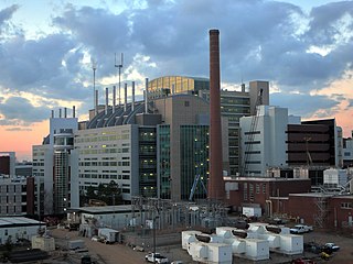
Druid Hills is a community which includes both a census-designated place (CDP) in unincorporated DeKalb County, Georgia, United States, as well as a neighborhood of the city of Atlanta. The CDP's population was 14,568 at the 2010 census. The CDP formerly contained the main campus of Emory University and the Centers for Disease Control and Prevention (CDC); they were annexed by Atlanta in 2018. The Atlanta-city section of Druid Hills is one of Atlanta's most affluent neighborhoods with a mean household income in excess of $238,500.
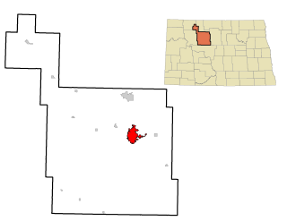
Minot is a city in and the county seat of Ward County, North Dakota, United States, in the state's north-central region. It is most widely known for the Air Force base approximately 15 miles (24 km) north of the city. With a population of 48,377 at the 2020 census. Minot is the state's fourth-largest city and a trading center for a large part of northern North Dakota, southwestern Manitoba, and southeastern Saskatchewan. Founded in 1886 during the construction of James J. Hill's Great Northern Railway, Minot is also known as "Magic City", commemorating its remarkable growth in size over a short time.
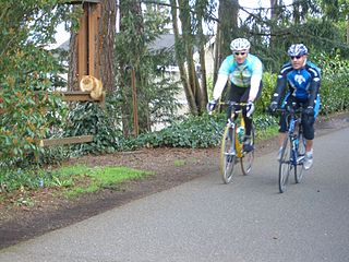
The Burke–Gilman Trail is a rail trail in King County, Washington. The 27-mile (43 km) multi-use recreational trail is part of the King County Regional Trail System and occupies an abandoned Seattle, Lake Shore and Eastern Railway corridor.
The Central Area, commonly called the Central District or The CD, is a mostly residential district in Seattle located east of downtown and First Hill ; west of Madrona, Leschi and Mt. Baker; south of Capitol Hill, and north of Rainier Valley. Historically, the Central District has been one of Seattle's most racially and ethnically diverse neighborhoods, and was once the center of Seattle's black community and a major hub of African-American businesses.

Delridge is a district in West Seattle, Washington, United States that stretches along Delridge Way, an arterial that follows the eastern slope of the valley of Longfellow Creek, from near its source just within the southern city limits north to the West Seattle Bridge over the Duwamish River.

Wisconsin Avenue is a major thoroughfare in Washington, D.C., and its Maryland suburbs. The southern terminus begins in Georgetown just north of the Potomac River, at an intersection with K Street under the elevated Whitehurst Freeway. The section of Wisconsin Avenue in Georgetown was called High Street before the street names in Georgetown were changed in 1895 to conform to those of the L'Enfant Plan for the federal city.
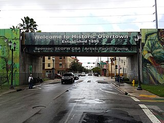
Overtown is a neighborhood of Miami, Florida, United States, just northwest of Downtown Miami. Originally called Colored Town during the Jim Crow era of the late 19th through the mid-20th century, the area was once the preeminent and is the historic center for commerce in the black community in Miami and South Florida.
MSU Dome is a 10,000-seat multi-purpose arena on 11th Ave NW in Minot, North Dakota. Built in the early 1980s, is home to the Minot State University Beavers basketball team. It is also regularly used for the Prairie Rose State Games, Regional Special Olympics, Math Track Meets, and Minot High School and MSU graduation ceremonies. The MSU Dome is also home to several North Dakota High School Championships each year, of these the North Dakota State Class B Basketball Championship is the biggest attraction to Minot and the Dome.
Hawthorne Hills is a residential neighborhood in Seattle, Washington. It is officially split between the neighborhoods of Bryant and Windermere, but is generally recognized as a distinct neighborhood. The northern boundary is Northeast 65th Street. The southern and eastern boundary is Sand Point Way. The western boundary is 40th Avenue Northeast. Hawthorne Hills is bounded on the north by View Ridge, on the east by Windermere, on the south by Laurelhurst, and on the west by Bryant. There is a sign for the neighborhood along Sand Point Way.
Minot City Transit, also known as City Bus, is a fixed-route public transport service in the city of Minot, North Dakota.
The City of Oklahoma City uses Special Zoning Districts as a tool to maintain the character of many neighborhood communities.
Midtown is a geographic area of Omaha, Nebraska that is a culturally, socially and economically important area of the city. It is home to major research centers, national corporations, several historic districts, and a number of historic residences.
The geography of Minot, North Dakota is treated extensively in this article.

This is a list of the LGM-30 Minuteman missile Missile Alert Facilities and Launch Facilities of the 91st Missile Wing, 20th Air Force, assigned to Minot AFB, North Dakota.

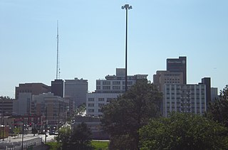
Downtown Minot is the central business district of Minot, North Dakota, located south of the Souris River in the Souris Valley. Downtown is the site of the first permanent settlement in Minot in 1886. Downtown is home to many of Minot's cultural sites of interest. It is also home to numerous galleries, stores and restaurants. The Minot Riverwalk traverses the downtown.

North Hill is a neighborhood in Minot, North Dakota, located north of the Souris River, above the Souris River Valley. It is a primarily residential neighborhood, though there are industries and businesses in the area, primarily along North Broadway and 21st Ave NW. North Hill is also home to Minot International Airport.

South Hill is a neighborhood in Minot, North Dakota, located south of the Souris River, above the Souris River Valley. It is a primarily residential neighborhood, although there are commercial zones along South Broadway, Twentieth Avenue South and around the Dakota Square Mall.
Upper Brooklyn or Brooklyn Heights is a neighborhood on South Hill in Minot, North Dakota. The neighborhood consists of the sections of the Brooklyn Addition that are not part of Downtown Minot. The High Third neighborhood, the Lower Brooklyn neighborhood and the area around the Minot Municipal Auditorium, which were part of the Brooklyn Addition, are considered part of the downtown area. Upper Brooklyn is bordered by downtown and the BNSF railroad tracks to the north, Minot High School's Magic City Campus to the west, Eleventh Avenue SW to the south and South Broadway and Lower Brooklyn to the east. The neighborhood is approximately 0.46 square kilometers. The neighborhood is home to the Scandinavian Heritage Park and Jim Hill Middle School.
Northwest Portland is one of the sextants of Portland, Oregon.
References
- ↑ "Minot Parks District". Archived from the original on 2011-10-10. Retrieved 2013-07-02.
- ↑ "St. Alexius Medical Clinic". Archived from the original on 2012-06-27. Retrieved 2013-07-02.
- ↑ "Minot's Top Employers 1st Quarter, 2013" (PDF). 2013. Archived from the original (PDF) on 2016-03-04. Retrieved 2013-03-20.
Coordinates: 48°15′53″N101°18′09″W / 48.26460°N 101.30245°W