Poles River

Last updated
Poles
"Rivière des Pôles" (in French)
Nottaway map.png
Watershed of Nottaway River
Location
Country Canada
Province Quebec
Region Eeyou Istchee Baie-James (municipality)
Physical characteristics
SourceUnidentified lake
 - location Eeyou Istchee Baie-James (municipality), Nord-du-Québec, Quebec
 - coordinates 51°05′54″N76°22′47″W / 51.09833°N 76.37972°W / 51.09833; -76.37972
 - elevation268 m (879 ft)
Mouth Evans Lake
 - location
Eeyou Istchee Baie-James (municipality), Nord-du-Québec, Quebec
 - coordinates
51°01′08″N76°37′35″W / 51.01889°N 76.62639°W / 51.01889; -76.62639 Coordinates: 51°01′08″N76°37′35″W / 51.01889°N 76.62639°W / 51.01889; -76.62639
 - elevation
241 m (791 ft)
Length30.3 km (18.8 mi) [1]

The Poles River is a tributary of Evans Lake in Regional County Municipality (RCM) of Eeyou Istchee Baie-James (municipality) in the area of the Nord-du-Québec, Canadian province of Quebec, in Canada.

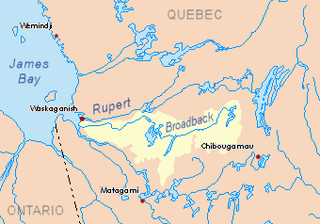
Lake Evans is a freshwater lake in the municipality of Eeyou Istchee James Bay, in the administrative region of Nord-du-Québec, in western Quebec, Canada. This lake is crossed by the Broadback River.

Baie-James Municipality in Quebec, Canada

The Municipality of Baie-James was a municipality in northern Quebec, Canada, which existed from 1971 to 2012. Located to the east of James Bay, Baie-James covered 297,332.84 km2 (114,800.85 sq mi) of land, making it the largest incorporated municipality in Canada — only eight unorganized territories were larger. Its territory almost entirely covered the administrative region of Jamésie, although it contained less than five percent of the population. Essentially, it was the remainder of the Jamésie Territory's land after all of the major population centres were removed.

Nord-du-Québec Place in Quebec, Canada

Nord-du-Québec is the largest, but the least populous, of the seventeen administrative regions of Quebec, Canada. With nearly 750,000 square kilometres (290,000 sq mi) of land area, and very extensive lakes and rivers, it covers much of the Labrador Peninsula and about 55% of the total land surface area of Quebec, while containing a little more than 0.5% of the population.

Contents

The hydrographic slope of Pôles River is not served by a carriageway. The northern route from Matagami passes West of Evans Lake, which is 66.9 kilometres (41.6 mi) north-west of the mouth of the Pôles River. The surface of the river is usually frozen from early November to mid-May, however, safe ice circulation is generally from mid-November to mid-April.

Matagami City in Quebec, Canada

Matagami is a small town in Quebec, Canada. It is located north of Amos, on Matagami Lake, at the northern terminus of Route 109 and the start of the James Bay Road. The town had a population of 1,526 as of the Canada 2011 Census.

Geography

The main hydrographic slopes near the Pôles River are:

Salamandre River river in Nord-du-Québec, Quebec

The Salamandre River is a tributary of the south shore of the Broadback River which flows west to the Rupert Bay, located south of the James Bay. The Salamandre River flows in the municipality of Eeyou Istchee Baie-James (municipality), in the administrative region of Nord-du-Québec, in Quebec, in Canada.

Broadback River tributary of Rupert bay (South of James Bay) flowing in municipality of Eeyou Istchee Baie-James, in administrative region of Nord-du-Québec, in Quebec, in Canada.

The Broadback River is a river in northern Quebec, Canada. It drains into Rupert Bay, just south of the Rupert River and Cree community Waskaganish. The major lake on the river's course is Lake Evans.

Nipukatasi River river in Nord-du-Québec, Quebec, Canada

The Nipukatasi River is a tributary of the Broadback River flowing west to Rupert Bay, south of James Bay. The Nipukatasi River flows in the municipality of Eeyou Istchee Baie-James (municipality), in the administrative region of Nord-du-Québec, in Quebec, in Canada.

The Poles River originates at the mouth of an unidentified lake (length: 3.2 kilometres (2.0 mi) altitude: 268 metres (879 ft)). This source is located at:

From its source, the "Rivière des Pôles" (English: Poles River) flows on 30.3 kilometres (18.8 mi) according to the following segments:

The Poles River flows to the bottom of the northeast bay of Evans Lake, facing an island with a length of 1.1 kilometres (0.68 mi). Evans Lake is crossed to the North by the Broadback River.

The mouth of the Pôles River is located at:

Toponymy

The toponym "Rivière des Pôles" was made official on December 5, 1968, at the Commission de toponymie du Québec, i.e. at the creation of this commission [3]

Related Research Articles

Natchiowatchouan River tributary of the Nottaway River (via Soscumica Lake), in Northern Quebec, Canada

The Natchiowatchouan River is a tributary of the Nottaway River, in the administrative region of Nord-du-Québec, in the Canadian province of Quebec, in Canada. Most of the course of the river flows into Millet Township.

Muskiki River tributary of the Nottaway River, northwestern Quebec, Canada

The Muskiki River is a tributary of the Nottaway River (via Lake Soscumica, in the administrative region of Nord-du-Québec, in the Canadian province of Quebec, at Canada.

Deux Lacs River tributary of the Nottaway River, northwestern Quebec, Canada

The Deux-Lacs River is a tributary of the Nottaway River, in the administrative region of Nord-du-Québec, in the Canadian province of Quebec, in Canada. The course of the river flows in the cantons of Péruse, Paramé and Villieu.

Pahunan River tributary of the Kitchigama River, in Northern Quebec, in Quebec, in Canada

The River Pahunan is a tributary of the Kitchigama River, in the administrative region of Nord-du-Québec, in the Canadian province the Quebec, in Canada. The course of this river flows in the townships of Grasset, the Forest and Paramé.

Dana Lake lake in Quebec, Canada

The Lake Dana is a freshwater body of the territory of Eeyou Istchee Baie-James (municipality), in the administrative region of Nord-du-Québec, in the province of Quebec, at Canada.

Chabinoche River tributary of Evans Lake, northwestern Quebec, Canada

The Chabinoche River is a tributary of Evans Lake, in Eeyou Istchee Baie-James (municipality), in the administrative region of Nord-du-Québec, in the Canadian province of Quebec, in Canada.

Canet River river in Nord-du-Québec, Quebec, Canada

The Canet River is a tributary of Matagami Lake, flowing into the territory of Eeyou Istchee Baie-James (municipality), in the administrative region of Nord-du-Québec, in Quebec, in Canada.

Enistustikweyach River tributary of Dana Lake, part of the Broadback River, northwestern Quebec, Canada

The Enistustikweyach River is a tributary of Dana Lake in Regional County Municipality (RCM) of Eeyou Istchee James Bay (municipality), in the administrative region of Nord-du-Québec, in the Canadian province of Quebec, in Canada.

Upaunan River tributary of the Enistustikweyach River in northwestern Quebec, Canada

The Upaunan River is a tributary of the Enistustikweyach River in Regional County Municipality (RCM) of Eeyou Istchee James Bay (municipality) in the administrative region of the Nord-du-Québec, in Canadian province of Quebec, in Canada.

Pauschikushish Ewiwach River tributary of Dana Lake in northwestern Quebec, Canada

The Pauschikushish River Ewiwach is a tributary of Dana Lake in Regional County Municipality (RCM) of Eeyou Istchee Baie-James (municipality), in the administrative region of Nord-du-Québec, in the Canadian province of Quebec, in Canada.

Matawawaskweyau River tributary of the Pauschikushish Ewiwach River in northwestern Quebec, Canada

The Matawawaskweyau River is a tributary of the Pauschikushish Ewiwach River in Regional County Municipality (RCM) of Eeyou Istchee James Bay (municipality), in the administrative region of Nord-du-Québec, Canadian province of Quebec, in Canada.

Iskaskunikaw River tributary of the Pauschikushish Ewiwach River in northwestern Quebec, Canada

The Iskaskunikaw River is a tributary of the Pauschikushish Ewiwach River in Regional County Municipality (RCM) of Eeyou Istchee James Bay (municipality), in the administrative region of Nord-du-Québec, Canadian province of Quebec, Canada.

Kakaskutatakuch River tributary of the Iskaskunikaw River in northwestern Quebec, Canada

The Kakaskutatakuch River is a tributary of the Iskaskunikaw River in Regional County Municipality (RCM) of Eeyou Istchee James Bay (municipality) in the area of the Nord-du-Québec, Canadian province of Quebec, in Canada.

Kauskatitineu River tributary of Lake Tast in northwestern Quebec, Canada

The Kauskatitineu River is a tributary of Du Tast Lake, in Regional County Municipality (RCM) of Eeyou Istchee Baie-James (municipality), in the administrative region of Nord-du-Québec, in the Canadian province of Quebec, in Canada.

Iyinu Kaniput River tributary of Dana Lake, in Northern Quebec, Canada

The Iyinu Kaniput River is a tributary of Dana Lake, in Regional County Municipality (RCM) of Eeyou Istchee Baie-James (municipality), in the administrative region of Nord-du-Québec, in the Canadian province of Quebec, in Canada.

Théodat River tributary of Evans Lake, in northwestern Quebec, Canada

The Théodat River is a tributary of Evans Lake, in Regional County Municipality (MRC) of Eeyou Istchee Baie-James (municipality), in the administrative region from Nord-du-Québec, Canadian province of Quebec, in Canada.

Utamikaneu River watercourse in Canada

The Utamikaneu River is a tributary of Dana Lake, in Regional County Municipality (MRC) of Eeyou Istchee Baie-James (municipality), in the administrative region of Nord-du-Québec, in the Canadian province of Quebec, in Canada.

Chensagi Lake lake crossed by the Chensagi River, Waswanipi Slope, Northwestern Quebec, Canada

Chensagi Lake is a freshwater body of the southern part of Baie-James, in the administrative region of Nord-du-Québec, in the province of Quebec, in Canada. The surface of the lake is partly in the township of Grandfontaine.

Chensagi River West tributary of the Chensagi River, Waswanipi Slope, Northwestern Quebec, Canada

The Chensagi River West is a tributary of the Chensagi River, in Regional County Municipality (RCM) of Eeyou Istchee James Bay (municipality), in the area of the Nord-du-Québec, Canadian province of Quebec, in Canada. The lower part of the river runs through the township of Dambourges.

References

Map all coordinates using: OpenStreetMap  
Download coordinates as: KML  ·  GPX
  1. Atlas of Canada
  2. Distances measured from the Atlas of Canada (published on the Internet). Department of Natural Resources Canada.
  3. "Commission de toponymie du Québec - Bank of place names - Toponym: "Rivière des Pôles"". toponymie.gouv.qc.ca. Retrieved 2017-11-25.

See also