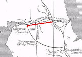
The Stanegate was an important Roman road built in what is now northern England. It linked two forts that guarded important river crossings: Corstopitum (Corbridge) on the River Tyne in the east, and situated on Dere Street, and Luguvalium (Carlisle) on the River Eden in the west. The Stanegate ran through the natural gap formed by the valleys of the River Tyne in Northumberland and the River Irthing in Cumbria. It predated Hadrian's Wall by several decades; the Wall would later follow a similar route, slightly to the north.

The River Irthing is a river in Cumbria, England and a major tributary of the River Eden. The name is recorded as Ard or Arden in early references. For the first 15 miles of its course it defines the border between Northumberland and Cumbria.
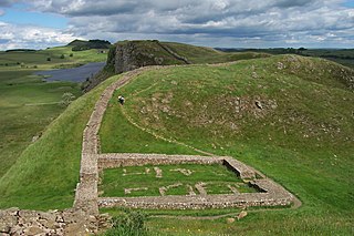
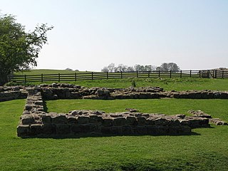
A milecastle was a small fort (fortlet), a rectangular fortification built during the period of the Roman Empire. They were placed at intervals of approximately one Roman mile along several major frontiers, for example Hadrian's Wall in Great Britain, hence the name.

Milecastle 48 , is a milecastle on Hadrian's Wall. Its remains lie near the village of Gilsland in Cumbria where it was historically known as "The King's Stables", owing to the well-preserved interior walls. Unusually a substantial section of stone stairs has survived within the milecastle. The two turrets associated with this milecastle have also survived as above-ground masonry.
Milecastle 49 was a milecastle on Hadrian's Wall.
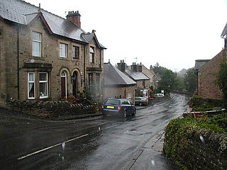
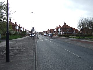
Gilsland is a village in northern England about 20 miles (32 km) west of Hexham, and about 18 miles (29 km) east of Carlisle, which straddles the border between Cumbria and Northumberland. The village provides an amenity centre for visitors touring Hadrian's Wall and other features of historical interest in this area of rugged Border country, popularised by the Romantic novelist Sir Walter Scott.

Milecastle 4 was a milecastle of the Roman Hadrian's Wall. Its remains exist beneath the Newcastle Arts Centre at 67-75 Westgate Road. This position is some way away from its predicted position which is at these coordinates: 54.970440°N 1.608669°W The actual location is between the predicted positions of Turrets 4A and 4B, which has led to suggestions that the numbering and positioning of milecastles and turrets on this part of Hadrian's Wall should be reconsidered.

Milecastle 3 (Ouseburn) was a milecastle of the Roman Hadrian's Wall. No remains exist, but it was thought to have been located at the junction of the A187 Byker Bridge and Stephen Street.

The Popping Stone is a group of three rounded boulders in the Irthing Gorge near the village of Gilsland. It was not always this shape, however, and photographs from before 1870 show a single, much larger stone that must have been drastically altered soon after this date. Nearly all written references to the Popping Stone mention various traditions associated with courtship and marriage proposals, and usually repeat the legend of (Sir) Walter Scott's proposal to Charlotte Carpenter there in 1797. Close to the Popping Stone was an ancient, gnarled Hawthorn tree named the Kissing Bush, but Aln noted in the early 1940s that this had been cut down.
Mumps Hall was an inn at the confluence of the Poltross Burn and the River Irthing, a site now at the centre of the village of Gilsland in Cumbria.
Milecastle 1 was a milecastle of the Roman Hadrian's Wall. It was located near the valley of Stott's Pow. Its remains are covered over, and are located beneath the recreation ground at Miller's Dene. Early excavations and investigations of Turret 0B were mistakenly interpreted as Milecastle 1. The Milecastle sits within the parish of Wallsend.

Milecastle 0 is a possible milecastle of the Roman Hadrian's Wall which may have preexisted the fort of Segedunum. Although its existence has been suggested by historian Peter Hill, no evidence of this milecastle has been found. It is not known whether the decision to establish forts on the line of the wall predated the decision to extend the wall to Wallsend, so it is possible that this milecastle was never built.
Milecastle 2 (Walker) was a milecastle of the Roman Hadrian's Wall. No remains are currently visible, having been built over, but its probable location is at or near the junction of the A187 Fossway and Tunstall Avenue, in the parish of Wallsend.

Milecastle 7 was a milecastle of the Roman Hadrian's Wall. The milecastle itself has not been discovered by archaeologists and its presumed location lies beneath a modern housing development. Roman finds have been made in the area and the associated structure of Turret 7B is a significant surviving structure of the wall.

Milecastle 8 was a milecastle of the Roman Hadrian's Wall. Its remains are located in West Denton, Newcastle upon Tyne. The milecastle has two associated turret structures that are known as turret 8A and turret 8B. The turrets and milecastle were excavated in the 1920s, yielding some pottery and stone carvings, and have since been overlain by modern roads. The exact location of the structures is disputed, with the road hiding any surface traces. The Milecastle forms part of the Hadrian's Wall World Heritage Site.
Milecastle 9 was a milecastle of the Roman Hadrian's Wall. Its remains exist partially as a low platform, and are located in West Denton, 300 yards (270 m) from Chapel House Farm. However, the northern part of the remains are now mostly covered by the modern roads (A69/B6528). The milecastle marks a watershed between those with relatively well defined positions and those whose position are less certain.

Milecastle 10 was a milecastle of the Roman Hadrian's Wall. It is located near to the modern village of Throckley in Tyne and Wear, northern England. Much of the milecastle lies beneath a road but partial remains of the north wall can be seen in the garden of Dene House. It has been excavated several times and its walls located, though the remains have been "considerably damaged by ploughing". Only one of the two associated turrets has been located and excavated.

Milecastle 21 was a milecastle of the Roman Hadrian's Wall. The site was identified by measurement only, as the milecastle's remains have been totally removed. This is probably due to extensive quarrying at the site, which now lies under pasture.

Milecastle 23 (Stanley) was a milecastle of the Roman Hadrian's Wall. Its remains exist as a low, grass covered platform with traces of an external ditch. It is located to the south of the B6318 Military Road around 1.5 kilometres (0.93 mi) west of its junction with the A68.

Waterhead is a civil parish in Carlisle district, Cumbria, England. At the 2011 census it had a population of 130.
