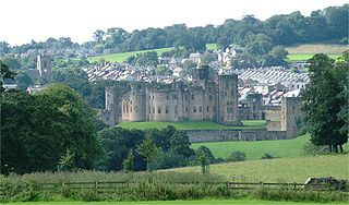
Alnwick is a market town in Northumberland, England, of which it is the traditional county town. The population at the 2011 Census was 8,116.

Feed Me Weird Things is the debut studio album by English electronic musician Tom Jenkinson under the alias Squarepusher. It was released on 3 June 1996 by Rephlex Records.

The River Irthing is a river in Cumbria, England and a major tributary of the River Eden. The name is recorded as Ard or Arden in early references. For the first 15 miles of its course it defines the border between Northumberland and Cumbria.

Craigleith is an area of west Edinburgh, Scotland. Its name comes from various forms of Craig of Inverleith, or rock or hill of Inverleith. The area lies between Ravelston Dykes, to Crewe Toll and the Ferry Road, and Comely Bank on the east. Queensferry Road and Craigleith Road both pass through here. There are also a number of private schools in the area such as Stewart's Melville College and The Mary Erskine School.
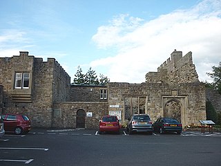
Blenkinsopp Castle is a fire-damaged, partly demolished 19th-century country mansion, incorporating the ruinous remains of a 14th-century tower house, which is located above the Tipalt Burn approximately one mile south of Greenhead, Northumberland, England. It is a Grade II listed building; it is also a Scheduled Ancient Monument as one of the "surviving tower houses retaining significant medieval remains".

Milecastle 48 , is a milecastle on Hadrian's Wall. Its remains lie near the village of Gilsland in Cumbria where it was historically known as "The King's Stables", owing to the well-preserved interior walls. Unusually a substantial section of stone stairs has survived within the milecastle. The two turrets associated with this milecastle have also survived as above-ground masonry.
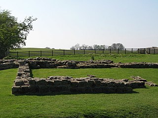
Milecastle 49 was a milecastle on Hadrian's Wall.

Gilsland Spa is the present-day name of a hotel at Gilsland, Cumbria, England. It is named from the sulphurous spring which issues from a cliff below the hotel.
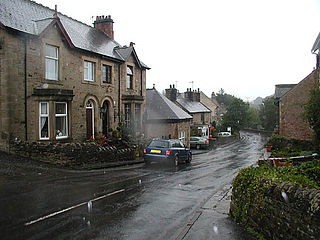
Gilsland is a village in northern England about 20 miles (32 km) west of Hexham, and about 18 miles (29 km) east of Carlisle, which straddles the border between Cumbria and Northumberland. The village provides an amenity centre for visitors touring Hadrian's Wall and other features of historical interest in this area of rugged Border country, popularised by the Romantic novelist Sir Walter Scott.

Bridge of Weir railway station was a railway station serving the village of Bridge of Weir, Renfrewshire, Scotland, originally as part of the Bridge of Weir Railway.

The Turoe stone is a granite stone decorated in a Celtic style located in the village of Bullaun, County Galway, Ireland, 6 km north of Loughrea off the R350 regional road. It probably dates to about the period 100 BC to 100 AD. The stone is now positioned in a covered protective structure on the lawn in front of Turoe House, set in a concrete base surrounded by a metal cattle grill. The Turoe stone is National Monument of Ireland Nr. 327 (NM#327)
Blenkinsop Hall is a privately owned castellated 19th-century country house situated on the banks of the Tipalt Burn near Greenhead, Northumberland. The legal address of the property is Haltwhistle, Northumberland, NE49 9LY. It is a Grade II listed building. The property is located near Blenkinsopp Castle which is primarily a ruin; the castle was owned by the same family as the Hall for generations.

Anthony Jenkinson was born at Market Harborough, Leicestershire. He was one of the first Englishmen to explore Muscovy and present-day Russia. Jenkinson was a traveller and explorer on behalf of the Muscovy Company and the English crown. He also met Ivan the Terrible several times during his trips to Moscow and Russia. He detailed the accounts of his travel through several written works over his life.
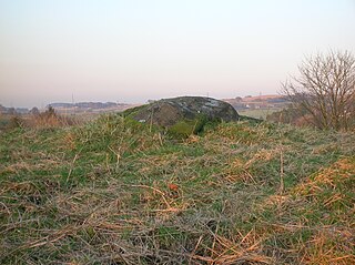
Carlin Stone or Carlin Stane is the name given to a number of prehistoric standing stones and natural stone or landscape features in Scotland. The significance of the name is unclear, other than its association with old hags, witches, and the legends of the Cailleach.
Mumps Hall was an inn at the confluence of the Poltross Burn and the River Irthing, a site now at the centre of the village of Gilsland in Cumbria.

Cwmystwyth is a village in Ceredigion, Wales near Devil's Bridge, and Pont-rhyd-y-groes.
St Mary Magdalene’s Church is a small mid-Victorian Anglican church on an isolated hillside in north-east Cumbria, England. It is the parish church of Gilsland, but is almost a mile from the village and may have been intended as much for the use of visitors to the nearby Gilsland Spa hotel as for the village. It is noteworthy in that the founder, G.G. Mounsey, a local landowner and first elected mayor of Carlisle, published a detailed summary of his reasons for building the church and thus threw into relief some of the reasoning behind Victorian church building and restoration.

Gilsland railway station was a railway station on the Newcastle and Carlisle Railway, on the Carlisle to Hexham section. It was situated near the centre of the village of Gilsland.

Milecastle 37 is one of the milecastles on Hadrian's Wall. It is immediately west of the Housesteads Roman Fort.

Jenny's Lantern is an area of moorland in north Northumberland, England, taking its name from an 18th-century 'eye-catcher' folly sited towards the top of a small promontory hill above the River Aln. Situated on the southern slope of the Jenny's Lantern area is an Iron Age hillfort, overbuilt by and adjoined to a larger and very well preserved Romano-British stone-built settlement and field system.


