Poptún Airport | |||||||||||
---|---|---|---|---|---|---|---|---|---|---|---|
Summary | |||||||||||
Airport type | Public | ||||||||||
Serves | Poptún, Guatemala | ||||||||||
Elevation AMSL | 1,693 ft / 516 m | ||||||||||
Coordinates | 16°19′35″N89°25′00″W / 16.32639°N 89.41667°W Coordinates: 16°19′35″N89°25′00″W / 16.32639°N 89.41667°W | ||||||||||
Map | |||||||||||
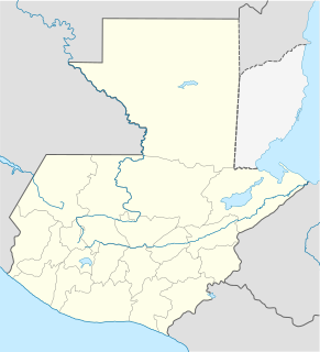
Location in Petén Department Location in Guatemala | |||||||||||
Runways | |||||||||||
| |||||||||||
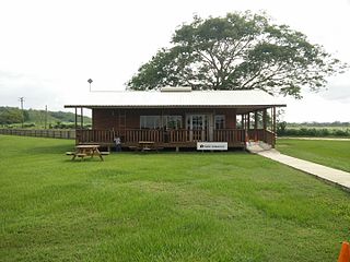
Poptún Airport( IATA : PON, ICAO : MGPP) is an airport serving the town of Poptún in Guatemala.
An IATA airport code, also known as an IATA location identifier, IATA station code or simply a location identifier, is a three-letter code designating many airports around the world, defined by the International Air Transport Association (IATA). The characters prominently displayed on baggage tags attached at airport check-in desks are an example of a way these codes are used.
The ICAOairport code or location indicator is a four-letter code designating aerodromes around the world. These codes, as defined by the International Civil Aviation Organization and published in ICAO Document 7910: Location Indicators, are used by air traffic control and airline operations such as flight planning.
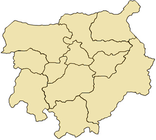
Poptún is a municipality in the El Petén department of Guatemala. It covers an area of 1,128 km2, and had a population of 35,663 at the 2002 Census; the latest official estimate was 64,988. It is some 385 km from Guatemala City. Since 1989, Military Zone 23 in Poptún has been the home of the Guatemalan Army's elite Kaibiles special operations force.
The runway is within the town. There are low hills 2 kilometres (1.2 mi) south of the airport.
Transportation in Guatemala includes roads, waterways, and airports. It formerly included railways.
Machaquila is a major ruined city of the Maya civilization in what is now the El Peten department of Guatemala.
San José Airport serves the city of Puerto San José, the recreative town of Monterrico, the port of Puerto Quetzal and the eastern Guatemalan Pacific coast. It is operated and administrated by DGAC - Dirección General de Aeronáutica Civil de Guatemala. San José Airport is in the western part of the city of Puerto San José, near the Pacific coast.
Cobán Airport is an airport serving Cobán, the capital of the Alta Verapaz Department of Guatemala.
Retalhuleu Airport, also known as Base Aérea del Sur, is an airport serving Retalhuleu, the capital of Retalhuleu Department in Guatemala.
Coatepeque Airport is an airport serving Coatepeque, a city in the Quetzaltenango Department of Guatemala. The airport is in a wooded area on the southwest side of town.
Quiché Airport is an airport serving Santa Cruz del Quiché, the capital of Quiché Department, Guatemala. The airport is just south of the city.
Boende Airport is an airport serving the town of Boende in Tshuapa Province, Democratic Republic of the Congo.
Copacabana Airport is an extremely high elevation airport serving Copacabana, a town on Lake Titicaca in the La Paz Department of Bolivia.
Zacapa Airport is an airport serving the city of Zacapa, the capital municipality of Zacapa Department in Guatemala. The airport is on the southwest side of the city, alongside the Río Grande de Zacapa.
Rubelsanto Airport is an airport serving the village of Rubelsanto in Alta Verapaz Department, Guatemala.
Las Vegas Airport is an airport 4 kilometres (2.5 mi) east of Río Dulce, a village in Izabal Department, Guatemala.
Playa Grande Airport is an airstrip serving the town of Playa Grande in the Quiché Department of Guatemala.
Malacatán Airport is an airport serving the town of Malacatán in the San Marcos Department of Guatemala.
La Libertad Airport is an airport serving the town of La Libertad in Petén Department, Guatemala. It is 4 kilometres (2.5 mi) southwest of the town.
Huehuetenango Airport is an airport serving the city of Huehuetenango, the capital of Huehuetenango Department, Guatemala.
Esquipulas Airport is an airstrip serving the city of Esquipulas in Chiquimula Department, Guatemala.
Carmelita Airport is an airstrip serving Carmelita, a small community in the Maya Biosphere Reserve of Guatemala. A section of the runway also serves as a street in the village.
Bananera Airport is an airport serving the city of Morales in Izabal Department, Guatemala.
San Ignacio Town Airstrip is a public use airport serving San Ignacio, a town in the Cayo District of Belize. The airport is 6 kilometres (4 mi) southwest of San Ignacio and 5 kilometres (3.1 mi) east of the border with Guatemala.
The Aviation Safety Network (ASN) is a website that keeps track of aviation accidents, incidents, and hijackings. Their database contains details of over 10,700 reports. The ASN includes an aviation database with aviation investigations, news, photos, and statistics.
This Guatemala location article is a stub. You can help Wikipedia by expanding it. |