Kokot is a village in the administrative district of Gmina Kije, within Pińczów County, Świętokrzyskie Voivodeship, in south-central Poland. It lies approximately 2 kilometres (1 mi) west of Kije, 9 km (6 mi) north of Pińczów, and 31 km (19 mi) south of the regional capital Kielce.
Gorleston Links was a railway station in Gorleston, England. It was located on an embankment to the north of Links Road and to the south west of the end of Hill Avenue. The tracks southward crossed Links Road by bridge.
Kije is a village in the administrative district of Gmina Błaszki, within Sieradz County, Łódź Voivodeship, in central Poland. It lies approximately 11 kilometres (7 mi) south of Błaszki, 25 km (16 mi) west of Sieradz, and 78 km (48 mi) west of the regional capital Łódź.
Borczyn is a village in the administrative district of Gmina Kije, within Pińczów County, Świętokrzyskie Voivodeship, in south-central Poland. It lies approximately 4 kilometres (2 mi) north-west of Kije, 12 km (7 mi) north of Pińczów, and 29 km (18 mi) south of the regional capital Kielce.
Czechów is a village in the administrative district of Gmina Kije, within Pińczów County, Świętokrzyskie Voivodeship, in south-central Poland. It lies approximately 4 kilometres (2 mi) south of Kije, 7 km (4 mi) north-east of Pińczów, and 34 km (21 mi) south of the regional capital Kielce.
Gartatowice is a village in the administrative district of Gmina Kije, within Pińczów County, Świętokrzyskie Voivodeship, in south-central Poland. It lies approximately 5 kilometres (3 mi) south-east of Kije, 8 km (5 mi) north-east of Pińczów, and 35 km (22 mi) south of the regional capital Kielce.
Gołuchów is a village in the administrative district of Gmina Kije, within Pińczów County, Świętokrzyskie Voivodeship, in south-central Poland. It lies approximately 5 kilometres (3 mi) north-east of Kije, 13 km (8 mi) north-east of Pińczów, and 29 km (18 mi) south of the regional capital Kielce.
Janów is a village in the administrative district of Gmina Kije, within Pińczów County, Świętokrzyskie Voivodeship, in south-central Poland. It lies approximately 5 kilometres (3 mi) south-east of Kije, 7 km (4 mi) north-east of Pińczów, and 35 km (22 mi) south of the regional capital Kielce.
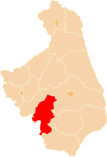
Kije is a village in Pińczów County, Świętokrzyskie Voivodeship, in south-central Poland. It is the seat of the gmina called Gmina Kije. It lies approximately 9 kilometres (6 mi) north of Pińczów and 31 km (19 mi) south of the regional capital Kielce.
Umianowice is a village in the administrative district of Gmina Kije, within Pińczów County, Świętokrzyskie Voivodeship, in south-central Poland. It lies approximately 6 kilometres (4 mi) south-west of Kije, 4 km (2 mi) north of Pińczów, and 36 km (22 mi) south of the regional capital Kielce.
Wierzbica is a village in the administrative district of Gmina Kije, within Pińczów County, Świętokrzyskie Voivodeship, in south-central Poland. It lies approximately 3 kilometres (2 mi) north of Kije, 12 km (7 mi) north of Pińczów, and 29 km (18 mi) south of the regional capital Kielce.
Wymysłów is a village in the administrative district of Gmina Kije, within Pińczów County, Świętokrzyskie Voivodeship, in south-central Poland. It lies approximately 3 kilometres (2 mi) north-east of Kije, 12 km (7 mi) north-east of Pińczów, and 29 km (18 mi) south of the regional capital Kielce.
Pniewo-Czeruchy is a village in the administrative district of Gmina Regimin, within Ciechanów County, Masovian Voivodeship, in east-central Poland. It lies approximately 5 kilometres (3 mi) west of Regimin, 12 km (7 mi) north-west of Ciechanów, and 87 km (54 mi) north-west of Warsaw.
Kije is a village in the administrative district of Gmina Sulechów, within Zielona Góra County, Lubusz Voivodeship, in western Poland. It lies approximately 6 kilometres (4 mi) west of Sulechów and 18 km (11 mi) north of Zielona Góra.
Kije is a village in the administrative district of Gmina Świętajno, within Olecko County, Warmian-Masurian Voivodeship, in northern Poland.
Kije is a settlement in the administrative district of Gmina Bobolice, within Koszalin County, West Pomeranian Voivodeship, in north-western Poland.
Preobraženje is a village in the municipality of Vranje, Serbia. According to the 2002 census, the village has a population of 69 people.
Jahaf District is a district of the Dhale Governorate, Yemen. As of 2003, the district had a population of 22,897 inhabitants.
Mường Mùn is a commune (xã) and village of the Tuần Giáo District of Điện Biên Province, northwestern Vietnam.

Lumphini MRT station is a Bangkok MRT station on the Blue Line. It is located on Rama IV Road, near Witthayu Road and Lumphini Park. Although the station's name refers to Lumphini Park, the Rama VI Monument that is the main sight of the park is closer to Si Lom MRT station.