Port Clarence Bay

Last updated
Port Clarence Bay is the large bight on the eastern side of Bering Strait Bering Strait.jpeg
Port Clarence Bay is the large bight on the eastern side of Bering Strait

Port Clarence Bay is a waterway in the U.S. state of Alaska. It has the only harbor and safe anchorage for large vessels in Seward Peninsula. The bay is located 25 miles southeast of York. It is a large body of comparatively deep water, nearly circular in outline, and cut off from the sea by a long, low sand spit, which terminates in Point Spencer at the entrance to the bay. Along the north side of Port Clarence Bay, there is a shallow lagoon, separated from the bay by a narrow sand spit. This lagoon extends several miles west of the entrance to Port Clarence. [1] The hamlet of Port Clarence, Alaska is situated on the bay.

Waterway Any navigable body of water

A waterway is any navigable body of water. Broad distinctions are useful to avoid ambiguity, and disambiguation will be of varying importance depending on the nuance of the equivalent word in other languages. A first distinction is necessary between maritime shipping routes and waterways used by inland water craft. Maritime shipping routes cross oceans and seas, and some lakes, where navigability is assumed, and no engineering is required, except to provide the draft for deep-sea shipping to approach seaports (channels), or to provide a short cut across an isthmus; this is the function of ship canals. Dredged channels in the sea are not usually described as waterways. There is an exception to this initial distinction, essentially for legal purposes, see under international waters.

U.S. state constituent political entity of the United States

In the United States, a state is a constituent political entity, of which there are currently 50. Bound together in a political union, each state holds governmental jurisdiction over a separate and defined geographic territory and shares its sovereignty with the federal government. Due to this shared sovereignty, Americans are citizens both of the federal republic and of the state in which they reside. State citizenship and residency are flexible, and no government approval is required to move between states, except for persons restricted by certain types of court orders. Four states use the term commonwealth rather than state in their full official names.

Alaska State of the United States of America

Alaska is a U.S. state in the northwest extremity of North America, just across the Bering Strait from Asia. The Canadian province of British Columbia and territory of Yukon border the state to the east and southeast. Its most extreme western part is Attu Island, and it has a maritime border with Russia to the west across the Bering Strait. To the north are the Chukchi and Beaufort seas—southern parts of the Arctic Ocean. The Pacific Ocean lies to the south and southwest. It is the largest U.S. state by area and the seventh largest subnational division in the world. In addition, it is the 3rd least populous and the most sparsely populated of the 50 United States; nevertheless, it is by far the most populous territory located mostly north of the 60th parallel in North America: its population—estimated at 738,432 by the United States Census Bureau in 2015— is more than quadruple the combined populations of Northern Canada and Greenland. Approximately half of Alaska's residents live within the Anchorage metropolitan area. Alaska's economy is dominated by the fishing, natural gas, and oil industries, resources which it has in abundance. Military bases and tourism are also a significant part of the economy.

Geography

The harbor at Port Clarence Bay, close to the strait, is free from ocean swell, and was the rendezvous for the Arctic whaling fleet. The bay itself is clear of ice about June 25 to 30. There were three native settlements on the northeast side of the bay, and the dwellers assembled on Point Spencer in the early part of July for trade with the whaling vessels.

The bay is formed by a sand spit which extends from the mainland west and then north, terminating in Point Spencer. The end of the point is quite bold-to and can be approached as close as 1 mile, with depth of 7 fathoms. The channel between Point Spencer and Point Jackson, on the north shore, is about 4 miles wide, clear of danger, and carries from 7 to 9 fathoms. One and one-half miles south of Point Spencer a shoal makes into the bay from the sand spit, having depths of 2.5 fathoms 1 mile off. The northern half of the bay has a general depth of 7 fathoms as close as 1 mile from the shore; the southern half of the bay shoals gradually from this depth toward the shore, and the extreme southern part is very shoal. The north shore is clear of danger, and can be approached as close as i mile, the soundings decreasing regularly to the beach.

Port Clarence connects at its northeast end with Grantley Harbor, which is 3 to 4 miles wide, about 12 miles long, and connects at its eastern end by a narrow, difficult channel with a large lake farther inland. The mouth of the harbor is formed by two sand spits which slightly overlap. The water westward of the sand spits is shoal, but there is a channel close to the north one which can be used by vessels drawing 12 feet or less, but which should be sounded out before attempting to enter. Inside the harbor, the depths range from 2£ to 3 fathoms, and it is probable that a draft of 12 feet can be taken through the channel to the lake. Vessels have gone into Grantley Harbor to heave down and repair on the north sand spit.

Grantley Harbor waterway located at the bay of Port Clarence, Alaska, U.S.

Grantley Harbor is a waterway located at the bay of Port Clarence, Alaska, on the Seward Peninsula in the U.S. state of Alaska. The inner harbor at the entrance to the northeast corner of the bay was named after Lord Grantley.

Fresh water can be obtained in several places in Port Clarence, the best being from a stream on the east side south of Cape Riley and bearing east-southeast from Point Spencer.

The anchorage used by the whaling fleet is in 5 fathoms, just inside Point Spencer.

In this vicinity, fog is quite prevalent and very dense in summer.

Southwesterly winds increase and northeasterly winds decrease the height of tide.

Outside of Point Spencer the current sets northwestward with a velocity of 1 to 2 knots.

A shoal having a least reported depth of 1.5 fathoms lies nearly 5 miles offshore and about halfway between Cape Douglass and Point Spencer, and vessels should keep well outside of it. Extending about west-northwest from this shoal toward Cape York is a ridge having hard bottom and depths ranging from 4 fathoms near its southeastern end to 5 fathoms in about the latitude of Point Spencer. This ridge extends nearly to the north shore. [2]

Related Research Articles

Unalaska, Alaska City in Alaska, United States

Unalaska is the chief center of population in the Aleutian Islands. The city is in the Aleutians West Census Area, a regional component of the Unorganized Borough in the U.S. state of Alaska. Unalaska is located on Unalaska Island and neighboring Amaknak Island in the Aleutian Islands off mainland Alaska. The population was 4,376 at the 2010 census, which is 79% of the entire Aleutians West Census Area. Unalaska is the second largest city in the Unorganized Borough, behind Bethel.

Shoal A natural landform that rises from the bed of a body of water to near the surface and is covered by unconsolidated material

In oceanography, geomorphology, and earth sciences, a shoal is a natural submerged ridge, bank, or bar that consists of, or is covered by, sand or other unconsolidated material, and rises from the bed of a body of water to near the surface. Often it refers to those submerged ridges, banks, or bars that rise near enough to the surface of a body of water as to constitute a danger to navigation. Shoals are also known as sandbanks, sandbars, or gravelbars. Two or more shoals that are either separated by shared troughs or interconnected by past or present sedimentary and hydrographic processes are referred to as a shoal complex.

Umnak Island in Alaska, United States

Umnak is one of the Fox Islands of the Aleutian Islands. With 686.01 square miles (1,776.76 km2) of land area, it is the third largest island in the Aleutian archipelago and the 19th largest island in the United States. The island is home to a large volcanic caldera on Mount Okmok and the only field of geysers in Alaska. It is separated from Unalaska Island by Umnak Pass. In 2000, Umnak was permanently inhabited by only 39 people.

Smoky Point is a point of land in the U.S. state of Alaska, located at 57°36′44″N157°41′24″W, where Ugashik Bay joins the much larger Bristol Bay. The most easily distinguishable landmark is the United States Coast Guard lighthouse which is visible to mariners on the eastern shore of Bristol Bay and all of Ugashik Bay.

Egegik River river in Alaska, United States

The Egegik River is a waterway in the U.S. state of Alaska. A biological survey was conducted at the base of the Alaska Peninsula in 1902 by Wilfred Hudson Osgood, which included the Egegik River.

Providence Bay

Providence Bay is a fjord in the southern coast of the Chukchi Peninsula of northeastern Siberia. It was a popular rendezvous, wintering spot, and provisioning spot for whalers and traders in the nineteenth and early twentieth centuries. Emma Harbor is a large sheltered bay in the eastern shore of Providence Bay. Provideniya and Ureliki settlements and Provideniya Bay Airport stand on the Komsomolskaya Bay. Plover Bay in English sources sometimes refers specifically to the anchorage behind Napkum Spit within Providence Bay but was commonly used as a synonym for Providence Bay; Russian 19th century sources used the term for an anchorage within Providence Bay.

Tautira Bay

Tautira Bay is located on the island of Tahiti in French Polynesia. It is part of the commune Taiarapu-Est. It is formed by Tautira Point and reef on the eastern side, and by the barrier reef on the western side. It is reached through a gap in the reef about half a mile wide, with deep water, with Tautira point giving it protection from winds from north-east. It is 0.5 miles (0.80 km) wide and about the same depth. The bay opens to the northwest, affording protection with winds from northeastward through east and south to west-northwestward, but can be dangerous with those between north and west-northwestward. James Cook anchored several times in this bay, from which circumstance the name is derived. The depth in the middle of the entrance is from 35 to 60 fathoms, diminishing gradually to the shore. The bay is clear, except a small patch of 2 fathoms 600 feet (180 m) southward of the point of reef on the western side. The eastern and southeastern shore is lined with a sandy beach. The best anchorage is at about 1,200 feet (370 m) from the shore in 8.5 fathoms, sand, with the extreme of Tautira Point bearing 45°.

Murder Cove Cove in Alaska, United States

Murder Cove is located at the southernmost portion of Admiralty Island in the U.S. state of Alaska. The cove was home to the Tyee Company whaling station and was known for whaling operations from 1907 through 1913.

Tongass Narrows channel in Alaska, U.S.

Tongass Narrows is a Y-shaped channel, part of Southeast Alaska's Inside Passage. The waterway forms part of the Alaska Marine Highway and as such, is used by charter, commercial fishing, and recreational vessels, as well as commercial freight barges and tanks, kayaks and passenger ferries.

The Bob Blodgett Nome-Teller Memorial Highway, also known as the Nome-Teller Highway, but generally referred to as simply the Teller Highway, is a well-maintained gravel road in Alaska. It runs 72 miles northwest from Nome to the Inupiat village of Teller, located at the base of the sand spit that divides Port Clarence from Grantley Harbor.

Nepean Bay

Nepean Bay is a bay located on the north-east coast of Kangaroo Island in the Australian state of South Australia about 130 kilometres south-south-west of Adelaide. It was named by the British navigator, Matthew Flinders, after Sir Evan Nepean on 21 March 1802.

Teller Reindeer Station

Teller Reindeer Station was located near Teller in the U.S. state of Alaska. The idea of transporting domestic reindeer from Siberia to western Alaska was first suggested by Captain Michael A. Healy, an officer in the United States Revenue Cutter Service, as a possible solution to the Native Alaskans' food shortage problem. The station was established in 1892 by Sheldon Jackson, Commissioner of Education in Alaska and a Presbyterian minister, who named it in honor of Henry M. Teller. The U.S. Government's Alaska Reindeer Service program ended in the early 1900s.

Isanotski Strait

Isanotski Strait is a strait connecting the northern Gulf of Alaska with the Bering Sea, in the U.S. state of Alaska. Isanax̂ is the Aleut name for present day Isanotski Strait, and means gap, hole, rent, or tear in the Aleut language which was rendered as Isanotski in transliterated Russian. The strait appears as Исанакъ in 1802 and Исаноцкый in 1844 on Russian maps.

Ikatan Bay

Ikatan Bay is a waterway in the U.S. state of Alaska. The bay and Isanotski Strait separate Unimak Island from the Alaska Peninsula. They have been used by light-draft craft, intended for service on the Yukon River, in making the passage from Puget Sound ports to St. Michael.

Fox Islands Passes

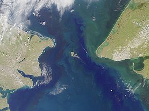
The Fox Islands Passes are waterways in the Fox Islands area of the U.S. state of Alaska, connecting the Bering Sea with the North Pacific Ocean.

Unalaska Bay

Unalaska Bay is a waterway of Unalaska Island in the U.S. state of Alaska. It is situated below the eastern slopes of Makushin Volcano. Composed of seven individual bays, Unalaska Bay opens onto the Bering Sea.

Cape Kalekhta

Cape Kalekhta is a headland on the northeast coast of Unalaska Island in the U.S. state of Alaska.

Germein Bay bay in South Australia

Germein Bay is a bay in the Australian state of South Australia located at the northern end Spencer Gulf on the gulf’s east coast to the immediate north of the city of Port Pirie. Its extent includes the port known as ‘Port Pirie’ and the former port of Port Germein. Since 2012, the majority of the bay has been within the protected area known as the Upper Spencer Gulf Marine Park.

American Bay is a waterway on Dall Island in the U.S. state of Alaska.

References

  1. Collier, Arthur James (1904). The Tin Deposits of the York Region, Alaska (Public domain ed.). U.S. Government Printing Office. pp. 38–.
  2. U.S. Coast and Geodetic Survey; Jarvis, D. H. (1900). Alaska: Coast Pilot Notes on the Fox Islands Passes, Unalaska Bay, Bering Sea, and Arctic Ocean as Far as Point Barrow (Public domain ed.). U.S. Government Printing Office. pp. 48–.

The public domain consists of all the creative works to which no exclusive intellectual property rights apply. Those rights may have expired, been forfeited, expressly waived, or may be inapplicable.

Coordinates: 05°16′40″N166°4′50″W / 5.27778°N 166.08056°W / 5.27778; -166.08056

Geographic coordinate system Coordinate system

A geographic coordinate system is a coordinate system that enables every location on Earth to be specified by a set of numbers, letters or symbols. The coordinates are often chosen such that one of the numbers represents a vertical position and two or three of the numbers represent a horizontal position; alternatively, a geographic position may be expressed in a combined three-dimensional Cartesian vector. A common choice of coordinates is latitude, longitude and elevation. To specify a location on a plane requires a map projection.