
The Gulf of St. Lawrence fringes the shores of the provinces of Quebec, New Brunswick, Nova Scotia, Prince Edward Island, Newfoundland and Labrador, in Canada, plus the islands Saint-Pierre and Miquelon, possessions of France, in North America.

Prince William Sound is a sound off the Gulf of Alaska on the south coast of the U.S. state of Alaska. It is located on the east side of the Kenai Peninsula. Its largest port is Valdez, at the southern terminus of the Trans-Alaska Pipeline System. Other settlements on the sound, which contains numerous small islands, include Cordova and Whittier plus the Alaska native villages of Chenega and Tatitlek.

A ria is a coastal inlet formed by the partial submergence of an unglaciated river valley. It is a drowned river valley that remains open to the sea.

The Avalon Peninsula is a large peninsula that makes up the southeast portion of the island of Newfoundland in Canada. It is 9,220.61 square kilometres (3,560.10 sq mi) in size.

This is a list of the extreme points of Ireland – the points that are furthest north, south, east or west in Ireland. It includes the Republic of Ireland and Northern Ireland.

Burin-Placentia West was a provincial electoral district for the House of Assembly of Newfoundland and Labrador, Canada. The district was known as Placentia West prior to 1975. As of 2011 there were 7,673 eligible voters living within the district.
St. Peter's is a small incorporated village located on Cape Breton Island in Richmond County, Nova Scotia, Canada.
The Port au Port Peninsula is a peninsula in the Canadian province of Newfoundland and Labrador. Roughly triangular in shape, it is located on the west coast of the island of Newfoundland.
The Burin Peninsula is a peninsula located on the south coast of the island of Newfoundland in the province of Newfoundland and Labrador. Marystown is the largest population centre on the peninsula.

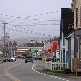
Port au Port West-Aguathuna-Felix Cove is a small town located on the Port au Port Peninsula of the Island of Newfoundland, Canada. The nearest large service area is Stephenville. The town was created in 1970 by amalgamating the small villages of Port au Port West, Aguathuna and Felix Cove. Its post office began on September 11, 1964. The first Post Mistress was Reisa Gabriel.
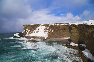
Cape St. George is a headland and community of the same name, located at the southwestern tip of the Port au Port Peninsula on the Canadian island of Newfoundland.
Lourdes is a town in the Canadian province of Newfoundland and Labrador. The town had a population of 465 in the Canada 2016 Census. The current mayor of Lourdes is Henry Gaudon.

The Quileute Indian Reservation is an Indian reservation for the Quileute people located on the northwestern Olympic Peninsula in Clallam County, Washington, United States. The reservation is at the mouth of the Quillayute River on the Pacific coast.

The 1983 Sea of Japan earthquake occurred on May 26, 1983 at 11:59:57 local time. It had a magnitude of 7.8 on the moment magnitude scale. It occurred in the Sea of Japan, about 100 km west of the coast of Noshiro in Akita Prefecture, Japan. Out of the 104 fatalities, all but four were killed by the resulting tsunami, which struck communities along the coast, especially Aomori and Akita Prefectures and the east coast of Noto Peninsula. Images of the tsunami hitting the fishing harbor of Wajima on Noto Peninsula were broadcast on TV. The waves exceeded 10 meters (33 ft) in some areas. Three of the fatalities were along the east coast of South Korea. The tsunami also hit Okushiri Island, the site of a more deadly tsunami 10 years later.
Port au Choix is a peninsula on the western coast of the island of Newfoundland, Canada. Discoveries as early as 1904 provide evidence that native peoples settled here, burials, structural remains, and artifacts such as points, tools, and bones of discarded food.
Division No. 1, Subdivision L is an unorganized subdivision on the Avalon Peninsula in Newfoundland and Labrador, Canada. It is in Division 1 and contains the unincorporated communities of Bareneed, Black Duck Pond, Blow Me Down, Coley's Point South, Hibb's Cove, Pick Eyes, Port de Grave, Ship Cove and The Dock

Route 221, also known as Burin Road, is a 15.9-kilometre-long (9.9 mi) east–west highway on the Burin Peninsula of the island of Newfoundland in the province of Newfoundland and Labrador. It connects Fox Cove-Mortier with Port au Bras, Burin, and Route 220.
On July 17, 2017, an earthquake struck near the Komandorski Islands, east of the Kamchatka Peninsula in the Bering Sea at. Although there were no casualties from this earthquake, it was notable for a rare characteristic known as supershear, and is one of the few times a large supershear earthquake has been observed. It was preceded by a few foreshocks months earlier, and aftershocks that continued for nearly six months.
On April 13, 1923 at 15:31 UTC, an earthquake occurred off the northern coast of the Kamchatka Peninsula in the USSR, present-day Russia. The earthquake had a surface-wave magnitude (Ms ) of 6.8–7.3 and an estimated moment magnitude (Mw ) of 7.0–8.2. This event came just two months after a slightly larger earthquake with an epicenter struck south of the April event. Both earthquakes were tsunamigenic although the latter generated wave heights far exceeding that of the one in February. After two foreshocks of "moderate force", the main event caused considerable damage. Most of the 36 casualties were the result of the tsunami inundation rather than the earthquake.
