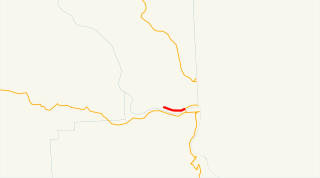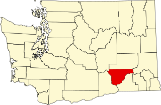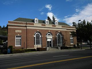
Colfax is the county seat of Whitman County, Washington, United States. The population was 2,805 at the 2010 census. The population is estimated at 2,826 per the State of Washington Office of Financial Management in 2015 making Colfax the second largest city in Whitman County behind Pullman. It is situated amidst wheat-covered hills in a valley at the confluence of the north and south forks of the Palouse River. U.S. Route 195, which forms the town's main street, intersects with State Route 26 at the north end of town; in the past, Colfax also lay at the junction of three major railway lines. It was named after Schuyler Colfax, the vice president from 1869-73.

The Palouse is a distinct geographic region of the northwestern United States, encompassing parts of north central Idaho, southeastern Washington, and, by some definitions, parts of northeast Oregon. It is a major agricultural area, primarily producing wheat and legumes. Situated about 160 miles (260 km) north of the Oregon Trail, the region experienced rapid growth in the late 19th century and was once Washington's most populous region, surpassing even the Puget Sound area.

North Central Idaho is an area which spans the central part of the state of Idaho and borders Oregon, Montana, and Washington. It is the southern half of the Idaho Panhandle region and is rich in agriculture and natural resources. Lewis and Clark travelled through this area on their journey to the Pacific Ocean in 1805-06. The primary cities in this region are Lewiston and Moscow, home of the University of Idaho.

The Palouse River is a tributary of the Snake River in Washington and Idaho, in the northwest United States. It flows for 167 miles (269 km) southwestwards, primarily through the Palouse region of southeastern Washington. It is part of the Columbia River Basin, as the Snake River is a tributary of the Columbia River.

Lower Granite Lock and Dam is a concrete gravity run-of-the-river dam in the northwest United States. On the lower Snake River in southeastern Washington, it bridges Whitman and Garfield counties. Opened 44 years ago in 1975, the dam is located 22 miles (35 km) south of Colfax and 35 miles (56 km) north of Pomeroy.

Elberton is a ghost town on the north fork of the Palouse River northeast of Colfax and northwest of Palouse in Whitman County, Washington, United States.

Joseph Canyon is a 2,000-foot (610 m)-deep basalt canyon in northern Wallowa County, Oregon, and southern Asotin County, Washington, United States.

State Route 193 (SR 193) is a 2.58-mile (4.15 km) long state highway that serves the Port of Wilma in Whitman County, located in the U.S. state of Washington. The highway parallels the Snake River from an intersection with SR 128 north of Clarkston to the Port of Wilma. The current road is a short segment of the former route that extended from U.S. Route 12 (US 12) in Clarkston to US 195 west of Colton that was added to the highway system in 1969 as Secondary State Highway 3G (SSH 3G) in 1969 and removed in 1992.

State Route 194 (SR 194) is a 21.01-mile (33.81 km) long state highway that serves the Lower Granite Dam in Whitman County, located in the U.S. state of Washington. The highway extends eastward from the Port of Almota on the Snake River to an intersection with U.S. Route 195 (US 195) west of Pullman. SR 194 was established in 1991, although the roadway has appeared on maps as early as 1933 and the Almota area being home to a ferry as early as 1893.

The Columbia Plateau Trail is a 130-mile-long (210 km), 20-foot-wide (6.1 m) corridor in eastern Washington state maintained as part of the Washington State Park system. The trail runs along the abandoned right-of-way of the former Spokane, Portland and Seattle Railway from Cheney to the confluence of the Snake and Columbia rivers at Pasco, Washington, passing through five counties in the southeastern part of the state. The trail's recreational uses include hiking, mountain biking, horseback riding, in-line skating on paved portions, and wildlife viewing.

The Moscow-Pullman Daily News is a daily newspaper in the northwestern United States, serving the Moscow, Idaho, and Pullman, Washington, metropolitan area. The two cities on the Palouse are the homes of the two states' land grant universities, the University of Idaho and Washington State University.

Ainsworth, Washington, was a ghost town in Franklin County, Washington. The town was on the northern bank of the mouth of the Snake River, in what is now Pasco, Washington.

The Clearwater River is in the northwestern United States, in north central Idaho. Its length is 74.8 miles (120.4 km), it flows westward from the Bitterroot Mountains along the Idaho-Montana border, and joins the Snake River at Lewiston. In October 1805, the Lewis and Clark Expedition descended the Clearwater River in dugout canoes, putting in at "Canoe Camp," five miles (8 km) downstream from Orofino; they reached the Columbia Bar and the Pacific Ocean about six weeks later.

The Bill Chipman Palouse Trail is a paved rail trail in the northwestern United States, from Pullman, Washington, eastward to Moscow, Idaho. Completed 21 years ago in 1998, it follows the former Union Pacific Railroad right-of-way and connects the rural university towns on the Palouse across the state border.
The Fort Walla Walla–Fort Colville Military Road was built in June 1859 to connect the Walla Walla area with its fairly easy access to the Columbia River to the mountainous area of the Huckleberry and Selkirk Mountains of current Northeast Washington and the Inland Northwest. Brigadier General William S. Harney, commander of the Department of Oregon, opened up the district north of the Snake River to settlers in 1858 and ordered Brevet Major Pinkney Lugenbeel, 9th Infantry Regiment to establish a U.S. Army post to restrain the Indians perceived as hostile to the U.S. Army's Northwest Division and to protect miners who traveled to the area after first reports of gold in the area appeared in Western Washington newspapers in July 1855.
Sunshine is an unincorporated community in Whitman County, in the U.S. state of Washington.
Whitlow is an unincorporated community in Whitman County, in the U.S. state of Washington.
Tekoa Mountain is a 4,009-foot (1,222 m) summit 4 km north of Tekoa, just south of the Spokane County–Whitman County line in the U.S. state of Washington. It is the highest point in Whitman County. The peak is used as a launch site by hang gliding enthusiasts except when it is closed for fire danger.


