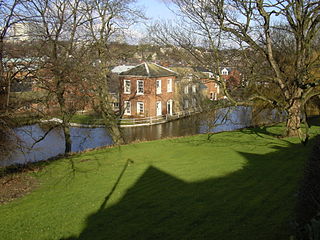
The Porter Brook is a river which flows through the City of Sheffield, England, descending over 1,000 feet (300 m) from its source on Burbage Moor to the west of the city to its mouth where it joins the River Sheaf in a culvert beneath Sheffield railway station. Like the other rivers in Sheffield, its steep gradient made it ideal for powering water mills and works associated with the metalworking and cutlery industries, and around 20 dams were constructed over the centuries to facilitate this. At its lower end, it is extensively culverted, but parts of it are gradually being restored to open channels, as part of a daylighting scheme for the city.

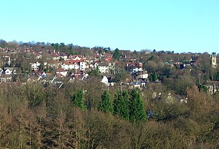
Ecclesall Ward—which includes the neighbourhoods of Banner Cross, Bents Green, Carterknowle, Ecclesall, Greystones, Millhouses, and Ringinglow—is one of the 28 electoral wards in the City of Sheffield, England. It is located in the southwestern part of the city and covers an area of 3.6 square miles. The population of this ward in 2007 was 19,211 people in 7,626 households, reducing to 6,657 at the 2011 Census. Ecclesall ward is one of the four wards that make up the South West Community Assembly and one of five wards that make up the Sheffield Hallam Parliamentary constituency. The Member of Parliament is Olivia Blake, a Labour MP. Ecclesall is one of the least socially deprived wards in the entire country, with a 2002 deprivation score of 4.7—making it the 8,105th most deprived ward out of 8,414 wards in the country. The demographic consists largely of white, middle-class families.

Broomhill and Sharrow Vale — which includes the districts of Broomhill, Broomhall, Crookesmoor, Endcliffe, Sharrow Vale and Tapton Hill — is one of the 28 electoral wards in City of Sheffield, England. The ward was created following the 2015 local government boundary review out of parts of the old Broomhill, Central and Nether Edge wards. It is located in the western part of the city. The population of the Broomhill ward in 2011 was 16,966 people in 5,708 households, covering an area of 2.7 km2. Broomhill & Sharrow Vale is one of the wards that make up the Sheffield Central Parliamentary Constituency.

The Moss is a brook in North East Derbyshire, England.

Sandwell Valley Country Park is a country park, run by Sandwell Metropolitan Borough Council, in Sandwell Valley, on the River Tame in the middle of the urban conurbation between Birmingham and West Bromwich in West Midlands, England.
Sheffield is a geographically diverse city in England. It nestles in the eastern foothills of the Pennines and the confluence of five rivers: Don, Sheaf, Rivelin, Loxley and Porter. As such, much of the city is built on hillsides, with views into the city centre or out to the countryside. The city is roughly one third urban, one third rural and one third in the Peak District. At its lowest point the city stands just 29 metres above sea level at Blackburn Meadows on the Rotherham border, rising up to over 500 m in some parts of the city to a peak of 548m at High Stones on the Derbyshire border; however, 89% of the housing in the city is between 100 and 200 metres above sea level. Over 95% of the population resides in the main urban area.

Cassiobury Park is the principal public park in Watford, Hertfordshire, in England. It was created in 1909 from the purchase by Watford Borough Council of part of the estate of the Earls of Essex around Cassiobury House which was subsequently demolished in 1927. It comprises over 190 acres (77 ha) and extends from the A412 Rickmansworth Road in the east to the Grand Union Canal in the west, and lies to the south of the Watford suburb of Cassiobury, which was also created from the estate. The western part is a 62-acre (25.1 ha) Local Nature Reserve managed by the Herts and Middlesex Wildlife Trust. The park hosts the free, weekly timed parkrun 5 km event every Saturday morning at 9 am, starting on the field near the Shepherds Road entrance to the park, and finishing by the bandstand.

Bingham Park is one of the chain of Porter Valley Parks in Sheffield, South Yorkshire, England.

Endcliffe Park is a large park in the city of Sheffield, South Yorkshire, England. The park was opened in 1887 to commemorate the Jubilee of Queen Victoria. When travelling West from the city centre it is the first in a series of parks and green spaces, known collectively as the Porter Valley Parks, all of which lie along the course of the Porter Brook. The next park in the sequence is Bingham Park, separated from Endcliffe Park by Rustlings Road. In 1924 Patrick Abercrombie said of the parks, "The Porter Brook Parkway, consisting as it does of a string of contiguous open spaces, is the finest example to be found in this country of a radial park strip, an elongated open space, leading from a built-up part of the city direct into the country, the land occupied being a river valley and so for the greater part unsuitable for building."

Burbage Brook is an upper tributary stream of the River Derwent in the Peak District of England.

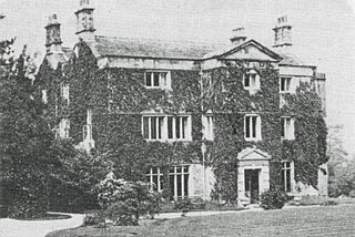
Whiteley Wood Hall was an English country house which was demolished in 1959. It stood off Common Lane in the Fulwood area of Sheffield, England. The hall’s stables and associated buildings are still standing and along with the surrounding grounds now serve as an outdoor activities centre for Girlguiding Sheffield. The stables are a Grade II listed building.

The Ponderosa is a recreation area within the City of Sheffield, South Yorkshire, England. Although not a public park it was designated as Open Space by Sheffield City Council in the 1993 Unitary Development Plan. It covers an area of over 25 acres (10 ha) and is located at 53.3868°N 1.4865°W, 0.9 miles (1.5 km) west of the city centre between the districts of Upperthorpe and Netherthorpe. Although the name “Ponderosa” was originally an informal name given by local children, it is now the accepted title and is recognised by the local council. Along with Weston Park and Crookes Valley Park it is one of the three “Crookesmoor Parks”.

Endcliffe Hall is a 19th-century, 36-room mansion situated on Endcliffe Vale Road in the City of Sheffield in the suburb of Endcliffe. The hall is situated just over 2 miles (3.2 km) west of the city centre and is a Grade II* Listed building.

William Goldring was a landscape architect, and naturalist. Goldring arrived in Royal Botanic Gardens, Kew (1875) where he was in charge of the Herbaceous Department at the world-famous botanical garden. He served as the Assistant Editor of The Garden (1879), and the Editor of Woods and Forests (1883-1886). He was also President of the Kew Guild, The Royal Botanic Gardens, Kew, London, England (1913). Goldring's work included many private houses, hospitals, asylums and public parks in England, Wales, India, and the United States of America. He is responsible for work on nearly 700 different garden landscape projects in England alone.
Cotterill Clough is a 5.6-hectare (14-acre) nature reserve near Manchester Airport. It is managed by the Cheshire Wildlife Trust and lies within a larger Site of Special Scientific Interest (SSSI). The Cotterill Brook, which flows through the reserve, is a tributary of the River Bollin. The reserve was purchased in 1934 by public subscription as a memorial to T. A. Coward (1867–1933), a famous Cheshire naturalist. It is 15 kilometres (9.3 mi) south of Manchester city centre and adjacent to Manchester Airport.
Gleadless Valley is a housing estate and electoral ward of the City of Sheffield in England. The population of the ward at the 2011 Census was 21,089. It lies 2.5 miles (4.0 km) south-southeast of the city centre. Formerly a rural area, Gleadless Valley was developed as a large housing project with around 4000 dwellings by Sheffield City Council between 1955 and 1962. It is an area of undulating land drained by the Meers Brook, which has its source on the high ground in the woodland at Gleadless. Adjacent are Gleadless to the east, Norton to the south-west, Heeley to the west and Arbourthorne to the north.

Glen Howe Park is a public recreation area in the village of Wharncliffe Side within the City of Sheffield, England. The park covers an area of 19 acres in the valley of the Tinker Brook, a minor tributary of the River Don. It is home to a variety of fungi, rare plants and animals only found in ancient woodlands.

Fulwood is a residential suburb and ward of the City of Sheffield in England, it lies 5.5 km west-southwest of the city centre. Formerly an ancient settlement and village on the Porter Brook, it became integrated into the city in the 1930s. It is bounded by the suburbs of Lodge Moor to the NW, Ranmoor to the east and Crosspool to the NE. The open countryside of the Peak District lies to the west and SW. The sub districts of Stumperlowe and Goole Green are part of the suburb. The population of the ward at the 2011 Census was 18,233. Fulwood is located in the Sheffield Hallam constituency which, as of the 2019 general election voted Labour.

Fox Hagg is a small nature reserve in the Rivelin Valley area of Sheffield, England. The Allen Sike flows along the north edge of the reserve and the River Rivelin flows through the reserve from Rivelin Dams to the west. The Wyming Brook Nature Reserve borders Fox Hagg to the west. The site is managed by the Wildlife Trust for Sheffield and Rotherham.


