Potočac

Last updated
Potočac
Village
CountryFlag of Serbia.svg  Serbia
District Pomoravlje District
Municipality Paraćin
Population (2002)
  Total 1,309
Time zone CET (UTC+1)
  Summer (DST) CEST (UTC+2)

Potočac is a village in the municipality of Paraćin, Serbia. According to the 2002 census, the village has a population of 1309 people. [1]

Village Small clustered human settlement smaller than a town

A village is a clustered human settlement or community, larger than a hamlet but smaller than a town, with a population ranging from a few hundred to a few thousand. Though villages are often located in rural areas, the term urban village is also applied to certain urban neighborhoods. Villages are normally permanent, with fixed dwellings; however, transient villages can occur. Further, the dwellings of a village are fairly close to one another, not scattered broadly over the landscape, as a dispersed settlement.
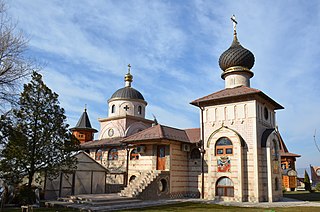
Paraćin Town and municipality in Šumadija and Western Serbia, Serbia

Paraćin is a town and municipality located in the Pomoravlje District of central Serbia. It is located in the valley of the Velika Morava river, north of Kruševac and southeast of Kragujevac. In 2011 the town had a population of 24,573. It also had a civil airport.

Serbia Republic in Southeastern Europe

Serbia, officially the Republic of Serbia, is a country situated at the crossroads of Central and Southeast Europe in the southern Pannonian Plain and the central Balkans. It borders Hungary to the north, Romania to the northeast, Bulgaria to the southeast, North Macedonia to the south, Croatia and Bosnia and Herzegovina to the west, and Montenegro to the southwest. The country claims a border with Albania through the disputed territory of Kosovo. Serbia's population numbers approximately seven million, most of whom are Orthodox Christians. Its capital, Belgrade, ranks among the oldest and largest citiеs in southeastern Europe.
Related Research Articles

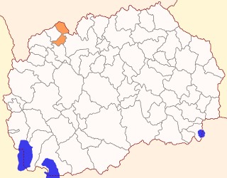
Jegunovce Municipality Rural municipality in Polog Statistical Region, North Macedonia

Jegunovce is a municipality in the northwest of the Republic of North Macedonia. Jegunovce is also the name of the village where the municipal seat is found. Jegunovce Municipality is part of the Polog Statistical Region.

The Khilok River is a river in Eastern Siberia and part of the Selenge River. The length of the river is 840 km (520 mi) and its watershed is 38,500 square kilometres (14,900 sq mi). There are a few settlements on its banks: Khilok, Bada etc.

Dąbrowa-Nowa Wieś is a village in the administrative district of Gmina Czyżew-Osada, within Wysokie Mazowieckie County, Podlaskie Voivodeship, in north-eastern Poland.

Siennica-Pietrasze is a village in the administrative district of Gmina Czyżew-Osada, within Wysokie Mazowieckie County, Podlaskie Voivodeship, in north-eastern Poland.

Rusănești is a commune in Olt County, Romania. It is composed of two villages, Jieni and Rusănești.

Lernagyugh Place in Shirak, Armenia

Lernagyugh is a small village in the Shirak Province of Armenia.

Pianowo-Bargły is a village in the administrative district of Gmina Nasielsk, within Nowy Dwór Mazowiecki County, Masovian Voivodeship, in east-central Poland.

Zambrzyniec is a village in the administrative district of Gmina Łochów, within Węgrów County, Masovian Voivodeship, in east-central Poland.

Kandyba or Candyba was a settlement in ancient Lycia, in modern-day Antalya province on the southwestern Mediterranean coast of Turkey. The modern Turkish village next to the ruins of ancient Kandyba is named Çataloluk.

Gęsie Góry is a village in the administrative district of Gmina Barciany, within Kętrzyn County, Warmian-Masurian Voivodeship, in northern Poland, close to the border with the Kaliningrad Oblast of Russia.

Grudaš Village in Toplica District, Serbia

Grudaš is a village in the municipality of Žitorađa, Serbia. According to the 2002 census, the village has a population of 280 people.

Voljčince Village in Toplica District, Serbia

Voljčince is a village in the municipality of Žitorađa, Serbia. According to the 2002 census, the village has a population of 937 people.

Zladovac Village in Toplica District, Serbia

Zladovac is a village in the municipality of Žitorađa, Serbia. According to the 2002 census, the village has a population of 20 people.

Karađorđevac Village in Jablanica District, Serbia

Karađorđevac is a village in the municipality of Leskovac, Serbia. According to the 2002 census, the village has a population of 417 people.

Manojlovce Village in Jablanica District, Serbia

Manojlovce is a village in the municipality of Leskovac, Serbia. According to the 2002 census, the village has a population of 778 people.

Međa (Leskovac) Village in Jablanica District, Serbia

Međa is a village in the municipality of Leskovac, Serbia. According to the 2002 census, the village has a population of 872 people.

Priboj, Leskovac Village in Jablanica District, Serbia

Priboj is a village in the municipality of Leskovac, Serbia. According to the 2002 census, the village has a population of 642.

Zalužnje Village in Jablanica District, Serbia

Zalužnje is a village in the municipality of Leskovac, Serbia. According to the 2002 census, the village has a population of 482 people.

Karadnik is a village in the municipality of Bujanovac, Serbia. According to the 2002 census, the town has a population of 455 people.

Veliköy is a village in the District of Şavşat, Artvin Province, Turkey. As of 2011 it had a population of 261 people.

References

  1. Popis stanovništva, domaćinstava i Stanova 2002. Knjiga 1: Nacionalna ili etnička pripadnost po naseljima. Republika Srbija, Republički zavod za statistiku Beograd 2003. ISBN   86-84433-00-9

Coordinates: 43°48′55″N21°18′55″E / 43.8153°N 21.3153°E / 43.8153; 21.3153

Geographic coordinate system Coordinate system

A geographic coordinate system is a coordinate system that enables every location on Earth to be specified by a set of numbers, letters or symbols. The coordinates are often chosen such that one of the numbers represents a vertical position and two or three of the numbers represent a horizontal position; alternatively, a geographic position may be expressed in a combined three-dimensional Cartesian vector. A common choice of coordinates is latitude, longitude and elevation. To specify a location on a plane requires a map projection.