Veľká Lodina is a village and municipality in Košice-okolie District in the Kosice Region of eastern Slovakia.

Wyszkowice is a village in the administrative district of Gmina Domaniów, within Oława County, Lower Silesian Voivodeship, in south-western Poland. It lies approximately 5 kilometres (3 mi) south-east of Domaniów, 12 kilometres (7 mi) south-west of Oława, and 31 kilometres (19 mi) south of the regional capital Wrocław.

Zélée Glacier is a glacier about 6 kilometres (3 nmi) wide and 11 kilometres (6 nmi) long, flowing north-northwest from the continental ice along the west side of Lacroix Nunatak and terminating in a prominent tongue at the west side of Port Martin. Probably first sighted in 1840 by the French expedition under Captain Jules Dumont d'Urville, although no glaciers were noted on d'Urville's chart of this coast. Photographed from the air by U.S. Navy Operation Highjump, 1946-47. Charted by the French Antarctic Expedition under Liotard, 1949–51, and named for the Zélée, corvette which accompanied d'Urville's flagship, the Astrolabe.

Poćwiardówka is a village in the administrative district of Gmina Brzeziny, within Brzeziny County, Łódź Voivodeship, in central Poland. It lies approximately 8 kilometres (5 mi) north of Brzeziny and 21 km (13 mi) north-east of the regional capital Łódź.

Krzykowice is a village in the administrative district of Gmina Wolbórz, within Piotrków County, Łódź Voivodeship, in central Poland. It lies approximately 3 kilometres (2 mi) north-east of Wolbórz, 19 km (12 mi) north-east of Piotrków Trybunalski, and 41 km (25 mi) south-east of the regional capital Łódź.

Tumusin is a village in the administrative district of Gmina Poddębice, within Poddębice County, Łódź Voivodeship, in central Poland. It lies approximately 7 kilometres (4 mi) south-east of Poddębice and 31 km (19 mi) west of the regional capital Łódź.

Pratkowice is a village in the administrative district of Gmina Wielgomłyny, with in Radomsko County, Łódź Voivodeship, in central Poland. It lies approximately 9 kilometres (6 mi) north-east of Wielgomłyny, 30 km (19 mi) east of Radomsko, and 86 km (53 mi) south of the regional capital Łódź.

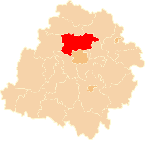
Warszewice is a village in the administrative district of Gmina Stryków, within Zgierz County, Łódź Voivodeship, in central Poland. It lies approximately 4 kilometres (2 mi) south of Stryków, 14 km (9 mi) east of Zgierz, and 14 km (9 mi) north-east of the regional capital Łódź.

Jedlicze A is a village in the administrative district of Gmina Zgierz, within Zgierz County, Łódź Voivodeship, in central Poland. It lies approximately 8 kilometres (5 mi) west of Zgierz and 14 km (9 mi) north-west of the regional capital Łódź.

Jedlicze B is a village in the administrative district of Gmina Zgierz, within Zgierz County, Łódź Voivodeship, in central Poland. It lies approximately 9 kilometres (6 mi) west of Zgierz and 15 km (9 mi) north-west of the regional capital Łódź.

Józefów is a village in the administrative district of Gmina Zgierz, within Zgierz County, Łódź Voivodeship, in central Poland. It lies approximately 7 kilometres (4 mi) east of Zgierz and 10 km (6 mi) north of the regional capital Łódź.

Maciejów is a village in the administrative district of Gmina Zgierz, within Zgierz County, Łódź Voivodeship, in central Poland. It lies approximately 3 kilometres (2 mi) north-east of Zgierz and 10 km (6 mi) north of the regional capital Łódź.

Prądnik Korzkiewski is a village in the administrative district of Gmina Wielka Wieś, within Kraków County, Lesser Poland Voivodeship, in southern Poland.

Gąski is a village in the administrative district of Gmina Tarczyn, within Piaseczno County, Masovian Voivodeship, in east-central Poland. It lies approximately 4 kilometres (2 mi) south-east of Tarczyn, 17 km (11 mi) south-west of Piaseczno, and 31 km (19 mi) south of Warsaw.

Gładków is a village in the administrative district of Gmina Tarczyn, within Piaseczno County, Masovian Voivodeship, in east-central Poland. It lies approximately 3 kilometres (2 mi) south-east of Tarczyn, 16 km (10 mi) south-west of Piaseczno, and 30 km (19 mi) south of Warsaw.

Ruda is a village in the administrative district of Gmina Tarczyn, within Piaseczno County, Masovian Voivodeship, in east-central Poland. It lies approximately 3 kilometres (2 mi) south-east of Tarczyn, 16 km (10 mi) south-west of Piaseczno, and 30 km (19 mi) south of Warsaw.

Stefanówka is a village in the administrative district of Gmina Tarczyn, within Piaseczno County, Masovian Voivodeship, in east-central Poland. It lies approximately 4 kilometres (2 mi) south-east of Tarczyn, 17 km (11 mi) south-west of Piaseczno, and 31 km (19 mi) south of Warsaw.

Wylezin is a village in the administrative district of Gmina Tarczyn, within Piaseczno County, Masovian Voivodeship, in east-central Poland. It lies approximately 4 kilometres (2 mi) south-east of Tarczyn, 17 km (11 mi) south-west of Piaseczno, and 31 km (19 mi) south of Warsaw.

Kosy is a village in the administrative district of Gmina Bartoszyce, within Bartoszyce County, Warmian-Masurian Voivodeship, in northern Poland, close to the border with the Kaliningrad Oblast of Russia. It lies approximately 11 kilometres (7 mi) south-east of Bartoszyce and 49 km (30 mi) north-east of the regional capital Olsztyn.
Chak Fourteen MB is a village and one of the 51 Union Councils of Khushab District in the Punjab Province of Pakistan. It is located at 32°10'0N 72°52'20E.


