Prehistory of Laguna (province)

Last updated

Laguna is a province of the Philippines found in Southern Luzon and features a freshwater lake and river valleys surrounded by arable land. This makes Laguna a good site for potential archeological sites. Its lake basin and fertile land makes for the area easily habitable, granting early settlers an accessible source of fish, eels, game and grain to support a thriving community of people. The coasts rivers of Laguna give the region a quick method of transportation and make trade with foreign merchants easier.

Contents

Laguna has been investigated multiple times by several archeological teams and has yielded several finds. Henry Otley Beyer had studied the shores of Laguna de Bay, particularly near the northern regions of Rizal and Manila. In his Outline Review of Philippine Archaeology by Islands and Provinces, he also made mention of the archeological potential of the eastern shores of the lake in which Pila lies. [1] He pointed out that "it should turn out to be one of the most important centers of trade as well as of culture during the early part of the present millennium" [2] for its strategic location.

Excavations

The Esso – Elizalde Project

Following the expedition of Dr. Robert Fox in 1958 in the province of Batangas, the knowledge of the basics of archeology, such as the presence of artifacts under the ground and how to unearth these artifacts, quickly spread among the locals. The recovered artifacts, pottery, were sold as a source of income. In the 1960s, the towns of Laguna were also gripped in a frenzy of pot-hunting and yielded celadon, qingbai and various brown-glazed and red-underglaze wares. [3]

Seeking to investigate the pot-hunting frenzy in Laguna, an archeological study was led in 1967 by Julita Fernandez and Amelia Rogel of the University of the Philippines - Anthropology Department alongside Dr. Fox and Avelino Legaspi from the Anthropology Division of the National Museum. The study was funded by the ESSO Standard Philippines and Mr and Mrs Manuel Elizalde and lasted from May to October of the same year. It consisted of 10 archeological excavations in Pila, Lumban, Balibago and Talim Island. [3] [4]

Findings

Three out of four sites yielded 153 graves, dated to approximately 12th to 15th century CE through recovered ceramics. The study yielded evidence of cremation in the sites, with remains either buried in soil or placed inside jars. Specimens recovered from the excavation include celadon dishes with fish motifs, celadon censers, qingbai and blue and white jarlets, small lead-glazed water droppers and teapots, qingbai double gourd vessels, large grey-glazed ewers, figurines of carabao with riders in plain and spotted qingbai, and brown wares of all sizes and shapes. Iron and glass bracelets, and colored beads and earrings that appear to be gold or copper were also part of the discovered. [4] [5]

250 to 300 of the recovered specimen were donated by the Elizaldes to Pila, alongside a building designated The Pila Museum. These were later transferred to a heritage building by the Pila Historical Society Foundation. [5]

Locsin – University of San Carlos Archaeological Project

In the same year as the ESSO-Elizalde Project, a separate study was conducted by the University of San Carlos, alongside Leandro and Cecilia Locsin, supervised by Rosa C.P. Tenazas. The excavations in the barrio of Pinagbayanan, Municipality of Laguna started from the fourth of September, 1967 and lasted until the 19th of March, 1968. The excavated area had three sites, namely, Site I: Pinagbayanan/Agra, Site II: Pinagbayanan/Mendoza No. 1 and Site III: Pinagbayanan/Mendoza No. 2. Most of the artifacts discovered were collected on the first two months of excavation. Luckily, a few burials were uncovered by a typhoon on November, 1967. Sites I and II had a total area of 2,720 square meters, that is, 170 4 x 4 squares and 241 burials.

Findings and Conclusions

The excavations yielded the following results: The area was primarily inhabited and/or used for burials by settlements from at least the 12th to 14th century AD. This period can be divided into three: Iron Age (Period I); Lower Sung (Period II); and Upper Sung/Yuan (Period III).

The earliest was the Iron Age. Three burials were associated with this period. Also, based on the distinct pottery types, it was considered to be the time before contacts with the outside world through trade with China begun.

A relatively long period was Period II. The sites were used as burial grounds for inhumation burials in this time. A distinct burial practice was the bundling of the corpse with grave goods.

On Period III, the sites were used for both habitation and burial. This was concluded because of the presence of net sinkers, spindle whorls, postholes, etc.

Artifacts discovered strongly support actual Chinese settlement in the area during the said periods. Recovered were water droppers/miniature pouring vessels which the Chinese had great appreciation for their beauty. Also, net sinkers molded into the male symbol and in one instance the female symbol, expresses the preoccupation with fertility and ancestor worship also evident in many parts of the Far East to the North during the Sung Period.

A great discovery was the practice of cremation in the area which had a form similar to the one practiced in China during approximately the same period. Although secondary burial was widespread in Southeast Asia, what makes this discovery unique was the concept of secondary cremation, which had limited distribution and was known in China, during the Sung period.

Thirty three out of the fifty five burials uncovered within the Period III level were cremation burials of two types (1) burial directly in a pit and (2) burial in a container. The second type was supported by a number of observations which include that a number of jars recovered had traces of charred skeletal remains believed to be human and the presence of grave goods, like ceramic pieces, inside the jars. The concept of secondary cremation was described as "after undergoing one of several processes of primary burial to allow time for the flesh to decompose, the bones were collected and burned in a ritual before the actual reburial". [2] This is also supported by the fact that in primary cremations, large fragments of charred skeletal materials rarely occur where as in the excavation site, large fragments of bones were found. Another significant discovery, which may also support the concept of secondary cremation, was the presence of a Crematory Complex. It is a structure with three chambers which are not large enough to contain an average-sized adult corpse, in other words, it was used only for burning disarticulated skeletal remains.

On the people's way of living, other results imply that first, wet rice agriculture was practiced during this time. Also, with the presence of spindle whorls, cotton was grown and weaving was also practiced. The presence of net sinkers and with the fact that the area was near the lake, implies that they engaged in fishing, while hunting and animal husbandry was also exercised. Pigs were domesticated and animal remains show that horses were also present. Iron wastes and slag were also discovered indicating the production of iron tools and weapons.

Other artifacts discovered are the earthenware. Non-Iron Age types (under Periods I and II) fall under four types: (1) the Kendi (spouted variety), which in almost all cases had only one spout and one lug and generally squat; (2) the simple cooking pot, which had spherical body with a rounded bottom and everted lip rim; (3) rimless pots or bowls, characterized by having elliptical body which ends in a plain, slightly inturned lip rim; and (4) miscellaneous earthenware, which includes heavy stoves and pot covers. The pot covers are different from what we use today. They are usually concave, instead of being convex, and had a cylindrical handle at the center.

Also found are pottery disks which are associated with graves identified as children's graves. Thus the pottery disks are believed to have been playthings for children. Incidentally, pottery disks are also found in some excavations in Thailand and are said to have been "used in a game called Len Lum (playing holes)", wherein shallow holes slightly larger than the disk are made by twisting the disks down onto the ground and the players attempt to pitch the disk, into the hole, from a distance.

Related Research Articles

<span class="mw-page-title-main">Pila, Laguna</span> Municipality in Laguna, Philippines

Pila, officially the Municipality of Pila, is a 3rd class municipality in the province of Laguna, Philippines. According to the 2020 census, it has a population of 54,613 people.

<span class="mw-page-title-main">Kolomoki Mounds</span> Archaeological site in Georgia, US

The Kolomoki Mounds is one of the largest and earliest Woodland period earthwork mound complexes in the Southeastern United States and is the largest in Georgia. Constructed from 350CE to 600CE, the mound complex is located in southwest Georgia, in present-day Early County near the Chattahoochee River.

<span class="mw-page-title-main">Grand Village of the Illinois</span> Archaeological site in Illinois, United States

The Grand Village of the Illinois, also called Old Kaskaskia Village, is a site significant for being the best documented historic Native American village in the Illinois River valley. It was a large agricultural and trading village of Native Americans of the Illinois confederacy, located on the north bank of the Illinois River near the present town of Utica, Illinois. French explorers Louis Joliet and Father Jacques Marquette came across it in 1673. The Kaskaskia, a tribe of the Illiniwek people lived in the village. It grew rapidly after a French mission and fur trading post were established there in 1675, to a population of about 6,000 people in about 460 houses. Around 1691 the Kaskaskia and other Illiniwek moved further south, abandoning the site due to pressure from an Iroquois invasion from the northeast.

<span class="mw-page-title-main">Burgstallkogel (Sulm valley)</span> Hill in Austria

The Burgstallkogel is a hill situated near the confluence of the Sulm and the Saggau river valleys in Southern Styria in Austria, about 30 km south of Graz between Gleinstätten and Kleinklein. The hill hosted a significant settlement of trans-regional importance from 800 BC to about 600 BC. Surrounding the hill is one of the largest Iron Age necropolises in continental Europe, originally composed of at least 2,000 tumuli.

Unguja Ukuu is a historic Swahili settlement on Unguja island, in Zanzibar, Tanzania.

<span class="mw-page-title-main">Younge site</span> Archaeological site in Michigan, United States

The Younge site is an archeological site located in Goodland Township, Lapeer County, Michigan. It is classified as a prehistoric Late Woodland site and was designated as a Michigan State Historic Site on October 29, 1971. It was added to the National Register of Historic Places on October 29, 1976.

<span class="mw-page-title-main">Sinauli</span> Archaeological site in Uttar Pradesh, India

Sinauli is an archaeological site in western Uttar Pradesh, India, at the Ganga-Yamuna Doab. The site gained attention for its Bronze Age solid-disk wheel carts, found in 2018, which were interpreted by some as horse-pulled "chariots".

Part of series of articles upon Archaeology of Kosovo

The archaeological sites Randlev and Hesselbjerg refer to two closely related excavations done throughout the 20th century near the village of Randlev in the Odder Municipality of Denmark, three kilometers southeast of the town of Odder. Randlev is known primarily for its Romanesque church constructed sometime around 1100 A.D. Hesselbjerg refers to the large Viking-Age cemetery discovered on the Hesselbjerg family farm and the site Randlev refers to the nearby settlement from the same period. Although both Randlev and Hesselbjerg were contemporaneous and encompass a similar area, Hesselbjerg refers more specifically to the 104 graves discovered prior to the later excavation at the site Randlev, which pertains to the Viking Age settlement. The settlement consisted of a farm complex that was likely active during the ninth and tenth centuries; finds from the site such as silver hoards and elaborate jewelry indicate that the farm was likely prosperous, a conjecture which is supported by the extremely fertile land surrounding the area. Artifacts were found in the vicinity of the Hesselbjerg and Randlev sites as early as 1932 when a local farmer discovered a silver hoard, but serious excavations were not conducted until 1963. These excavations ended in 1970; however, Moesgård Museum returned to the site in 1997 and continued analysis until 2010.

Dewil Valley, located in the northernmost part of Palawan, an island province of the Philippines that is located in the Mimaropa region, is an archaeological site composed of thousands of artifacts and features. According to the University of the Philippines Archaeological Studies Program, or UP-ASP, the closest settlement can be found in New Ibajay, which is covered by the town capital of El Nido, which is located around 9 km (5.6 mi) south-east of Dewil Valley. Physically it measures around 7 km (4.3 mi) long, and 4 km (2.5 mi) wide. It is in this place which the Ille Cave, one of the main archaeological sites, can be found. It is actually a network of 3 cave mouths located at its base. It has been discovered that this site in particular has been used and occupied by humans over multiple time periods.

Porac, Pampanga contains areas in and near Babo Balukbuk in Porac, Philippines that have strong indication of human habitation, according to investigations published on the University of the Philippines Archaeological Studies Program website. Later test excavations confirmed this conclusion through the presence of materials dated around the 12th century to the 17th century C.E.

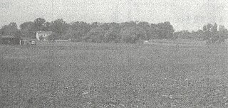
Pinagbayanan is a barrio in the municipality of Pila, Laguna, Philippines. The 2010 census estimates its population at 5,305 people. Archaeological excavations in the area have contributed to developments in the field of ceramics and led to the recognition of the importance of the area to archaeology.
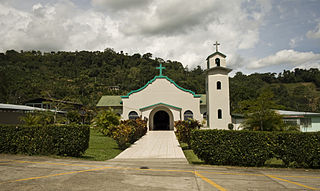
Philippine ceramics are mostly earthenware, pottery that has not been fired to the point of vitrification. Other types of pottery like tradeware and stoneware have been fired at high enough temperatures to vitrify. Earthenware ceramics in the Philippines are mainly differentiated from tradeware and stoneware by the materials used during the process and the temperature at which they are fired. Additionally, earthenware and stoneware pottery can generally be referred to as ceramics that are made with local materials, while tradeware ceramics can generally be referred to as ceramics that are made with non-local materials.

The Huber Site (11Ck-1) is located on Tinley Creek 2 miles west of Blue Island in Cook County, Illinois, near the city of Chicago. It is classified as a late prehistoric site with Upper Mississippian affiliation.

<span class="mw-page-title-main">Knoll Spring site</span> Archaeological site in Illinois, United States

The Knoll Spring site (11Ck-19), aka Au Sagaunashke village, is located in the Sag Valley, Palos Hills, in Cook County, Illinois, near the city of Chicago. It is classified as a late prehistoric site with Upper Mississippian Huber affiliation.

The Anker Site (11Ck-21) is located on the Little Calumet River near Chicago, Illinois. It is classified as a late prehistoric site with Upper Mississippian Huber affiliation.

The Gentleman Farm site is located in LaSalle County, Illinois, on the Illinois River. It is a multi-component site with the main occupation being a Langford tradition component of Upper Mississippian affiliation.

The Fisher Mound Group is a group of burial mounds with an associated village site located on the DesPlaines River near its convergence with the Kankakee River where they combine to form the Illinois River, in Will County, Illinois, about 60 miles southwest of Chicago. It is a multi-component stratified site representing several Prehistoric Upper Mississippian occupations as well as minor Late Woodland and Early Historic components.

The Carcajou Point site is located in Jefferson County, Wisconsin, on Lake Koshkonong. It is a multi-component site with prehistoric Upper Mississippian Oneota and Historic components.

The Fort Wayne mound site was a prehistoric burial mound located on the grounds of the Ordinance Department of the former Fort Wayne in Detroit, Michigan. It was one of a series of mounds in Detroit, including the Springwells Mound Group, the Carsten mound and the Great mound at the River Rouge. By the mid-20th century only the Fort Wayne mound was still standing. Today, the remains of the mound—located near Officers' Row—is fenced off to visitors.

References

  1. Beyer, H. Otley. 1947. Outline Review of Philippine Archaeology by Islands and Provinces. The Philippine Journal of Science, Vol 77, July–August.
  2. 1 2 Tenazas, Rosa C.P., A Report on the Archaeology of the Locsin - University of San Carlos Excavations in Pila, Laguna
  3. 1 2 "Treasures of Pila: Pila in Ancient Times". Archived from the original on 2015-04-23. Retrieved 2015-05-17.
  4. 1 2 Vitales, Timothy James. 2013. Archaeological Research in the Laguna de Bay area, Philippines. Hukay, Volume 18.
  5. 1 2 "Official Website of Pila, Laguna". Archived from the original on 2015-05-18. Retrieved 2015-05-17.