
Hembury is a Neolithic causewayed enclosure and Iron Age hill fort near Honiton in Devon. Its history stretches from the late fifth and early fourth millennia BC to the Roman invasion. The fort is situated on a south facing promontory at the end of a 240m high ridge in the Blackdown Hills. It lies to the north of and overlooking the River Otter valley and this location was probably chosen to give good views of the surrounding countryside as well as for defensive reasons.
Cadbury Castle is an Iron Age Hillfort close to Bickleigh, Devon, England. It was later encamped by the Parliamentarian forces during the English Civil War under Thomas Fairfax when he laid siege to Bickleigh Castle.

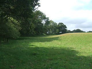
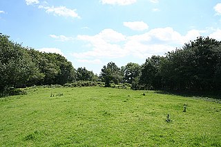
Castle Close is a circular earthwork located near Stoodleigh in Mid Devon, England at OS grid reference SS937181. It is described on maps as a settlement. Situated some 208 metres above sea level, overlooking the River Exe, it is most likely to be an Iron Age Hill fort or enclosure.

Cotley Castle is a large Iron Age Hill fort near Dunchideock in Devon and close to Exeter. It occupies a significant hilltop at 220 metres above sea level, just to the north of Great Haldon, part of the same ridge of the Haldon Hills.
Berry Castle is an earthwork probably dating to the Iron Age close to Black Dog in Devon north of Crediton and west of Tiverton. It does not fit the traditional pattern of an Iron Age Hill fort. Although the earthwork would seem to be an incomplete enclosure, it is not at the top of a hill, although it is on the south east slope of a major hill which peaks at 199 Metres above Sea Level.

There are two hills named Castle Hill within the immediate environs of Great Torrington in Devon, England. The first is within the town and is the site of the Norman & mediaeval castles, but was probably an Iron Age hill fort before this.50.9509°N 4.1436°W
Membury Castle is an Iron Age Hill fort situated above the Village of Membury in Devon. The fort occupies a commanding hilltop position some 204 metres above sea level with views across both the Yarty & Axe Valleys.

Musbury Castle is an Iron Age Hill fort situated above the Village of Musbury in Devon. The fort occupies a commanding hill top approx 175 Metres above Sea Level overlooking the Axe valleyat Ordnance Survey grid reference SY282941.
Wooston Castle is an Iron Age Hill fort situated on the edge of a hill overlooking the Teign Valley in Devon some 200 metres above sea level, only 3 km south and east of Prestonbury Castle and 5 km east of Cranbrook Castle.

Cranbrook Castle is an Iron Age Hill fort occupying a commanding hilltop just to the south of and overlooking the Teign valley in Devon. It is 337 metres above sea level and 2 km south and slightly west of Prestonbury castle, 3 km west of Wooston Castle.
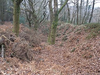
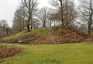
Berry Castle is an Iron Age Hill fort in the civil parish of Huntshaw, close to Weare Giffard in Devon, England, to the north of Great Torrington. The fort takes the form of an oval enclosure situated on a promontory in Huntshaw Wood some 95 Metres above Sea Level. Recent tree clearance (2015) has revealed that the 'fort' is rectangular in shape with entrances at either end, and may be a Roman camp or a local example of a neolithic sky burial enclosure.
Hembury Castle is an Iron Age Hill fort situated close to Tythecott, south of Buckland Brewer in Devon. The fort is situated on a promontory off the East of a large hill at some 137 Metres above Sea Level.
Castle Head is a British Iron Age Hill fort occupying a commanding position on a promontory at the neck of a bow in the River Tamar on the Devon side close to Dunterton. The fort is situated approximately 100 metres above sea level, there is another earthwork due South lower on the promontory at approx 50 metres above sea level, and others on the Cornwall side of the river.
Dewerstone is the site of an Iron Age Hill fort on a rocky promontory overlooking the River Plym on the South West edge of Dartmoor to the North of Plympton in Devon. The fort consists of ramparts to the Northern side of the promontory at approx 210 Metres above Sea Level.

Castle Dyke is an Iron Age hill fort situated between Chudleigh and Dawlish in Devon, England. The fort is situated on a Hilltop at approx 140 metres above sea level.
Hembury Castle is an Iron Age hillfort about a mile north-west of the village of Buckfast on the south-eastern edge of Dartmoor in Devon, England. The fort is about 178 metres above sea level on a promontory between the River Dart on the east and the Holy Brook, south-west. The slope down to the River Dart is very steep and is covered by Hembury Woods which is now a Site of Special Scientific Interest.
Holne Chase Castle is an Iron Age hill fort situated close to Buckland-in-the-Moor in Devon, England. The fort is situated on a promontory on the Northern slopes of Holne Chase in Chase Wood at approx 150 Metres above Sea Level overlooking the River Dart.

Capton is a village near Dartmouth in Devon, England.

Roborough Castle is an Iron Age enclosure or hill fort situated close to Lynton in Devon, England. The fort is situated on the North East edge of a Hillside forming a promontory above a tributary to the East Lyn River known as Hoaroak Water at approx 320 Metres above Sea Level.

Black Dog is a village in Mid Devon, ten miles west of Tiverton and six miles north of Crediton.


