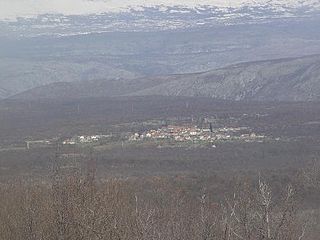
Pribinovići | |
---|---|
Village | |
Country | |
Canton | West Herzegovina Canton |
Municipality | Široki Brijeg |
Time zone | CET (UTC+1) |
• Summer (DST) | CEST (UTC+2) |
Pribinovići (Serbian : Прибиновићи) is a village in Bosnia and Herzegovina. According to the 1991 census, the village is located in the municipality of Široki Brijeg. [1]
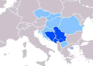
Serbian is the standardized variety of the Serbo-Croatian language mainly used by Serbs. It is the official language of Serbia, co-official in the territory of Kosovo, and one of the three official languages of Bosnia and Herzegovina. In addition, it is a recognized minority language in Montenegro where it is spoken by the relative majority of the population, as well as in Croatia, North Macedonia, Romania, Hungary, Slovakia, and the Czech Republic.
A village is a clustered human settlement or community, larger than a hamlet but smaller than a town, with a population ranging from a few hundred to a few thousand. Though villages are often located in rural areas, the term urban village is also applied to certain urban neighborhoods. Villages are normally permanent, with fixed dwellings; however, transient villages can occur. Further, the dwellings of a village are fairly close to one another, not scattered broadly over the landscape, as a dispersed settlement.
Bosnia and Herzegovina, sometimes called Bosnia–Herzegovina, and often known informally as Bosnia, is a country in Southeastern Europe, located within the Balkan Peninsula. Sarajevo is the capital and largest city.
Stanojevići is a village in Herzegovina, in Čapljina municipality, Federation of Bosnia and Herzegovina, Bosnia and Herzegovina.
Crnići is a village in the Municipality of Čapljina in the Herzegovina-Neretva Canton of the Federation of Bosnia and Herzegovina in Bosnia and Herzegovina.
Lokve is a village in Herzegovina, in Čapljina municipality, Federation of Bosnia and Herzegovina, Bosnia and Herzegovina.
Svitava is a village in Herzegovina, in Čapljina municipality, Federation of Bosnia and Herzegovina, Bosnia and Herzegovina.
Prćavci is a village in Herzegovina, in Čapljina municipality, Federation of Bosnia and Herzegovina, Bosnia and Herzegovina.
Rakovac is a village in the municipality of Pale, Bosnia and Herzegovina.
Opsječko is a village in the municipality of Čelinac, Republika Srpska, Bosnia and Herzegovina.
Ćaćice is a village in the municipality of Višegrad, Bosnia and Herzegovina.
Drinsko is a village in the municipality of Višegrad, Bosnia and Herzegovina.
Dušče is a village in the municipality of Višegrad, Bosnia and Herzegovina.
Gornja Crnča is a village in the municipality of Višegrad, Bosnia and Herzegovina.
Haluge is a village in the municipality of Višegrad, Bosnia and Herzegovina.
Jelići (Višegrad) is a village in the municipality of Višegrad, Bosnia and Herzegovina.
Okolišta is a village in the municipality of Višegrad, Bosnia and Herzegovina.
Palež is a village in the municipality of Višegrad, Bosnia and Herzegovina.
Pijavice is a village in the municipality of Višegrad, Bosnia and Herzegovina.
Stražbenice is a village in the municipality of Višegrad, Bosnia and Herzegovina.
Ubava is a village in the municipality of Višegrad, Bosnia and Herzegovina.
Vučine is a village in the municipality of Višegrad, Bosnia and Herzegovina.
Žlijeb is a village in the municipality of Višegrad, Bosnia and Herzegovina.
Coordinates: 43°22′33″N17°35′00″E / 43.37583°N 17.58333°E
A geographic coordinate system is a coordinate system that enables every location on Earth to be specified by a set of numbers, letters or symbols. The coordinates are often chosen such that one of the numbers represents a vertical position and two or three of the numbers represent a horizontal position; alternatively, a geographic position may be expressed in a combined three-dimensional Cartesian vector. A common choice of coordinates is latitude, longitude and elevation. To specify a location on a plane requires a map projection.
This West Herzegovina Canton geography article is a stub. You can help Wikipedia by expanding it. |