Related Research Articles

Mullan is a city in the northwest United States, located in the Silver Valley mining district of northern Idaho. The population was 646 at the 2020 census and 692 at the 2010 census, and 840 in 2000.

The Jarbidge River is a 51.8-mile-long (83.4 km), high elevation river in Elko County, Nevada, and Owyhee County, Idaho, in the United States. The Jarbidge originates as two main forks in the Jarbidge Mountains of northeastern Nevada and then flows through basalt and rhyolite canyons on the high plateau of the Owyhee Desert before joining the Bruneau River.

Burke Canyon is the canyon of the Burke-Canyon Creek, which runs through the northernmost part of Shoshone County, Idaho, U.S., within the northeastern Silver Valley. A hotbed for mining in the late-nineteenth and twentieth centuries, Burke Canyon now contains several ghost towns and remnants of former communities along Idaho State Highway 4, which runs northeast through the narrow canyon to the Montana border.

The Clearwater River is in the northwestern United States, in north central Idaho. Its length is 74.8 miles (120.4 km), it flows westward from the Bitterroot Mountains along the Idaho-Montana border, and joins the Snake River at Lewiston. In October 1805, the Lewis and Clark Expedition descended the Clearwater River in dugout canoes, putting in at "Canoe Camp," five miles (8 km) downstream from Orofino; they reached the Columbia Bar and the Pacific Ocean about six weeks later.
The Independence Mine was a larger producing mine in the Pine Creek region of the Coeur d'Alene mining district in Idaho. It produced lead, silver, and copper. The mine claim borders the Bunker Hill Sullivan mine claim, and work in on the mine was stopped in the 1940s. It was a major producer during both world wars. It also had a large hand in the development of Pinehurst, Idaho.
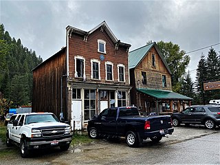
Murray is an unincorporated community in Shoshone County, Idaho, United States. It is twenty miles from Wallace along Dobson Pass Road. Prichard Creek flows through the community, forming a thin and deep valley in the surrounding Coeur d'Alene Mountains.
Big Dick Point is a summit in Shoshone County, Idaho, in the United States. With an elevation of 5,414 feet (1,650 m), Big Dick Point is the 1,822nd tallest mountain in Idaho. It is located to the south of Big Dick Creek.
Big Dick Creek is a stream in Shoshone County, Idaho, in the United States. It is a tributary to the north fork of the Saint Joe River.

Grimes Creek is a stream in Boise County, in the U.S. state of Idaho.
Prichard is an unincorporated community in Shoshone County, Idaho, United States.
Collins Creek is a stream in the U.S. state of Idaho.
Glade Creek is a stream in the U.S. state of Idaho. It is a tributary of the Lochsa River.
Mores Creek is a stream in the U.S. state of Idaho. It is a tributary to the Boise River.
References
- ↑ U.S. Geological Survey Geographic Names Information System: Prichard Creek
- ↑ Earl, Larry W. (Nov 2, 1990). "Early Idaho mining district makes great driving tour". Spokane Chronicle. p. 13. Retrieved 18 October 2015.
47°39′31″N115°58′18″W / 47.65860°N 115.97178°W
| | This article related to a river in Idaho is a stub. You can help Wikipedia by expanding it. |