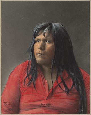
The Cocopah are Native Americans who live in Baja California, Mexico, and Arizona, United States.

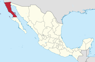
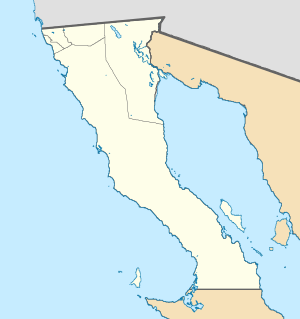
Baja California, officially Estado Libre y Soberano de Baja California, is a state in Mexico. It is the northernmost and westernmost of the 32 federal entities of Mexico. Before becoming a state in 1952, the area was known as the North Territory of Baja California. It has an area of 70,113 km2 (27,071 sq mi) and comprises the northern half of the Baja California Peninsula, north of the 28th parallel, plus oceanic Guadalupe Island. The mainland portion of the state is bordered on the west by the Pacific Ocean; on the east by Sonora, the U.S. state of Arizona, and the Gulf of California; on the north by the U.S. state of California; and on the south by Baja California Sur.

Mexicali is the capital city of the Mexican state of Baja California. The city, seat of the Mexicali Municipality, has a population of 689,775, according to the 2010 census, while the Calexico–Mexicali metropolitan area is home to 1,000,000 inhabitants on both sides of the Mexico–United States border. Mexicali is a regional economic and cultural hub for the border region of The Californias.

Baja California is a state in Northwest Mexico that is divided into seven municipalities. According to the 2020 Mexican census, Baja California is the 13th most populous state with 3,769,020 inhabitants and the 12th largest by land area spanning 73,290.08 square kilometres (28,297.46 sq mi).

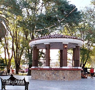
Tecate is a city in Tecate Municipality, Baja California. It is across the Mexico–US border from Tecate, California. As of 2019, the city had a population of 108,860 inhabitants, while the metropolitan area has a population of 132,406 inhabitants. Tecate is part of the San Diego-Tijuana metropolitan area and the largest city between Tijuana and Mexicali. Tecate is a regional economic hub and popular tourist destination, known as home to the Tecate Port of Entry and to Tecate Beer.

Mexicali International Airport ; officially Aeropuerto Internacional General Rodolfo Sánchez Taboada(General Rodolfo Sánchez Taboada International Airport) is an international airport located 20 kilometers east of Mexicali, Baja California, Mexico, near the U.S.-Mexico border. It is the northernmost airport in Mexico and serves the metropolitan area of Mexicali and the transborder region of Calexico-Mexicali. In addition to domestic flights within Mexico, the airport also facilitates domestic and international charter flights, flight training, and executive, and general aviation activities.

Municipalities are the second-level administrative divisions of Mexico, where the first-level administrative division is the state. They should not be confused with cities or towns that may share the same name as they are distinct entities and do not share geographical boundaries. As of January 2021, there are 2,454 municipalities in Mexico, excluding the 16 boroughs of Mexico City. If all 16 boroughs of Mexico City are counted, the total of municipalities will be 2,470.

The municipality of Ensenada is the fourth-largest municipality in Mexico with a land area of 19,526.8 km2 (7,539.3 sq mi) in 2020, about the same size as Hidalgo state and larger than five Mexican states.

Mexicali Municipality is a municipality in the Mexican state of Baja California. Its municipal seat is located in the city of Mexicali. As of 2020, the municipality had a total population of 1,049,792. The municipality has an area of 13,700 km2 (5,300 sq mi). This includes many smaller outlying communities as well as the city of Mexicali. Also, the islands of Baja California located in the Gulf of California are part of the municipality, among them the mudflat islands at the mouth of the Colorado River, Isla Ángel de la Guarda and the islands of the San Lorenzo Marine Archipelago National Park. Mexicali is the northernmost municipality of Latin America.

Tecate is a municipality in the Mexican state of Baja California. Its municipal seat is located in the city of Tecate. According to the 2020 census, it had a population of 108,440 inhabitants. The municipality has an area of 3,079.0 km².
Eugenio Elorduy Walther was a Mexican politician. He was governor of his adoptive state of Baja California from November 1, 2001 to October 31, 2007. His wife Maria Elena Blackaller served as first lady and had 4 children with Eugenio. Mariela, Erika, Eugenio, and Ernesto continue to carry out his remembrance today.
Federal Highway 5 is a tollfree part of the federal highways corridors, and follows the northeast length of the state of Baja California from the US-Mexico border in Mexicali at the northern point at San Felipe in the south. The highway is entirely inside the Mexicali Municipality. However, a state highway from San Felipe to Puertecitos is usually considered part of Fed. 5. From San Felipe to the south, the road follows the seacoast of the Gulf of California.
The First Federal Electoral District of Baja California(I Distrito Electoral Federal de Baja California) is one of the 300 Electoral Districts into which Mexico is divided for the purpose of elections to the federal Chamber of Deputies and one of eight such districts in the state of Baja California.
The Second Federal Electoral District of Baja California(II Distrito Electoral Federal de Baja California) is one of the 300 Electoral Districts into which Mexico is divided for the purpose of elections to the federal Chamber of Deputies and one of eight such districts in the state of Baja California.
Valle de las Palmas is located between two hamlets Espuela and Seco in the municipalities of Tijuana and Tecate, Baja California, Mexico. It is the site of a long-term planned urban development which would take advantage of proximity to the existing cities of Tijuana to the north west and Mexicali to the north east to create a similar sized city of one million people by the year 2030, on Mexican Federal Highway 3 around an existing industrial park and university campus Unidad Valle De Las Palmas. The first project in Valle de las Palmas, named Valle San Pedro, is proposed by the Mexican Federal Government, the State of Baja California, Urbi and Banobras. It has been certified as the first Integral Sustainable Urban Development or DUIS in Mexico, which establishes criteria in collaboration with Interamerican Development Bank IDB to evaluate projects that will receive inter-secretarial technical support and public investment. The locality reported a population of 1,860 inhabitants in the 2010 federal census. It is located at an altitude of 282 m. (925 ft.) above sea level.
The Autonomous University of Baja California (UABC) (Spanish: Universidad Autónoma de Baja California) is a public institution of higher education in Baja California. Established in 1957, UABC has its headquarters located in the city of Mexicali.
Federal Highway 2D is a part of the federal highways corridors, and is the designation for toll highways paralleling Mexican Federal Highway 2. Seven road segments are designated Highway 2D, all but one in the state of Baja California, providing a toll highway stretching from Tijuana in the west to around Mexicali in the east; one in Sonora, between Santa Ana and Altar; and another between the cities of Matamoros and Reynosa in Tamaulipas.
Same-sex marriage has been legal in Baja California since 3 November 2017 when the Secretary General of Government, Francisco Rueda Gómez, instructed the state's civil registry to immediately begin issuing marriage licenses to same-sex couples and cease enforcement of the state's same-sex marriage ban. This was in line with jurisprudence established by the Mexican Supreme Court, which has ruled that same-sex marriage bans violate Articles 1 and 4 of the Constitution of Mexico. Previously, Baja California had banned same-sex marriage both by statute and in its state constitution.

San Felipe is the newest municipality in the Mexican state of Baja California. Inaugurated on 1 January 2022, it is located approximately 190 kilometres (120 mi) south of Mexicali, the state capital.


