
Nowy Kawęczyn is a village in Skierniewice County, Łódź Voivodeship, in central Poland. It is the seat of the gmina called Gmina Nowy Kawęczyn. It lies approximately 11 kilometres (7 mi) south-east of Skierniewice and 55 km (34 mi) east of the regional capital Łódź.

Mělník District is a district (okres) within Central Bohemian Region of the Czech Republic. Its capital is city Mělník.
Gilford Island is an island in British Columbia, Canada, located between Tribune Channel and Knight Inlet. The island has an area of 382 square kilometres (147 sq mi). Turnour Island is to the south across Tribune Channel, the entrance to Thompson Sound to the east.
Błotnica is a village in the administrative district of Gmina Złoty Stok, within Ząbkowice Śląskie County, Lower Silesian Voivodeship, in south-western Poland, close to the Czech border. Prior to 1945 it was in Germany.
Sosnówka is a village in the administrative district of Gmina Wąbrzeźno, within Wąbrzeźno County, Kuyavian-Pomeranian Voivodeship, in north-central Poland. It lies approximately 8 kilometres (5 mi) south-west of Wąbrzeźno and 29 km (18 mi) north-east of Toruń.
Markowy Wygon is a village in the administrative district of Gmina Szudziałowo, within Sokółka County, Podlaskie Voivodeship, in north-eastern Poland, close to the border with Belarus. It lies approximately 6 kilometres (4 mi) south of Szudziałowo, 20 km (12 mi) south-east of Sokółka, and 35 km (22 mi) north-east of the regional capital Białystok.
Żarnowica Mała is a village in the administrative district of Gmina Wolbórz, within Piotrków County, Łódź Voivodeship, in central Poland. It lies approximately 3 kilometres (2 mi) south of Wolbórz, 14 km (9 mi) north-east of Piotrków Trybunalski, and 43 km (27 mi) south-east of the regional capital Łódź.
Bryzdzyn is a village in the administrative district of Gmina Kozłów, within Miechów County, Lesser Poland Voivodeship, in southern Poland. It lies approximately 3 kilometres (2 mi) south-east of Kozłów, 14 km (9 mi) north of Miechów, and 47 km (29 mi) north of the regional capital Kraków.
Moczydło is a village in the administrative district of Gmina Książ Wielki, within Miechów County, Lesser Poland Voivodeship, in southern Poland. It lies approximately 5 kilometres (3 mi) north-east of Książ Wielki, 17 km (11 mi) north-east of Miechów, and 50 km (31 mi) north of the regional capital Kraków.
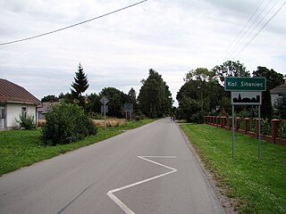
Sitaniec-Kolonia is a village in the administrative district of Gmina Zamość, within Zamość County, Lublin Voivodeship, in eastern Poland. It lies approximately 5 kilometres (3 mi) north of Zamość and 72 km (45 mi) south-east of the regional capital Lublin.
Helenów is a village in the administrative district of Gmina Gostynin, within Gostynin County, Masovian Voivodeship, in east-central Poland.

Mroczki is a village in the administrative district of Gmina Wiśniew, within Siedlce County, Masovian Voivodeship, in east-central Poland.
Pustelnik is a village in the administrative district of Gmina Ceranów, within Sokołów County, Masovian Voivodeship, in east-central Poland. It lies approximately 3 kilometres (2 mi) north-east of Ceranów, 27 km (17 mi) north of Sokołów Podlaski, and 98 km (61 mi) north-east of Warsaw.
Zakrzów is a village in the administrative district of Gmina Polska Cerekiew, within Kędzierzyn-Koźle County, Opole Voivodeship, in south-western Poland. It lies approximately 4 kilometres (2 mi) north-east of Polska Cerekiew, 12 km (7 mi) south of Kędzierzyn-Koźle, and 49 km (30 mi) south of the regional capital Opole.

Nikoličevo is a village in the municipality of Zaječar, Serbia. According to the 2002 census, the village has a population of 833 people.

Tvrtkovići is a village in the municipality of Višegrad, Bosnia and Herzegovina. It is around 60 km east of Sarajevo.
Osredak is a village in the municipality of Srebrenica, Bosnia and Herzegovina.
The Kolar River is a river of Nagpur district, Maharashtra, India, flowing southeast from above the town of Saoner to its juncture with the Kanhan River. It is in the Godavari river basin. The Kolar River forms the boundary between Saoner taluka and Ramtek taluka.

Malinaŭka is a Minsk Metro station. It was opened on June 3, 2014. Architectural elements of the station were enhanced by the work of sculptor Maxim Piatrul

Ramgarh is a community development block that forms an administrative division in Dumka district, Jharkhand state, India. It is located 38 km from Dumka, the district headquarters.


