Schoten is a former village in the Dutch province of North Holland. It was located between Haarlem and Santpoort.

Yoder is an unincorporated community in Pleasant Township, Allen County, Indiana. It was formerly known as Sheldon.

Highway 92 is a north-south highway in northeastern Israel. It follows the eastern edge of the Kinneret from Ma'agan junction in the south at Highway 98 to Yehudiya junction in the north at Highway 87. It is 24 km long.
Movilița is a commune located in Ialomița County, Romania. It is composed of three villages: Bițina-Pământeni, Bițina-Ungureni and Movilița.

Bronisławów is a village in the administrative district of Gmina Baranów, within Grodzisk Mazowiecki County, Masovian Voivodeship, in east-central Poland.

Skibniew-Kurcze is a village in the administrative district of Gmina Sokołów Podlaski, within Sokołów County, Masovian Voivodeship, in east-central Poland. It lies approximately 12 kilometres (7 mi) north-west of Sokołów Podlaski and 86 km (53 mi) east of Warsaw.
Szczepowice is a village in the administrative district of Gmina Kamieniec, within Grodzisk Wielkopolski County, Greater Poland Voivodeship, in west-central Poland.

Barczygłów is a village in the administrative district of Gmina Stare Miasto, within Konin County, Greater Poland Voivodeship, in west-central Poland. It lies approximately 4 kilometres (2 mi) south-west of Stare Miasto, 9 km (6 mi) south-west of Konin, and 90 km (56 mi) east of the regional capital Poznań.
Smolary Bytnickie is a village in the administrative district of Gmina Bytnica, within Krosno Odrzańskie County, Lubusz Voivodeship, in western Poland.

Kłodawka is a settlement in the administrative district of Gmina Chojnice, within Chojnice County, Pomeranian Voivodeship, in northern Poland. It lies approximately 10 kilometres (6 mi) north-east of Chojnice and 94 km (58 mi) south-west of the regional capital Gdańsk.

Czerniec is a village in the administrative district of Gmina Trąbki Wielkie, within Gdańsk County, Pomeranian Voivodeship, in northern Poland. It lies approximately 4 kilometres (2 mi) west of Trąbki Wielkie, 15 km (9 mi) south-west of Pruszcz Gdański, and 24 km (15 mi) south-west of the regional capital Gdańsk.

Sławki is a village in the administrative district of Gmina Somonino, within Kartuzy County, Pomeranian Voivodeship, in northern Poland. It lies approximately 3 kilometres (2 mi) south-west of Somonino, 9 km (6 mi) south of Kartuzy, and 33 km (21 mi) west of the regional capital Gdańsk.

Dargocice is a village in the administrative district of Gmina Gościno, within Kołobrzeg County, West Pomeranian Voivodeship, in north-western Poland. It lies approximately 20 kilometres (12 mi) south of Kołobrzeg and 95 km (59 mi) north-east of the regional capital Szczecin.

Bình Trung is a commune (xã) and village in Châu Đức District, Bà Rịa–Vũng Tàu Province, in Vietnam.

Ostfalia Hochschule für angewandte Wissenschaften, is a Fachhochschule in eastern Lower Saxony, Germany. The predecessor of the college, Staatliche Ingenieurschule Wolfenbüttel, was founded in 1928. It merged with two other independent institutions in August 1971.

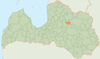
Jaunpiebalga Municipality is a municipality in Vidzeme, Latvia. The municipality was formed in 2009 by merging Jaunpiebalga parish and Zosēni parish the administrative centre being Jaunpiebalga.

Bouti Sayah is a town and commune in M'Sila Province, Algeria. According to the 1998 census it has a population of 7,806.
Imukvere is a village in Jõgeva Parish, Jõgeva County in eastern Estonia.

Kiltsi is a small borough in Väike-Maarja Parish, Lääne-Viru County, in northeastern Estonia.

Luo River, also known by its Chinese name as the Luo He, is a tributary of the Wei River. It flows through the Loess Plateau and has a length of about 680 kilometers (420 mi).


