Little Heath School is a voluntary-aided co-educational comprehensive secondary school. The school is located in the Little Heath area of the Reading suburb of Tilehurst, in the English county of Berkshire.
The Max Planck Institute of Molecular Cell Biology and Genetics (MPI-CBG) is a biology research institute located in Dresden, Germany. It was founded in 1998 and was fully operational in 2001. Twenty-four research groups work in molecular biology, cell biology, developmental biology,and biophysics supported by various facilities.

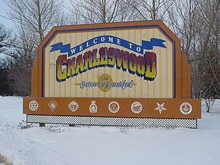
Roblin Park is one of the original neighbourhoods of the Charleswood community in Winnipeg, Manitoba, Canada.
Dobročovice is a village in the Central Bohemian Region of the Czech Republic. On August 28, 2006 it had 141 inhabitants. The first written notice about the village is from 1403. The municipality lies at an altitude of 273 metres and covers an area of 3.58 km².

Sis is a town in the Ararat Province of Armenia. The Sis territorial union refers to the seat of the archbishop of Sis, the capital of Armenian Cilicia.

Huszcza Druga is a village in the administrative district of Gmina Łomazy, within Biała Podlaska County, Lublin Voivodeship, in eastern Poland. It lies approximately 10 kilometres (6 mi) south-east of Łomazy, 22 km (14 mi) south-east of Biała Podlaska, and 85 km (53 mi) north-east of the regional capital Lublin.

Gëzlyubulak is a village in the Kalbajar Rayon of Azerbaijan.

Teodorów Duży is a village in the administrative district of Gmina Kodrąb, within Radomsko County, Łódź Voivodeship, in central Poland. It lies approximately 11 kilometres (7 mi) east of Radomsko and 81 km (50 mi) south of the regional capital Łódź.

Dąbrowa is a village in the administrative district of Gmina Milejów, within Łęczna County, Lublin Voivodeship, in eastern Poland. It lies approximately 10 kilometres (6 mi) east of Milejów-Osada, 16 km (10 mi) south-east of Łęczna, and 35 km (22 mi) east of the regional capital Lublin.

Stary Brus is a village in Włodawa County, Lublin Voivodeship, in eastern Poland. It is the seat of the gmina called Gmina Stary Brus. It lies approximately 20 kilometres (12 mi) south-west of Włodawa and 57 km (35 mi) north-east of the regional capital Lublin.

Turowice is a village in the administrative district of Gmina Fałków, within Końskie County, Świętokrzyskie Voivodeship, in south-central Poland. It lies approximately 6 kilometres (4 mi) north-west of Fałków, 26 km (16 mi) west of Końskie, and 52 km (32 mi) north-west of the regional capital Kielce.

Laskówka is a village in the administrative district of Gmina Dynów, within Rzeszów County, Subcarpathian Voivodeship, in south-eastern Poland. It lies approximately 5 kilometres (3 mi) north-east of Dynów and 29 km (18 mi) south-east of the regional capital Rzeszów.
Huta Emilia is a village in the administrative district of Gmina Strzegowo, within Mława County, Masovian Voivodeship, in east-central Poland.

Podraczynie is a village in the administrative district of Gmina Przesmyki, within Siedlce County, Masovian Voivodeship, in east-central Poland. It lies approximately 5 kilometres (3 mi) north-east of Przesmyki, 29 km (18 mi) north-east of Siedlce, and 112 km (70 mi) east of Warsaw.

Zalesie is a village in the administrative district of Gmina Iłów, within Sochaczew County, Masovian Voivodeship, in east-central Poland. It lies approximately 7 kilometres (4 mi) south of Iłów, 18 km (11 mi) west of Sochaczew, and 70 km (43 mi) west of Warsaw.

Adamowice is a village in the administrative district of Gmina Strzelce Opolskie, within Strzelce County, Opole Voivodeship, in south-western Poland. It lies approximately 3 kilometres (2 mi) north of Strzelce Opolskie and 30 km (19 mi) south-east of the regional capital Opole.

Borcz-Leśniczówka is a settlement in the administrative district of Gmina Somonino, within Kartuzy County, Pomeranian Voivodeship, in northern Poland. It lies approximately 7 kilometres (4 mi) east of Somonino, 10 km (6 mi) south-east of Kartuzy, and 26 km (16 mi) south-west of the regional capital Gdańsk.

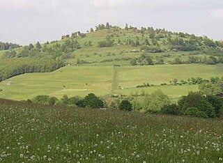
Osterkopf is a mountain of Landkreis Waldeck-Frankenberg, Hesse, Germany.
The Chwałowice coal mine is a large mine in the south of Poland in Chwałowice district of Rybnik, Silesian Voivodeship, 294 km south-west of the capital, Warsaw. Chwałowice represents one of the largest coal reserve in Poland having estimated reserves of 243.7 million tonnes of coal. The annual coal production is around 3.7 million tonnes.
Thomas Delarue was a co-educational special secondary boarding school in Tonbridge, Kent, England that was established in 1955 and closed in 1989. It was run by The Spastics Society and catered for pupils with cerebral palsy.


