Retniowiec is a village in the administrative district of Gmina Lipce Reymontowskie, within Skierniewice County, Łódź Voivodeship, in central Poland. It lies approximately 4 kilometres (2 mi) north of Lipce Reymontowskie, 14 km (9 mi) west of Skierniewice, and 38 km (24 mi) north-east of the regional capital Łódź.
Dąbrowice is a village in the administrative district of Gmina Maków, within Skierniewice County, Łódź Voivodeship, in central Poland. It lies approximately 5 kilometres (3 mi) south-east of Maków, 5 km (3 mi) south-west of Skierniewice, and 47 km (29 mi) east of the regional capital Łódź.
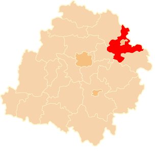
Jacochów is a village in the administrative district of Gmina Maków, within Skierniewice County, Łódź Voivodeship, in central Poland. It lies approximately 7 kilometres (4 mi) north-west of Maków, 12 km (7 mi) west of Skierniewice, and 42 km (26 mi) north-east of the regional capital Łódź.
Krężce is a village in the administrative district of Gmina Maków, within Skierniewice County, Łódź Voivodeship, in central Poland. It lies approximately 3 kilometres (2 mi) south-east of Maków, 5 km (3 mi) south-west of Skierniewice, and 46 km (29 mi) east of the regional capital Łódź.
Maków is a village in Skierniewice County, Łódź Voivodeship, in central Poland. It is the seat of the gmina called Gmina Maków. It lies approximately 7 kilometres (4 mi) west of Skierniewice and 44 km (27 mi) north-east of the regional capital Łódź.
Maków-Kolonia is a village in the administrative district of Gmina Maków, within Skierniewice County, Łódź Voivodeship, in central Poland. It lies approximately 2 kilometres (1 mi) north of Maków, 7 km (4 mi) west of Skierniewice, and 45 km (28 mi) north-east of the regional capital Łódź.
Sielce Lewe is a village in the administrative district of Gmina Maków, within Skierniewice County, Łódź Voivodeship, in central Poland. It lies approximately 5 kilometres (3 mi) north of Maków, 9 km (6 mi) north-west of Skierniewice, and 45 km (28 mi) north-east of the regional capital Łódź.
Sielce Prawe is a village in the administrative district of Gmina Maków, within Skierniewice County, Łódź Voivodeship, in central Poland. It lies approximately 5 kilometres (3 mi) north of Maków, 8 km (5 mi) north-west of Skierniewice, and 47 km (29 mi) north-east of the regional capital Łódź.
Słomków is a village in the administrative district of Gmina Maków, within Skierniewice County, Łódź Voivodeship, in central Poland. It lies approximately 4 kilometres (2 mi) west of Maków, 10 km (6 mi) west of Skierniewice, and 42 km (26 mi) north-east of the regional capital Łódź.
Święte Laski is a village in the administrative district of Gmina Maków, within Skierniewice County, Łódź Voivodeship, in central Poland. It lies approximately 6 kilometres (4 mi) west of Maków, 12 km (7 mi) west of Skierniewice, and 39 km (24 mi) north-east of the regional capital Łódź.
Święte Nowaki is a village in the administrative district of Gmina Maków, within Skierniewice County, Łódź Voivodeship, in central Poland. It lies approximately 4 kilometres (2 mi) west of Maków, 11 km (7 mi) west of Skierniewice, and 41 km (25 mi) north-east of the regional capital Łódź.
Wola Makowska is a village in the administrative district of Gmina Maków, within Skierniewice County, Łódź Voivodeship, in central Poland. It lies approximately 5 kilometres (3 mi) north of Maków, 8 km (5 mi) north-west of Skierniewice, and 46 km (29 mi) north-east of the regional capital Łódź.
Mokra Prawa is a village in the administrative district of Gmina Skierniewice, within Skierniewice County, Łódź Voivodeship, in central Poland. It lies approximately 5 kilometres (3 mi) north-west of Skierniewice and 50 km (31 mi) north-east of the regional capital Łódź.
Samice is a village in the administrative district of Gmina Skierniewice, within Skierniewice County, Łódź Voivodeship, in central Poland. It lies approximately 8 kilometres (5 mi) east of Skierniewice and 57 km (35 mi) east of the regional capital Łódź.
Krosnowa is a village in the administrative district of Gmina Słupia, within Skierniewice County, Łódź Voivodeship, in central Poland. It lies approximately 3 kilometres (2 mi) west of Słupia, 18 km (11 mi) south-west of Skierniewice, and 33 km (21 mi) east of the regional capital Łódź.
Marianów is a village in the administrative district of Gmina Słupia, within Skierniewice County, Łódź Voivodeship, in central Poland. It lies approximately 5 kilometres (3 mi) west of Słupia, 20 km (12 mi) south-west of Skierniewice, and 32 km (20 mi) east of the regional capital Łódź.
Podłęcze is a village in the administrative district of Gmina Słupia, within Skierniewice County, Łódź Voivodeship, in central Poland. It lies approximately 5 kilometres (3 mi) west of Słupia, 20 km (12 mi) south-west of Skierniewice, and 32 km (20 mi) east of the regional capital Łódź.
Winna Góra is a village in the administrative district of Gmina Słupia, within Skierniewice County, Łódź Voivodeship, in central Poland. It lies approximately 4 kilometres (2 mi) west of Słupia, 19 km (12 mi) south-west of Skierniewice, and 33 km (21 mi) east of the regional capital Łódź.
Zagórze is a village in the administrative district of Gmina Słupia, within Skierniewice County, Łódź Voivodeship, in central Poland. It lies approximately 4 kilometres (2 mi) north-west of Słupia, 16 km (10 mi) south-west of Skierniewice, and 35 km (22 mi) east of the regional capital Łódź.