
Corozal is a town and municipality of Puerto Rico located in the central-eastern region, north of Orocovis and Barranquitas; south of Vega Alta; southwest of Toa Alta; east of Morovis and Orocovis; and west of Naranjito. Corozal is spread over 12 barrios and Corozal Pueblo. It is part of the San Juan-Caguas-Guaynabo Metropolitan Statistical Area.
Toa Baja is a town and municipality of Puerto Rico located in the northern coast, north of Toa Alta and Bayamón; east of Dorado; and west of Cataño. Toa Baja is spread over five barrios, including Toa Baja Pueblo. Toa Baja is part of the San Juan-Caguas-Guaynabo Metropolitan Statistical Area. Toa Baja is located fifteen minutes by car from San Juan and two hours from Ponce.

Vega Baja is a town and municipality located on the coast of north central Puerto Rico. It is north of Morovis, east of Manatí, and west of Vega Alta. Vega Baja is spread over 14 barrios. The population of the municipality was 54,414 at the 2020 census. It is part of the San Juan–Caguas–Guaynabo metropolitan statistical area.

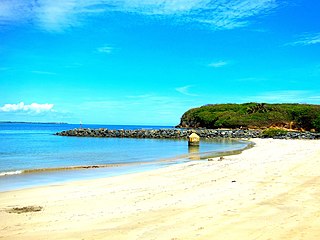
The La Plata River is the longest river in Puerto Rico. It is located in the north coast of the island. It flows from south to north, and drains into the Atlantic Ocean about 11 miles (18 km) west of San Juan. The mouth of the river is a resort area with white sandy beaches.

The Rio Grande de Loíza is a river in the island of Puerto Rico. It is the largest river in Puerto Rico by discharge volume. It is situated on the north coast of the island. It flows from south to north and drains into the Atlantic Ocean, a few miles east of San Juan.

The Culebrinas River, is a river in northwest Puerto Rico. It originates in southwestern Lares for 25 miles (40 km) till it empties into the Mona Passage south of downtown Aguadilla. It goes through Lares, San Sebastián, Moca, Aguada and Aguadilla municipalities. It is 37.33 miles long and when it floods causes damage to infrastructure in a number of municipalities.

Río Jacaguas is a river shared between the municipalities of Ponce and Juana Díaz in Puerto Rico. It flows from north to south, draining into the Caribbean Sea east of the city of Ponce. One of the 14 rivers in the municipality of Ponce, it is also the longest, at 39.72 kilometers (24.68 mi). The river has a discharge of 37,000 ft3/second, making it also Ponce's most affluent river.

Río Portugués is a river in the municipality of Ponce, Puerto Rico. In the 19th century, it was also known as Río de Ponce. Twenty-one bridges for motor vehicle traffic span Río Portugués in the municipality of Ponce alone. The river is also known as Río Tibes in the area where it flows through barrio Tibes in the municipality of Ponce. Río Portugués has a length of nearly 30 kilometers (19 mi) and runs south from the Cordillera Central mountain range into the Caribbean Sea. The Portugués is one of the best-known rivers in Ponce because of its prominent zigzagging through the city and its historical significance. The river is historically significant because the city of Ponce had its origins on its banks. It was originally known as Río Baramaya. It has its mouth at 17°58′51″N66°37′26″W. This river is one of the 14 rivers in the municipality.

The Cibuco River is a river of Vega Baja, Puerto Rico. Part of the river goes through Vega Alta and Corozal municipalities. It is 23.75 miles long. Cibuco River meets Indio River. The river flooded up to 15 feet during Hurricane Maria in some neighborhoods and as late as 2019, the river floods when rains are heavy.

The Río Grande de Arecibo is a river of Puerto Rico. The headwaters lie in the mountains to the south of Adjuntas. From there it flows north until it reaches the Atlantic Ocean near Arecibo. The tributaries lie along the side of the Cerro de Punta and the Utuado pluton. It flows through the northern, passing along a gorge that is 200 m deep and 800–1,200 m wide. It flows through the middle of Puerto Rico.

The Manatí River is a river in Puerto Rico, which flows through several northern municipalities of the island. The river is named after the municipality of Manatí where the river mouth is located.
The Guanajibo River is a river that runs through Hormigueros, Cabo Rojo, Mayagüez, San Germán, and Sabana Grande in Puerto Rico.
The Guayanilla River is a river of Guayanilla, Puerto Rico.

Río Inabón is one of one of the 14 rivers in the municipality of Ponce, Puerto Rico. With a length of some 32.01 kilometers (19.89 mi), it is Ponce's second longest river after Río Jacaguas. It is fed by the Río Anón, Río Guayo and the Emajagua Brook. It is also fed by Río Bacas and Río de las Raices. Originating at an altitude of approximately 4,100 feet (1,200 m), it forms at a higher altitude than any of the other 13 rivers in the municipality, and at one of the highest points of any river in Puerto Rico. With a watershed area covering 38.18 square miles, Río Inabón also has the second largest basin area of any of the municipality's 14 rivers after Río Jacaguas.
The Nigua River is a river of Salinas, Puerto Rico, which flows south to Rincón Bay in Santa Isabel, Puerto Rico.
The Nuevo River is a river of Puerto Rico.

Río Pastillo is a river in the municipality of Ponce, Puerto Rico. It is also known as Río Marueño in the area of the municipality where it runs through barrio Marueño. Together with Cañas River, Pastillo forms Matilde River. Pastillo is one of the 14 rivers in the municipality. The river originates at an altitude of 435 feet. Its tributaries are Quebrada Limon and Quebrada del Agua brooks and the river runs for 19 kilometers before feeding into Río Matilde at a height of 15 feet in Barrio Canas Urbano.

The Yauco River is a river that goes through Guayanilla and Yauco, municipalities in Puerto Rico.

Cerrillos River is a river in the municipality of Ponce, Puerto Rico. Río Cerrillos has its origin in barrio Anón and runs south until it feeds into Bucaná River. Río Cerrillos is commonly known by the locals as Maragüez River, because most of its course runs through Barrio Maragüez. This river is one of the 14 rivers in the municipality. The river has a discharge of 24,000 cubic feet per second, making it the second most affluent river in the municipality after Río Jacaguas.

