
Sabana Grande is a town and municipality of Puerto Rico located north of Lajas and Guánica; south of Maricao; east of San Germán; and west of Yauco. Sabana Grande is spread over seven barrios and Sabana Grande Pueblo. It is part of the San Germán-Cabo Rojo Metropolitan Statistical Area.

Puerto Rico Highway 2 (PR-2) is a road in Puerto Rico that connects the cities of San Juan and Ponce. At 156 miles (230 km) long, it is Puerto Rico's longest singled-signed highway.

Puerto Rico Highway 116 (PR-116) is a main highway in the southwest part of Puerto Rico, beginning in Guánica, Puerto Rico at Puerto Rico Highway 2 to Lajas, Puerto Rico at Puerto Rico Highway 101.
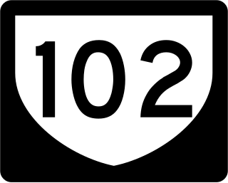
Puerto Rico Highway 102 (PR-102) is a main highway in the southwestern portion of the Porta del Sol region of Puerto Rico. It begins at Puerto Rico Highway 2 north of central Mayagüez and runs through the municipalities of Cabo Rojo and San Germán, coming to an end in downtown Sabana Grande.

Puerto Rico Highway 185 (PR-185) is a main highway that connects Canóvanas, Puerto Rico to Juncos, Puerto Rico and is about 25 kilometers long. It begins in downtown of Canóvanas, very close to Puerto Rico Highway 3 and ends in Puerto Rico Highway 952 and Puerto Rico Highway 30 in Juncos.
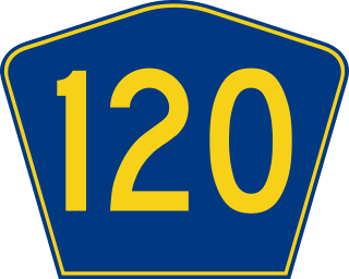
Puerto Rico Highway 120 (PR-120) is a main highway connecting Las Marías, Maricao and Sabana Grande, and is the main road through the Monte del Estado.
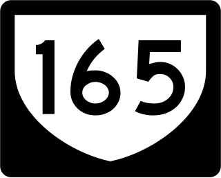
Puerto Rico Highway 165 (PR-165) is the road that goes from Naranjito to Guaynabo. The highway passes by Toa Alta, Toa Baja, Dorado, Levittown, Cataño and Guaynabo.

Puerto Rico Highway 142 (PR-142) is a north–south road that connects the northern region of Puerto Rico with the municipality of Corozal. With a length of about 8.2 kilometers (5.1 mi), PR-142 crosses the municipalities of Dorado, Toa Alta and Corozal, extending from PR-2 in Dorado to PR-159 near downtown Corozal.

Puerto Rico Highway 101 (PR-101) is a rural road leaving the town of Boquerón, Cabo Rojo and Lajas, to the town of San Germán. Among their intersections are the PR-100, PR-301, PR-103 PR-116, PR-166 and PR-102.

Puerto Rico Highway 103 (PR-103) is a rural road that connects from the PR-114, near Hormigueros, to the PR-101, in Cabo Rojo.

Puerto Rico Highway 124 (PR-124) is a rural road that connects from Lares to Las Marías.

Puerto Rico Highway 166 (PR-166) is a by-pass in San Germán, Puerto Rico. The highway is an avenue which was built for drivers passing through PR-102 could bypass the downtown area of San Germán.
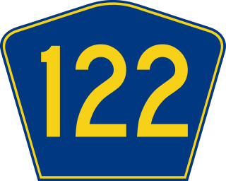
Puerto Rico Highway 122 (PR-122) is a north–south road between the municipalities of San Germán and Lajas, Puerto Rico. In San Germán, it begins at PR-2 and ends at PR-166, and in Lajas, it extends from PR-116 to PR-321. When completed, it will be extend from PR-116 at its southern terminus to PR-2 interchange in the northern end.
Puerto Rico Highway 866 (PR-866) is a main highway in the city of Toa Baja, Puerto Rico. It begins at its intersection with PR-2 in Candelaria and ends at PR-167 in Levittown.
Puerto Rico Highway 693 (PR-693) is a road located between the municipalities of Dorado, Puerto Rico and Vega Alta, passing through downtown Dorado. It begins at its intersection with PR-2 and PR-165 in Río Lajas and ends at PR-690 in Sabana. It is a short divided highway in southern Dorado, which serves as an alternate route for PR-165 west of Río de la Plata.

Puerto Rico Highway 118 (PR-118) is a rural road located between Lajas, Puerto Rico and San Germán. This road extends from PR-117 in Lajas Arriba and ends at PR-102 in Retiro.
Puerto Rico Highway 121 (PR-121) is a road that travels from Sabana Grande, Puerto Rico to Yauco. This highway begins at its intersection with PR-102 and PR-368 in downtown Sabana Grande and ends at its junction with PR-127 and PR-128 in Susúa Baja.

Puerto Rico Highway 190 (PR-190) is a road located in Carolina, Puerto Rico. This highway begins at its intersection with PR-26 in Cangrejo Arriba and ends at its junction with PR-3 and PR-8887 between Sabana Abajo and San Antón barrios.
Puerto Rico Highway 187 (PR-187) is a road that travels from Río Grande, Puerto Rico to Carolina, passing through Loíza. This highway begins at its intersection with PR-3 and PR-66 in Guzmán Abajo and ends at PR-26 in Isla Verde.
Puerto Rico Highway 690 (PR-690) is a north–south road located entirely in the municipality of Vega Alta, Puerto Rico. With a length of 7.6 kilometers (4.7 mi), it begins at its junction with PR-676 in Bajura barrio and ends at Cerro Gordo Beach in Sabana barrio.


