Hatillo is a town and municipality located in Puerto Rico's north coast, bordered by the Atlantic Ocean to the north, Lares and Utuado to the south, Camuy to the west, and Arecibo to the east. According to the 2000 US Census Hatillo is spread over nine barrios and Hatillo Pueblo. It is part of the San Juan-Caguas-Guaynabo Metropolitan Statistical Area.

Puerto Rico Highway 2 (PR-2) is a road in Puerto Rico that connects the cities of San Juan and Ponce. At 156 miles (230 km) long, it is Puerto Rico's longest singled-signed highway.

Puerto Rico Highway 111 (PR-111) is a highway connecting Aguadilla, Puerto Rico at Puerto Rico Highway 2 and Puerto Rico Highway 115 to Utuado, Puerto Rico at Puerto Rico Highway 140.
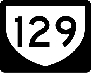
Puerto Rico Highway 129 (PR-129) is a north–south highway in North-Central Puerto Rico, connecting the town of Lares with Arecibo. It crosses the northern karst country of the island. When traveling from the northern coast of Puerto Rico, PR-129 can be used to reach the Arecibo Observatory and the Camuy River Caverns Park.
Puerto Rico Highway 156 (PR-156) is a long east–west highway which connects Caguas to Orocovis, passing through Aguas Buenas, Comerío and Barranquitas. This route extends from its junction with PR-1 in downtown Caguas to PR-5155 in downtown Orocovis.

Puerto Rico Highway 119 (PR-119) is a long north-to-south highway in Puerto Rico that goes from Puerto Rico Highway 2 in Hatillo, close to its border with Camuy to the same highway in San Germán. It goes through the municipalities of Camuy, San Sebastián, Las Marías and Maricao before ending in the freeway segment of PR-2. Between Camuy and San Sebastián it passes near Guajataca Lake, the largest artificial lake in western Puerto Rico.
Puerto Rico Highway 165 (PR-165) is the road that goes from Naranjito to Guaynabo. The highway passes by Toa Alta, Toa Baja, Dorado, Levittown, Cataño and Guaynabo.

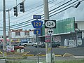
Puerto Rico Highway 124 (PR-124) is a rural road that connects from Lares to Las Marías.

Puerto Rico Highway 130 (PR-130) is the main north–south route within the municipality of Hatillo, Puerto Rico.

Puerto Rico Highway 128 (PR-128) is a road that travels from Yauco, Puerto Rico to Lares. This highway extends from PR-2 in Yauco and ends at PR-111 near downtown Lares.

Puerto Rico Highway 107 (PR-107), or Carretera Pedro Albizu Campos, is a north–south highway located in Aguadilla, Puerto Rico. It extends from PR-2 to Ramey Air Force Base.

Puerto Rico Highway 157 (PR-157) is a rural road in Puerto Rico that travels from Ciales to Orocovis. It begins at its intersection with PR-149 in Toro Negro and ends at its junction with PR-155 near downtown Orocovis.

Puerto Rico Highway 153 (PR-153) is a rural road that goes from Santa Isabel, Puerto Rico to Coamo. This road extends from PR-1 in downtown Santa Isabel and ends at its junction with PR-14 and PR-138 near downtown Coamo.

Puerto Rico Highway 162 (PR-162) is a road that travels from Aibonito, Puerto Rico to Barranquitas. This highway begins at its intersection with PR-1 in Cuyón and ends at its junction with PR-156 in downtown Barranquitas.

Puerto Rico Highway 803 (PR-803) is a north–south road that travels from eastern Corozal to southwestern Naranjito in Puerto Rico. With a length of 10.2 km (6.3 mi), it begins at PR-164 in Palmarejo barrio and ends at its junction with PR-152 and PR-802 in Cedro Arriba barrio.

Puerto Rico Highway 805 (PR-805) is an east–west road located in the municipality of Corozal in Puerto Rico. With a length of 7.3 km (4.5 mi), it extends from its intersection with PR-568 near the Cuchillas boundary, passing through Negros barrio until its junction with PR-803 in Palos Blancos area.

Puerto Rico Highway 807 (PR-807) is a north–south road located in the municipality of Corozal in Puerto Rico. With a length of 6.9 km (4.3 mi), it begins at Calle San Manuel in downtown Corozal, passing through Dos Bocas barrio until its southern terminus at its junction with PR-805 on the Palos Blancos–Negros line.

Puerto Rico Highway 818 (PR-818) is an east–west road located in the municipality of Corozal in Puerto Rico. With a length of 4.3 km (2.7 mi), it begins at its junction with PR-159 in Barrio Pueblo, and ends at Baja del Palo sector in Barrio Cibuco.

Puerto Rico Highway 869 (PR-869) is a north–south road located in Cataño, Puerto Rico. It begins at its intersection with PR-5 and PR-22 near Bayamón municipal limit and ends at its junction with PR-165 near Toa Baja municipal limit.

Puerto Rico Highway 487 (PR-487) is a north–south road located entirely in the municipality of Hatillo, Puerto Rico. With a length of 8.7 kilometers (5.4 mi), it begins at its intersection with PR-130 and PR-488 on the Naranjito–Buena Vista line, and ends at its junction with PR-129 in Bayaney barrio.

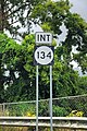
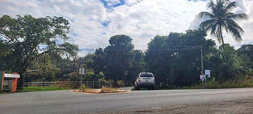 Southbound beginning of PR-134 at PR-129 junction in Campo Alegre, Hatillo