Puerto Rico Highway 52 (PR-52), a major toll road in Puerto Rico, is also known as Autopista Luis A. Ferré. It was formerly called Expreso Las Américas. It runs from PR-1 in southwest Río Piedras and heads south until it intersects with highway PR-2 in Ponce. At its north end, the short PR-18 continues north from PR-52 towards San Juan. This short segment is known as Expreso Las Americas, the only segment of the route still unofficially bearing this name, since PR-18 is officially named Roberto Sánchez Vilella Expressway. The combined route of PR-18 and PR-52 runs concurrent with the unsigned Interstate Highway PRI-1. Toll stations are located in San Juan, Caguas, Salinas, Juana Díaz, and Ponce.
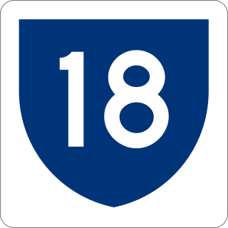
Puerto Rico Highway 18 (PR-18) is a freeway in Puerto Rico, which is also known as Expreso Las Américas. It runs from its north end at its intersection with PR-22 in San Juan to its south end in Río Piedras where it intersects with PR-1. At this point PR-18 becomes PR-52, known as Autopista Luis A. Ferré.

Puerto Rico Highway 3(PR-3) at nearly 100 miles long, is the second longest highway on Puerto Rico. It connects the San Juan neighborhood of Río Piedras to downtown Salinas indirectly around the eastern coast of the island. Highway 3 ranges from a three lane urban avenue in San Juan to a one lane rural road past Fajardo. While other roads connect San Juan, it runs the coastline of Puerto Rico east of San Juan, beginning in Río Piedras near Santurce and goes to Fajardo where it goes south paralleling the coastline to Humacao and Maunabo. It goes up to a mountain-scenic route and goes west to Salinas, where it meets PR-1.
Puerto Rico Highway 53 (PR-53) or unsigned Interstate PR3 is a main tollway that is parallel to Puerto Rico Highway 3, which goes from Fajardo to Salinas. Some segments are still in planning, but when finished it will be about 58 miles (93 km) in length. Two tunnels, about 0.6 mi (1 km) long each, in the towns of Yabucoa and Maunabo were completed in October 2008. It will connect the cities of Fajardo, Ceiba, Naguabo, Humacao, Yabucoa, Maunabo, Patillas, Arroyo, Guayama and Salinas, thus bordering the entire eastern and southeastern coasts of Puerto Rico. Its northern terminus is at PR-3 and PR-194 in Fajardo, and its south terminus is at PR-52 in Salinas.

Puerto Rico Highway 413 (PR-413) is a rural road located at the west point of Rincón, Puerto Rico and is famous in the island for being the main access to beaches near Tres Palmas and the Rincón Lighthouse, where local and international surfing tournaments take place. It is named the "Road to Happiness".
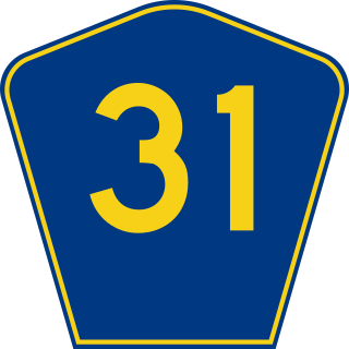
Puerto Rico Highway 31 (PR-31) is a main, rural highway connecting Juncos at Puerto Rico Highway 198 to Naguabo at Puerto Rico Highway 3.

Puerto Rico Highway 8 (PR-8) is a main highway that serves as a third route from San Juan, Puerto Rico to Carolina, Puerto Rico. It is, still, a highly congested highway, noticeable when congestion jams are found in PR-17 where PR-8 begins and it continues to PR-3. The first kilometers of PR-8 were known before as Puerto Rico Highway 4, but the Department of Transportation renumbered the entire highway PR-8 and there is no longer a PR-4. It ends in PR-3 in Carolina.

Puerto Rico Highway 15 (PR-15) is a main highway connecting Cayey and Guayama. It takes longer though, than going south to Salinas through PR-52 and taking PR-53 to Guayama, due to it being a rural road.

Puerto Rico Highway 301 (PR-301) is a main highway in Cabo Rojo, Puerto Rico. It begins in PR-101, close to PR-100, and goes south all the way to Los Morrillos Light, where it ends. It is the main access to the lighthouse, the Cabo Rojo cliffs, and Playa Sucia.

Puerto Rico Highway 204 (PR-204) was previously a short connector road between PR-22 and PR-2 in Barceloneta, Puerto Rico but was renumbered Puerto Rico Highway 140, and a new PR-204 was built in Las Piedras, Puerto Rico, which connects PR-30 and PR-198 to PR-183 in the municipality. The new connector was constructed to better serve residents of the town which can only enter through the exit to PR-183 and has a high frequency of long congestion and traffic jams. The main movie theater in the east coast can be accessed by the road.

Avenida Juan Ponce de León, coextensive as Route PR-25 along its entire length, is one of the main thoroughfares in San Juan, Puerto Rico.
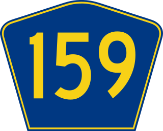
Puerto Rico Highway 159 (PR-159) is the main road from Morovis to Toa Alta, passing through the municipality of Corozal, Puerto Rico.
Puerto Rico Highway 40 (PR-40) is an urban road in Hato Rey. This is a short road that connects from the PR-25 to PR-27. This road is called Avenida Quisqueya.
Puerto Rico Highway 39 (PR-39) is an urban road in Santurce. This is a short road that connects from the PR-1 to PR-26 and is parallel to PR-2. This road intersects with PR-35 and PR-25. This road is called Calle Cerra.

Puerto Rico Highway 191 (PR-191) is a rural road located in eastern Puerto Rico and is the main access to the El Yunque National Forest.
Puerto Rico Highway 32 (PR-32) is an urban road in Caguas, Puerto Rico. This road goes from PR-1 in Bairoa to PR-172 in Turabo, east of downtown, and it is known as Avenida Luis Muñoz Marín.
Puerto Rico Highway 693 (PR-693) is a road located between the municipalities of Dorado, Puerto Rico and Vega Alta, passing through downtown Dorado. It begins at its intersection with PR-2 and PR-165 in Río Lajas and ends at PR-690 in Sabana. It is a short divided highway in southern Dorado, which serves as an alternate route for PR-165 west of Río de la Plata.

Puerto Rico Highway 192 (PR-192) is the main access to downtown Naguabo, Puerto Rico. This road extends from PR-31 between Río and Maizales barrios to PR-3 in Húcares.
Puerto Rico Highway 200 (PR-200) is a road located in Vieques, Puerto Rico. This highway extends from Mosquito to Puerto Diablo, passing through Isabel II.

Puerto Rico Highway 633 (PR-633) is an east–west rural road located between the municipalities of Ciales and Morovis, Puerto Rico. It begins at its intersection with PR-149 in Hato Viejo barrio and ends at its junction with PR-155 in Barahona.
