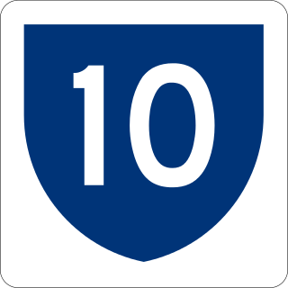
Puerto Rico Highway 10 (PR-10) is a major highway in Puerto Rico. The primary state road connects the city of Ponce in the south coast to Arecibo in the north; it is also the shortest route between the two cities.
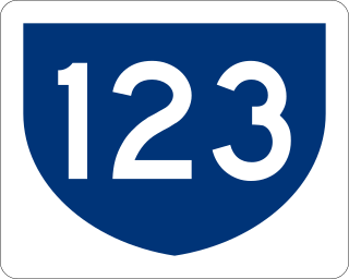
Puerto Rico Highway 123 (PR-123) is a secondary highway that connects the city Arecibo to the city of Ponce. It runs through the towns of Utuado and Adjuntas, before reaching Ponce. A parallel road is being built, PR-10, that is expected to take on most of the traffic currently using PR-123.
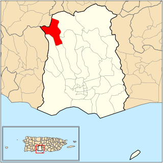
Guaraguao is one of the 31 barrios in the municipality of Ponce, Puerto Rico. Along with Anón, Coto Laurel, Marueño, Quebrada Limón, Real, and San Patricio, and the coastal barrios of Canas and Capitanejo, Guaraguao is one of the municipality's nine bordering barrios. It borders the municipalities of Adjuntas and Peñuelas. The name of this barrio is of native Taino Indian origin. It was created in 1878. Barrio Guaraguao is one of three Ponce barrios located on the Cordillera Central mountain range.

Marueño is one of the 31 barrios of the municipality of Ponce, Puerto Rico. Along with Anón, Coto Laurel, Guaraguao, Quebrada Limón, Real, and San Patricio, and the coastal barrios of Canas and Capitanejo, Marueño is one of the municipality's nine bordering barrios. Marueño borders the municipality of Peñuelas. The name of this barrio is of native Indian origin. It was created in 1831.

San Patricio is one of the 31 barrios of the municipality of Ponce, Puerto Rico. It is one of the municipality's nine bordering barrios, along with Anón, Coto Laurel, Guaraguao, Quebrada Limón, Real, and Marueño, and the coastal barrios of Canas and Capitanejo. Its northern edge borders the municipalities of Utuado and Jayuya. It was founded in 1878. Barrio San Patricio is one of three Ponce barrios located on the Cordillera Central mountain range.

Puerto Rico Highway 500 (PR-500) is a tertiary road in Ponce, Puerto Rico. The highway has both of its endpoints, as well as all of its length, entirely within the Ponce city limits. It runs east to west.

Puerto Rico Highway 132 (PR-132) is a secondary highway that connects the town of Guayanilla to the city of Ponce, Puerto Rico. The road runs through the town of Peñuelas before reaching Ponce. In Ponce, PR-132 starts where Calle Villa ends.

Puerto Rico Highway 503 (PR-503), also called Carretera Tibes, is a tertiary state road that connects Barrio Consejo, in the southwestern part of the municipality of Utuado, to Barrio Tercero in the city of Ponce, and ending at Museo de la Historia de Ponce, one block east of the center of the city at Plaza Las Delicias.

Puerto Rico Highway 585 (PR-585) is tertiary state highway in Ponce, Puerto Rico. The road leads from PR-2R in Sector Pámpanos of Barrio Canas to Avenida Padre Noel in Barrio Playa. It runs west to east, starting from its western terminus at PR-2R and ending at its eastern terminus at PR-123.

Puerto Rico Highway 578 (PR-578) is tertiary state highway in Ponce, Puerto Rico. The road runs from east to west, parallel to PR-1, and it forms the boundary between the northern end of barrio Bucaná and the southern end of barrio Sabanetas. The road is located entirely within the municipality of Ponce.

Puerto Rico Highway 511 (PR-511) is a tertiary state highway in Ponce, Puerto Rico.

Puerto Rico Highway 139 (PR-139) is a two-way secondary highway in the municipality of Ponce, Puerto Rico.

Puerto Rico Highway 501 (PR-501) is a tertiary state highway in Ponce, Puerto Rico. The road runs north to south, and mostly alongside Rio Pastillo in barrio Marueño. It southern terminus is at PR-123, just off Calle 18 of Urbanizacion Las Delicias in barrio Magueyes, and its northern end is also at PR-123 but in barrio Guaraguao.
Puerto Rico Highway 502 (PR-502) is a tertiary state highway in Ponce, Puerto Rico. The road runs north to south through barrio Quebrada Limón. Its southern terminus is at an intersection with PR-132. Its northern terminus is at its intersection with PR-501.

Puerto Rico Highway 505 (PR-505) is a tertiary state highway in Ponce, Puerto Rico.

Puerto Rico Highway 504 (PR-504) is a tertiary state highway in Ponce, Puerto Rico. The road runs north to south, and mostly along Río Chiquito in barrio Portugués Rural. Its southern terminus is at an intersection with PR-503, near PR-10 at the southern edge of Barrio Portugués.

Puerto Rico Highway 577 (PR-577) is a short tertiary mountainous state road that connects PR-143 to the Cerro Maravilla communications towers, in Barrio Anón, Ponce, Puerto Rico. The road's northern terminus is at the Cerro Maravilla communications towers atop the Cerro Maravilla mountain, and its southern terminus is at its intersection with PR-143.

Puerto Rico Highway 510 (PR-510) is a tertiary highway in southern Puerto Rico. The road runs north to south in a general south-southwestern direction. The road connects PR-1 in Barrio Capitanejo, Ponce, to PR-14 in the town of Juana Díaz. Portions of the Juana Díaz portion of the road were damaged in September 2017 by Hurricane Maria.

Puerto Rico Highway 516 (PR-516) is a tertiary state highway in the northern area of barrio Guaraguao in Ponce, Puerto Rico, near Ponce's border with Adjuntas's barrio Portugués. The road travels east to west. It starts at its intersection with PR-123 and heads west to end at Ponce's border with Peñuelas, from where PR-391 picks up into the municipality of Peñuelas. The road runs through dense mountain vegetation into the interior regions of barrio Guaraguao.

Puerto Rico Highway 549 (PR-549) is a tertiary state road in Ponce, Puerto Rico. The road has both of its endpoints, as well as all of its length, entirely within Barrio Canas in the municipality of Ponce. The road is a country road that runs north to south, entirely in the western portion of Barrio Canas. Its southern terminus is at a dirt path that leads to the westernmost endpoint of PR-500 in Barrio Canas and its northern end is at PR-132 also in Barrio Canas.

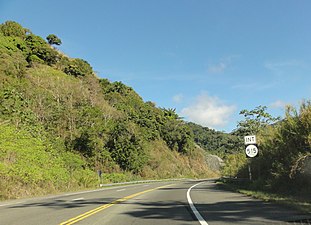
 Puerto Rico Highway 515 in Guaraguao