List of highways in Ponce, Puerto Rico

Last updated

Map of major roads in Ponce, Puerto Rico, shown in red. Ponce, Puerto Rico, roads map.svg
Map of major roads in Ponce, Puerto Rico, shown in red.

This is a list of highways in Ponce, Puerto Rico. The list focuses on major, signed, roads in the municipality of Ponce, Puerto Rico. [1] [2] The list shows local roads, that is, those with both terminuses within the municipality ("intra-municipal" roads), as well as inter-municipal roads.

Contents

List of highways

RouteNetworkAxisSouthern or western terminusNorthern or eastern terminusTypeLength, km (mi)NotesPhoto
PR-1 PrimaryS to N Ponce San Juan Inter-municipal133.7 (83.1) [3] via Cayey Bulevar Miguel Pou, mirando hacia el oeste, en Barrio San Anton, Ponce, PR (20181230 074625).jpg
PR-1P PrimaryW to EPonce Tercero Localunknown Carretera PR-1P, Calle Cristina, Barrio Tercero, Ponce, Puerto Rico, mirando al este (20220102 073517).jpg
PR-2 PrimaryS to NPonceSan JuanInter-municipal230 (140)via Mayagüez PR-2 Ponce.jpg
PR-2R PrimaryS to N Canas Canas Urbano Local1.6 (0.99) Carretera PR-2R, interseccion con la PR-585, Barrio Canas Urbano, Ponce, Puerto Rico, mirando al norte (20220101 093132).jpg
PR-9 PrimaryS to N Vayas CanasLocal12 (7.5)via Portugués; a.k.a. Expreso Román Baldorioty de Castro PR-9 near Barrio Portugues exit in Ponce, Puerto Rico, looking west (IMG-2718).jpg
PR-10 PrimaryS to NPonce Arecibo Inter-municipal68.26 (42.41) [4] via Adjuntas Road Puerto Rico 10 (PR-10), Puerto Rico's first green road (DSC05642C).jpg
PR-12 PrimaryS to N Playa PonceLocal5.28 (3.28) [5] a.k.a. Expreso Santiago de los Caballeros PR-12, viajando hacia el Sur, al norte de la salida hacia la PR-133 (Calle Comercio), en Ponce, PR (DSC01665).jpg
PR-14 PrimaryW to EPonceCayeyInter-municipal73.1 (45.4) [6] Avenida Tito Castro (PR-14), Bo. Machuelo Abajo, Ponce, Puerto Rico, visto desde interseccion con la Av. Fagot, mirando al este (DSC02967).jpg
PR-14P PrimaryW to EPonce Machuelo Abajo Localunknown Carretera PR-14P, Avenida Betances, Barrio Sexto, Ponce, Puerto Rico, mirando al oeste (20220102 075004).jpg
PR-14R PrimaryW to EPonceMachuelo AbajoLocalunknown Puente La Milagrosa, C. Guadalupe (PR-14R), Bo. Machuelo Abajo, Ponce, PR, mirando al oeste (DSC01863A).jpg
PR-52 PrimaryS to NPonceSan JuanInter-municipal108 (67) [7] a.k.a. Expreso Luis A. Ferré Letras de PONCE, PR-52 southbound, Barrio Sabanetas, Ponce, Puerto Rico, looking southwest (DSC05090Z).jpg
PR-123 SecondaryS to NPonceAreciboInter-municipal60 (37)via Adjuntas PR-123, al norte de la interseccion con PR-9, Bo. Magueyes Urbano, Ponce, Puerto Rico, mirando al norte (DSC02720).jpg
PR-123P SecondaryS to N Primero PonceLocalunknown Carretera PR-123P, Calle Concordia esquina Calle Villa, Barrio Primero, Ponce, Puerto Rico, mirando al sur (20220102 072903).jpg
PR-132 SecondaryW to E Guayanilla PonceInter-municipal25.9 (16.1) [8] Un segmento de la carretera PR-132, en Ponce, Puerto Rico, viajando de Penuelas hacia Ponce (DSC02308).jpg
PR-133 SecondaryW to EPonce San Antón Local2.0 (1.2) [5] a.k.a. Calle Comercio PR-133 (Calle Comercio), Barrio San Anton, Ponce, Puerto Rico, mirando al este-sureste (DSC03365).jpg
PR-139 SecondaryS to NPonce Maragüez Local24.8 (15.4) PR-139 in Barrio Maraguez in Ponce, Puerto Rico, heading SB (IMG 3784).jpg
PR-139R SecondaryS to N Machuelo Arriba MaragüezLocal2.9 (1.8) [9] Carretera PR-139R, Barrio Machuelo Arriba, Ponce, Puerto Rico, mirando al sur (20220102 090831).jpg
PR-143 SecondaryW to EAdjuntas Barranquitas Inter-municipal58.7 (36.5) [10] [11] via Ponce Carretera PR-143 (Viajando hacia el Oeste) y acercandose a la Carretera PR-577 hacia el Cerro Maravilla, Barrio Anon, Ponce, Puerto Rico (DSC01621).jpg
PR-163 SecondaryW to ECanas UrbanoSan AntónLocal4.8 (3.0)a.k.a. Avenida Las Américas IMG 2733 - PR-163, Avenida Las Americas, eastbound, in Ponce, PR.jpg
PR-500 TertiaryW to ECanas Magueyes Local1.00 (0.62) PR-500 heading NB in Barrio Canas, Ponce, Puerto Rico (IMG 2721).jpg
PR-501 TertiaryS to NPonce Marueño Local7.0 (4.3) Escena en el Barrio Magueyes, Ponce, PR (DSC01804).jpg
PR-502 TertiaryS to NPonce Quebrada Limón Local5.3 (3.3) PR-502 viajando hacia el sur en Barrio Quebrada Limon, Ponce, PR (IMG 2727).jpg
PR-503 TertiaryS to N Cantera Jayuya Local21.8 (13.5) PR-503 heading northbound in Barrio Portugues in Ponce, PR (IMG 2712).jpg
PR-504 TertiaryS to NPoncePortuguésLocal6.7 (4.2) PR-504 heading SB in Barrio Portugues in Ponce, PR (IMG 2707).jpg
PR-505 TertiaryS to NPonceMachuelo ArribaLocal16.6 (10.3) PR-505 viajando hacia el Este en Barrio San Patricio, Ponce, Puerto Rico (DSC01648).jpg
PR-506 TertiaryS to NCanteraVayasLocal2.0 (1.2) PR-506, Bo. Coto Laurel, Ponce, Puerto Rico, vista desde la PR-52, mirando al norte (DSC03513A).jpg
PR-507 TertiaryS to NCapitanejoCapitanejoLocalunknown Carretera PR-507, Sector Buyones, Barrio Capitanejo, Ponce, Puerto Rico, mirando al sur (20211231 125528).jpg
PR-510 TertiaryS to N Capitanejo Juana Díaz Inter-municipal10.3 (6.4) [12] [13] Un sector rural del Barrio Capitanejo en Ponce, PR (DSC05626).jpg
PR-511 TertiaryS to NPonce Anón Local16.4 (10.2) PR-511 in Barrio Real in Ponce, Puerto Rico, looking north (IMG-3411).jpg
PR-515 TertiaryW to E Guaraguao GuaraguaoLocal1.5 (0.93) [14] PR-10 viajando hacia el norte, acercandose a la interseccion con la PR-515 en Barrio Guaraguao, Ponce, PR (DSC03014).jpg
PR-516 TertiaryW to EGuaraguaoGuaraguaoLocal3.1 (1.9) [15] Letrero en PR-123, km 25.1, viajando al sur, anunciando interseccion con PR-516, Bo. Guaraguao, Ponce, PR (DSC04481).jpg
PR-520 TertiaryW to E Peñuelas Quebrada LimónInter-municipalunknown Letrero en PR-502, km 3.7, viajando al oeste, indicando entrada a la PR-520, Bo. Qda. Limon, Ponce, PR (DSC04305).jpg
PR-549 TertiaryS to NCanasCanasLocal4.2 (2.6) Letrero en PR-132, viajando al oeste, anunciando entrada a la PR-549, Bo. Canas, Ponce, Puerto Rico (DSC04316).jpg
PR-577 TertiaryS to NAnónAnónLocal0.30 (0.19) Cerro Maravilla; dead end road Carretera PR-143 (Viajando hacia el Oeste) y acercandose a la Carretera PR-577 hacia el Cerro Maravilla, Barrio Anon, Ponce, Puerto Rico (DSC01621).jpg
PR-578 TertiaryW to E Bucaná Sabanetas Local0.9 (0.56) Carretera PR-578, km 0.2, Barrio Sabanetas, Ponce, Puerto Rico, mirando al oeste (20220101 100348).jpg
PR-581 TertiaryS to NCapitanejoCapitanejoLocalunknown Carretera PR-581, cerca del km 0.1, Sector Tiburones, Barrio Capitanejo, Ponce, Puerto Rico, mirando al sur (20211230 093850).jpg
PR-585 TertiaryS to NCanasPlayaLocal3.8 (2.4) Carretera PR-585 interseccion con la PR-2, mirando hacia el sur, en Barrio Canas, Ponce, PR (IMG 3375).jpg
PR-588 TertiaryS to NPortuguésPortuguésLocal1.7 (1.1) [16] Letrero en PR-504, km 3.4, viajando al sur, anunciando interseccion con PR-588, Bo. Portugues, Ponce, PR (DSC03973).jpg
PR-591 TertiaryW to E El Tuque El TuqueLocal3.1 (1.9) [17] PR-591, sector El Tuque, Bo. Canas, Ponce, Puerto Rico, mirando al oeste (DSC02976).jpg
PR-5139 TertiaryS to N Cerrillos Machuelo ArribaLocal2.8 (1.7) [18] PR-5139, km 2.7, Bo. Machuelo Arriba, Ponce, Puerto Rico, mirando al sur (DSC03415B).jpg
PR-5506 TertiaryS to NVayasSabanetasLocal1.4 (0.87) [19] Carretera PR-5506, km 1.4, terminal norte, interseccion con la PR-10, Bo. Sabanetas, Ponce, PR, mirando al suroeste (20220101 102034).jpg
PR-5510 TertiaryS to NCapitanejoJuana DíazInter-municipal1.4 (0.87) [20] Carretera PR-5510, km 1.3, Barrio Capitanejo, Ponce, Puerto Rico, mirando al sur (20220101 111101).jpg
PR-5549 TertiaryS to NCanas UrbanoCanas UrbanoLocalunknown Carretera PR-5549, km 0, Barrio Canas Urbano, Ponce, Puerto Rico, mirando al sur (20220101 093944).jpg

See also

Related Research Articles

<span class="mw-page-title-main">Anón River</span> River of Puerto Rico

Anón River is a river in the municipality of Ponce, Puerto Rico. It is located in the northeastern area of the municipality. Río Anón is one of the 14 rivers in the municipality and, at 1,060 feet (320 m), it is also the third with the highest river mouth location, after Río Prieto and Río Blanco, both of which have their mouths at 1,381 feet (421 m). Río Anón is a tributary of Río Inabón. It has a length of approximately 4 kilometers (2.5 mi) and generally runs south. It has both its origin and its mouth in Barrio Anón.

<span class="mw-page-title-main">Bayagán River</span> River of Puerto Rico

Río Bayagán is a river in the municipality of Ponce, Puerto Rico. Bayagán is a tributary of Cerrillos River. It has a length of approximately six kilometers and runs in a southerly direction, mostly along PR-505. It originates in barrio Montes Llanos and runs south through barrio Machuelo Arriba for about nine kilometers until it meets Río Cerrillos. It is part of the Bucaná River watershed. This river is one of the 14 rivers in the municipality.

<span class="mw-page-title-main">Río Blanco (Ponce, Puerto Rico)</span> River of Puerto Rico

Río Blanco is a river in the municipality of Ponce, Puerto Rico. It is located in the northeastern area of the municipality. It empties into the Río Prieto. Together with the Río Prieto, the Río Blanco is one of the two rivers in Ponce with their mouth at the highest elevation. This river is one of the 14 rivers in the municipality.

<span class="mw-page-title-main">Cañas River (Ponce, Puerto Rico)</span> River of Puerto Rico

Cañas River, also known as Río Cañas, is a river in the municipality of Ponce, Puerto Rico. It is also known as Río Magueyes in the area where it flows through Barrio Magueyes, also in the municipality of Ponce. This river is one of the 14 rivers in the municipality.

<span class="mw-page-title-main">Chiquito River (Ponce, Puerto Rico)</span> River of Puerto Rico

Chiquito River is a river in the municipality of Ponce, Puerto Rico. This river feeds into Río Portugués in the sector called Parras, about 0.5 km (0.3 mi) north of the intersection of PR-504 and PR-505. It has its origin in the mountains west of Montes Llanos. Río Chiquito is fed by Quebrada del Pastillo. This river is one of the 14 rivers in the municipality of Ponce.

<span class="mw-page-title-main">San Patricio River</span> River of Puerto Rico

San Patricio River is a river in the municipality of Ponce, Puerto Rico. It is part of the Bucaná River river system via Cerrillos River. San Patricio is one of the 14 rivers in the municipality.

<span class="mw-page-title-main">Anón</span> Barrio of Ponce, Puerto Rico

Anón is one of the 31 barrios in the municipality of Ponce, Puerto Rico. Along with Marueño, Coto Laurel, Guaraguao, Quebrada Limon, Real, and San Patricio, and the coastal barrios of Canas and Capitanejo, Anón is one of the municipality's nine bordering barrios. Anón borders the municipalities of Jayuya and Juana Diaz. The name of this barrio is of native Indian origin. It was founded in 1878. Barrio Anón is one of three Ponce barrios located on the Cordillera Central mountain range.

<span class="mw-page-title-main">Tibes</span> Barrio of Ponce, Puerto Rico

Tibes is one of the 31 barrios in the municipality of Ponce, Puerto Rico. Together with Magueyes, Portugués, Montes Llanos, Maragüez, Machuelo Arriba, Sabanetas, and Cerrillos, barrio Tibes is one of the municipality's eight rural interior barrios. Tibes attracted attention recently when, in 1975, what was to become the discovery of the oldest cemetery in the West Indies came about as a result of rainstorms. The name of this barrio is of native Indian origin. It was organized in 1831.

<span class="mw-page-title-main">Canas, Ponce, Puerto Rico</span> Barrio of Puerto Rico

Canas is one of the 31 barrios in the municipality of Ponce, Puerto Rico. Along with Anón, Coto Laurel, Guaraguao, Quebrada Limón, Real, San Patricio, and Marueño, and the coastal barrio of Capitanejo, Canas is one of the municipality's nine bordering barrios. It borders the municipality of Peñuelas. Along with Playa, Bucana, Vayas and Capitanejo, Canas is also one of Ponce's five coastal barrios. It was founded in 1831.

<span class="mw-page-title-main">Magueyes, Ponce, Puerto Rico</span> Barrio of Puerto Rico

Magueyes is one of the 31 barrios of the municipality of Ponce, Puerto Rico. Together with Cerrillos, Machuelo Arriba, Maragüez, Montes Llanos, Portugués, Sabanetas, and Tibes, Magueyes is one of the municipality's eight interior barrios. The name of this barrio is of native Indian origin. It was created in 1831.

<span class="mw-page-title-main">Montes Llanos</span> Barrio of Ponce, Puerto Rico

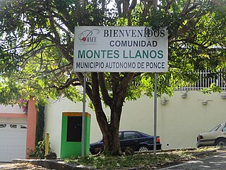
Montes Llanos, is one of the 31 barrios in the municipality of Ponce, Puerto Rico. Along with Magueyes, Tibes, Portugués, Maragüez, Machuelo Arriba, and Cerrillos, Montes Llanos is one of the municipality's seven rural interior barrios. It was created in 1898.

<span class="mw-page-title-main">Marueño</span> Barrio of Ponce, Puerto Rico

Marueño is one of the 31 barrios of the municipality of Ponce, Puerto Rico. Along with Anón, Coto Laurel, Guaraguao, Quebrada Limón, Real, and San Patricio, and the coastal barrios of Canas and Capitanejo, Marueño is one of the municipality's nine bordering barrios. Marueño borders the municipality of Peñuelas. The name of this barrio is of native Indian origin. It was created in 1831.

<span class="mw-page-title-main">Quebrada Limón</span> Barrio of Ponce, Puerto Rico

Quebrada Limón is one of the 31 barrios of the municipality of Ponce, Puerto Rico. Along with Anón, Coto Laurel, Guaraguao, Marueño, Real, and San Patricio, and the coastal barrios of Canas and Capitanejo, Quebrada Limón is one of the municipality's nine bordering barrios. It borders the municipality of Peñuelas. It was founded in 1878.

<span class="mw-page-title-main">Cerrillos, Ponce, Puerto Rico</span> Barrio of Puerto Rico

Cerrillos is one of the 31 barrios of the municipality of Ponce, Puerto Rico. Along with Magueyes, Tibes, Portugués, Montes Llanos, Maragüez, and Machuelo Arriba, Cerrillos is one of the municipality's seven interior rural barrios. It was founded in 1878.

<span class="mw-page-title-main">Real, Ponce, Puerto Rico</span> Barrio of Puerto Rico

Real is one of the 31 barrios of the municipality of Ponce, Puerto Rico. Along with Anón, Coto Laurel, Guaraguao, Quebrada Limón, Marueño, and San Patricio, and the coastal barrios of Canas and Capitanejo, Real is one of the municipality's nine bordering barrios. It borders the municipality of Juana Diaz. It was founded in 1878.

<span class="mw-page-title-main">Machuelo Abajo</span> Barrio of Ponce, Puerto Rico

Machuelo Abajo is one of the 31 barrios of the municipality of Ponce, Puerto Rico. Along with Canas Urbano, Magueyes Urbano, Portugués Urbano, and San Antón, Machuelo Abajo is one of the municipality's five originally rural barrios that are now also part of the urban zone of the city of Ponce. It was founded in 1818.

<span class="mw-page-title-main">Machuelo Arriba</span> Barrio of Ponce, Puerto Rico

Machuelo Arriba is one of the 31 barrios of the municipality of Ponce, Puerto Rico. Along with the barrios of Magueyes, Tibes, Portugués, Montes Llanos, Maragüez, and Cerrillos, Machuelo Arriba is one of the municipality's seven rural interior barrios. It was established in 1831.

<span class="mw-page-title-main">San Patricio, Ponce, Puerto Rico</span> Barrio of Puerto Rico

San Patricio is one of the 31 barrios of the municipality of Ponce, Puerto Rico. It is one of the municipality's nine bordering barrios, along with Anón, Coto Laurel, Guaraguao, Quebrada Limón, Real, and Marueño, and the coastal barrios of Canas and Capitanejo. Its northern edge borders the municipalities of Utuado and Jayuya. It was founded in 1878. Barrio San Patricio is one of three Ponce barrios located on the Cordillera Central mountain range.

<span class="mw-page-title-main">Cerrillos River</span> River of Puerto Rico

Cerrillos River is a river in the municipality of Ponce, Puerto Rico. Río Cerrillos has its origin in barrio Anón and runs south until it feeds into Bucaná River. Río Cerrillos is commonly known by the locals as Maragüez River, because most of its course runs through Barrio Maragüez. This river is one of the 14 rivers in the municipality. The river has a discharge of 24,000 cubic feet per second, making it the second most affluent river in the municipality after Río Jacaguas.

References

  1. Maptest. Archived 2010-02-18 at the Wayback Machine Government of the Commonwealth of Puerto Rico. General Purpose Population Data, Census 2000. Unidad de Sistemas de Información Geográfica, Área de Tecnología de Información Gubernamental, Oficina de Gerencia y Presupuesto. Gobierno de Puerto Rico. Retrieved 8 October 2013.
  2. Webcensus. Archived 2010-08-12 at the Wayback Machine Government of the Commonwealth of Puerto Rico. General Purpose Population Data, Census 2000. Unidad de Sistemas de Información Geográfica, Área de Tecnología de Información Gubernamental, Oficina de Gerencia y Presupuesto. Gobierno de Puerto Rico. Retrieved 8 October 2013.
  3. La Carretera Central: un viaje escénico a la historia de Puerto Rico. Pumarada-O’Neill, Luis and Castro Arroyo, Maria de los Angeles. Centro de Investigación de Desarrollo del Recinto Universitario de Mayagüez and Oficina Estatal de Preservación Histórica de Puerto Rico. 1996. ISBN   0-9650011-2-1. page 8. Accessed 2 May 2018.
  4. "Listado de Sistemas Viales: Muestra" [Listing of Roadway Systems: Sampling](PDF) (in Spanish). Puerto Rico Department of Transportation. Archived from the original (PDF) on 6 February 2011. Retrieved 13 January 2011.
  5. 1 2 Guía de Carreteras Principales, Expresos y Autopistas. Autoridad de Carreteras y Transportación (ACT). Government of Puerto Rico. San Juan, Puerto Rico. 2010. Archived 2010-11-28 at the Wayback Machine
  6. Google (28 February 2020). "PR-14" (Map). Google Maps . Google. Retrieved 28 February 2020.
  7. Puerto Rico Highway and Transportation Authority: Upcoming P3 Projects. Puerto Rico Public-Private Partnerships Authority. Puerto Rico Projects Conference. p.35.
  8. Google (6 March 2020). "PR-132" (Map). Google Maps . Google. Retrieved 6 March 2020.
  9. Google (2 March 2020). "PR-139R" (Map). Google Maps . Google. Retrieved 2 March 2020.
  10. Google (2 March 2020). "PR-143 west" (Map). Google Maps . Google. Retrieved 2 March 2020.
  11. Google (8 March 2020). "PR-143 east" (Map). Google Maps . Google. Retrieved 8 March 2020.
  12. Google (1 March 2020). "PR-510 west" (Map). Google Maps . Google. Retrieved 1 March 2020.
  13. Google (1 March 2020). "PR-510 east" (Map). Google Maps . Google. Retrieved 1 March 2020.
  14. Google (1 March 2020). "PR-515" (Map). Google Maps . Google. Retrieved 1 March 2020.
  15. Google (1 March 2020). "PR-516" (Map). Google Maps . Google. Retrieved 1 March 2020.
  16. Google (1 March 2020). "PR-588" (Map). Google Maps . Google. Retrieved 1 March 2020.
  17. Google (1 March 2020). "PR-591" (Map). Google Maps . Google. Retrieved 1 March 2020.
  18. Google (16 August 2020). "PR-5139" (Map). Google Maps . Google. Retrieved 16 August 2020.
  19. Google (1 March 2020). "PR-5506" (Map). Google Maps . Google. Retrieved 1 March 2020.
  20. Google (22 March 2020). "PR-5510" (Map). Google Maps . Google. Retrieved 22 March 2020.