Puerto Rico Highway 52 (PR-52), a major toll road in Puerto Rico, is also known as Autopista Luis A. Ferré. It was formerly called Expreso Las Américas. It runs from PR-1 in southwest Río Piedras and heads south until it intersects with highway PR-2 in Ponce. At its north end, the short PR-18 continues north from PR-52 towards San Juan. This short segment is known as Expreso Las Américas, the only segment of the route still unofficially bearing this name, since PR-18 is officially named Roberto Sánchez Vilella Expressway. The combined route of PR-18 and PR-52 runs concurrent with the unsigned Interstate Highway PRI-1. Toll stations are located in San Juan, Caguas, Salinas, Juana Díaz, and Ponce.

Puerto Rico Highway 2 (PR-2) is a road in Puerto Rico that connects the cities of San Juan and Ponce. At 156 miles (230 km) long, it is Puerto Rico's longest singled-signed highway.
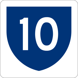
Puerto Rico Highway 10 (PR-10) is a major highway in Puerto Rico. The primary state road connects the city of Ponce in the south coast to Arecibo in the north; it is also the shortest route between the two cities.

El Tuque is a beach and family recreational and tourist complex in the Punta Cucharas sector of Barrio Canas in Ponce, Puerto Rico. It was designed in the early 1960s by Luis Flores, an architect from Cayey, Puerto Rico. It is located on PR-2, Km 220.1, in the El Tuque sector of Barrio Canas in Ponce. The sector of El Tuque is considered Puerto Rico's largest populated sector. The beach opened on 17 July 1965.

Canas is one of the 31 barrios in the municipality of Ponce, Puerto Rico. Along with Anón, Coto Laurel, Guaraguao, Quebrada Limón, Real, San Patricio, and Marueño, and the coastal barrio of Capitanejo, Canas is one of the municipality's nine bordering barrios. It borders the municipality of Peñuelas. Along with Playa, Bucana, Vayas and Capitanejo, Canas is also one of Ponce's five coastal barrios. It was founded in 1831.

Puerto Rico Highway 9 (PR-9), also called the Anillo de Circunvalación de Ponce, is a limited-access state highway located entirely within the limits of the municipality of Ponce, Puerto Rico, and connecting Puerto Rico Highway 10 in Barrio Portugués in the north to Puerto Rico Highway 52 in barrio Canas in the south, crossing Barrio Magueyes. The Oficina de Ordenación Territorial of the Autonomous Municipality of Ponce calls this road Ronda de Circunvalación Román Baldorioty de Castro. The roadway is still under construction.
Quebrada Limón is one of the 31 barrios of the municipality of Ponce, Puerto Rico. Along with Anón, Coto Laurel, Guaraguao, Marueño, Real, and San Patricio, and the coastal barrios of Canas and Capitanejo, Quebrada Limón is one of the municipality's nine bordering barrios. It borders the municipality of Peñuelas. It was founded in 1878.

Puerto Rico Highway 500 (PR-500) is a tertiary road in Ponce, Puerto Rico. The highway has both of its endpoints, as well as all of its length, entirely within the Ponce city limits. It runs east to west.

Puerto Rico Highway 132 (PR-132) is a secondary highway that connects the town of Guayanilla to the city of Ponce, Puerto Rico. The road runs through the town of Peñuelas before reaching Ponce. In Ponce, PR-132 starts where Calle Villa ends.

Puerto Rico Highway 585 (PR-585) is tertiary state highway in Ponce, Puerto Rico. The road leads from PR-2R in Sector Pámpanos of Barrio Canas to Avenida Padre Noel in Barrio Playa. It runs west to east, starting from its western terminus at PR-2R and ending at its eastern terminus at PR-123.

Puerto Rico Highway 578 (PR-578) is tertiary state highway in Ponce, Puerto Rico. The road runs from east to west, parallel to PR-1, and it forms the boundary between the northern end of barrio Bucaná and the southern end of barrio Sabanetas. The road is located entirely within the municipality of Ponce.

Puerto Rico Highway 511 (PR-511) is a tertiary state highway in the municipality of Ponce in Puerto Rico. With a length of 16.4 km (10.2 mi), it extends from PR-14 between barrios Coto Laurel and Real to PR-143 between Ponce and Jayuya.

Puerto Rico Highway 505 (PR-505) is a tertiary state highway in Ponce, Puerto Rico.

Puerto Rico Highway 504 (PR-504) is a tertiary state highway in the municipality of Ponce in Puerto Rico. With a length of 6.9 km (4.3 mi), the road runs south to north, and mostly along the Río Chiquito in barrio Portugués Rural. Its southern terminus is at an intersection with PR-503, near PR-10 at the southern edge of Barrio Portugués, and the northern terminus is located at PR-505 on the Machuelo Arriba–Portugués–Montes Llanos tripoint.

Puerto Rico Highway 506 (PR-506) is a two-lane tertiary highway in the municipality of Ponce in Puerto Rico. The road runs north to south, joining PR-14, where PR-506 starts, to PR-52 interchange, where it ends. The road is located entirely within Barrio Coto Laurel and its length is 2.0 km (1.2 mi).

Puerto Rico Highway 510 (PR-510) is a tertiary highway in southern Puerto Rico. The road runs north to south in a general south-southwestern direction. The road connects PR-1 in Barrio Capitanejo, Ponce, to PR-14 in the town of Juana Díaz. Portions of the Juana Díaz portion of the road were damaged in September 2017 by Hurricane Maria.

Puerto Rico Highway 163 (PR-163) is a major two-way thoroughfare in Ponce, Puerto Rico. The road has both of its termini as well as all of its length entirely within the Ponce city limits. The road runs east to west from its eastern terminus at PR-2 in Barrio San Antón to its western terminus at PR-500 in Barrio Canas. The road has a length of 4.8 kilometers. Most of the road runs as part of Avenida Las Américas.

Puerto Rico Highway 549 (PR-549) is a tertiary state road in Ponce, Puerto Rico. The road has both of its endpoints, as well as all of its length, entirely within Barrio Canas in the municipality of Ponce. The road is a country road that runs north to south, entirely in the western portion of Barrio Canas. Its southern terminus is at a dirt path that leads to the westernmost endpoint of PR-500 in Barrio Canas and its northern end is at PR-132 also in Barrio Canas.


