Puerto Rico Highway 503

Last updated

PR secondary 503.svg Ellipse sign 503.svg

Highway 503

Ruta 503
Carretera David Medina Feliciano [1]
Mapa de la carretera PR-503 en Ponce, Puerto Rico (M503).svg
Map of Puerto Rico road PR-503 within the Municipality of Ponce in relation to the other major roads in the municipality
Route information
Maintained by Puerto Rico DTPW
Length17.0 km [2] [3]  (10.6 mi)
Southern segment
South endCalle Salsa in Sexto
Major intersections
North end Portugués Dam in Tibes
Northern segment
South endPR primary 10.svg PR-10 in Tibes
Major intersectionsPR secondary 505.svg PR-505 in San Patricio
North endPR secondary 143.svg PR-143 in Consejo
Location
Country United States
Territory Puerto Rico
Municipalities Ponce, Adjuntas, Utuado
Highway system
Ellipse sign 502.svg PR-502 Ellipse sign 504.svg PR-504

Puerto Rico Highway 503 (PR-503), also called Carretera Tibes (Road to Tibes), [4] is a tertiary [5] state [6] road that connects Barrio Consejo, in the southwestern part of the municipality of Utuado, to Barrio Tercero in the city of Ponce, and ending at Museo de la Historia de Ponce, one block east of the center of the city at Plaza Las Delicias.

Contents

Route description

The road's northern terminus is at its intersection with Puerto Rico Highway 143 in Utuado's barrio Consejo, about 1/4 mile north of Utuado's borderline with the municipality of Adjuntas. The road runs in a southerly fashion from its northern terminus at Barrio Consejo, Utuado, through barrio Portugués of the municipality of Adjuntas, and then enters the municipality of Ponce, running through barrios Guaraguao, San Patricio, and Tibes. Starting in 2008, the flow of this road through Barrio Tibes was interrupted by the construction of the Rio Portugués river dam. As a result, there is now a permanent 3-mile stretch of this road that no longer exists. The road picks up again at the southern end of the Rio Portugues river dam, continuing in its southerly run through the rest of barrio Tibes and then through barrios Portugués Rural, and Portugués Urbano of the municipality of Ponce, before reaching barrio Sexto (Cantera) in the city of Ponce. The road then follows the course of Calle Mayor Cantera street in Ponce until it comes to its southern terminus at Calle Mayor street's intersection with Calle Isabel, (Calle Isabel is signed as PR-1).

Portugués dam

PR-503 used to be a single stretch country road from Ponce to Utuado until the late 2000s when construction of the Portugués Dam changed that. [1] In the mid 2010s a segment of this roadway was obliterated by the construction of the Portugués River reservoir, which now sits between the northern section of the road and the southern segment, disrupting the continuity of the road, but providing two approaches to the Dam and access to it from both the north and the south.

Road renamed

On 12 July 2011, Governor Luis Fortuño signed Law #130-2011 (House Bill 2885) naming this road as the David Medina-Feliciano Highway in honor of the costumbrista painter from Ponce. [1]

History

Prior to its numerical designation, PR-503 was only known as Carretera Tibes. [7] The current numerical designation corresponds to the 1953 Puerto Rico highway renumbering, a process implemented by the Puerto Rico Department of Transportation and Public Works (Spanish : Departamento de Transportación y Obras Públicas) that increased the insular highway network to connect existing routes with different locations around Puerto Rico.

Major intersections

MunicipalityLocationkm [2] [3] miDestinationsNotes
Ponce Sexto 0.00.0 PR-Calle Salsa  Ponce Southern terminus of PR-503
Portugués 1.4–
1.7
0.87–
1.1
PR primary 10.svgEllipse sign 504.svg PR-10 (Carretera Salvador "Chiry" Vassallo Ruiz) / PR-504  Adjuntas, Juana Díaz, Machuelo Arriba Partial cloverleaf interchange
Tibes 3.42.1PR primary 10.svg PR-10 (Carretera Salvador "Chiry" Vassallo Ruiz) Ponce, Adjuntas
5.53.4[[Puerto Rico Highway Portugués Dam |PR-Portugués Dam]] Tibes Northern terminus of southern segment; dead end road
Gap in route
0.00.0PR primary 10.svg PR-10 (Carretera Salvador "Chiry" Vassallo Ruiz) Ponce, Adjuntas Southern terminus of northern segment
San Patricio 7.34.5South plate county (es).svg
PR secondary 505.svg
PR-505 south (Carretera La Guardarraya) Ponce
Adjuntas
No major junctions
Utuado Consejo 11.57.1PR secondary 143.svg PR-143 (Ruta Panorámica) Adjuntas, Barranquitas Northern terminus of PR-503
1.000 mi = 1.609 km; 1.000 km = 0.621 mi

See also

Related Research Articles

<span class="mw-page-title-main">Puerto Rico Highway 2</span> Highway in Puerto Rico

Puerto Rico Highway 2 (PR-2) is a road in Puerto Rico that connects the cities of San Juan and Ponce. At 156 miles (230 km) long, it is Puerto Rico's longest singled-signed highway.

<span class="mw-page-title-main">Puerto Rico Highway 10</span> Highway in Puerto Rico

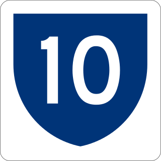
Puerto Rico Highway 10 (PR-10) is a major highway in Puerto Rico. The primary state road connects the city of Ponce in the south coast to Arecibo in the north; it is also the shortest route between the two cities.

<span class="mw-page-title-main">Puerto Rico Highway 12</span> Highway in Puerto Rico

Puerto Rico Highway 12 (PR-12), also called Avenida Malecón, and Avenida Santiago de los Caballeros, is a 6.4-kilometer, limited-access highway entirely located within the city limits of Ponce, Puerto Rico, and connecting Puerto Rico Highway 14 to the La Guancha area in Barrio Playa in Ponce. It is similar to a freeway but has one traffic light near its intersection with PR-14. In addition to its northern and southern terminus, the highway has four full interchange exits: PR-52, PR-2, PR-133/Calle Comercio, and Avenida Las Américas. Since PR-12's southern terminus is at the Port of Ponce, its traffic volume is expected to grow as construction in the new Port of the Americas is completed.

<span class="mw-page-title-main">Puerto Rico Highway 123</span> Highway in Puerto Rico

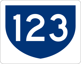
Puerto Rico Highway 123 (PR-123) is a secondary highway that connects the city Arecibo to the city of Ponce. It runs through the towns of Utuado and Adjuntas, before reaching Ponce. A parallel road is being built, PR-10, that is expected to take on most of the traffic currently using PR-123.

The Ruta Panorámica, officially the Ruta Panorámica Luis Muñoz Marín, is a 167-mile (269 km) network of some 40 secondary roads which traverse the island of Puerto Rico from west to east along its Cordillera Central. Most of the route consists of three roads, PR-105, PR-143, and PR-182. The route starts in Mayagüez and ends in Maunabo. The first major segment of the route runs from Mayagüez to Maricao as Route 105, then from Adjuntas to Aibonito as Route 143, and then follows Route 182 toward Maunabo.

<span class="mw-page-title-main">Portugués River</span> River of Puerto Rico

Río Portugués is a river in the municipality of Ponce, Puerto Rico. In the 19th century, it was also known as Río de Ponce. Twenty-one bridges for motor vehicle traffic span Río Portugués in the municipality of Ponce alone. The river is also known as Río Tibes in the area where it flows through barrio Tibes in the municipality of Ponce. Río Portugués has a length of nearly 30 kilometers (19 mi) and runs south from the Cordillera Central mountain range into the Caribbean Sea. The Portugués is one of the best-known rivers in Ponce because of its prominent zigzagging through the city and its historical significance. The river is historically significant because the city of Ponce had its origins on its banks. It was originally known as Río Baramaya. It has its mouth at 17°58′51″N66°37′26″W. This river is one of the 14 rivers in the municipality.

<span class="mw-page-title-main">Tibes</span> Barrio of Ponce, Puerto Rico

Tibes is one of the 31 barrios in the municipality of Ponce, Puerto Rico. Together with Magueyes, Portugués, Montes Llanos, Maragüez, Machuelo Arriba, Sabanetas, and Cerrillos, barrio Tibes is one of the municipality's eight rural interior barrios. Tibes attracted attention recently when, in 1975, what was to become the discovery of the oldest cemetery in the West Indies came about as a result of rainstorms. The name of this barrio is of native Indian origin. It was organized in 1831.

<span class="mw-page-title-main">Portugués (Ponce)</span> Barrio of Ponce, Puerto Rico

Portugués Rural or, more commonly, simply Portugués, is one of the 31 barrios in the municipality of Ponce, Puerto Rico. Along with Magueyes, Tibes, Montes Llanos, Maragüez, Machuelo Arriba, Sabanetas, and Cerrillos, Portugués is one of the municipality's eight rural interior barrios. It was founded in 1831.

<span class="mw-page-title-main">San Patricio, Ponce, Puerto Rico</span> Barrio of Puerto Rico

San Patricio is one of the 31 barrios of the municipality of Ponce, Puerto Rico. It is one of the municipality's nine bordering barrios, along with Anón, Coto Laurel, Guaraguao, Quebrada Limón, Real, and Marueño, and the coastal barrios of Canas and Capitanejo. Its northern edge borders the municipalities of Utuado and Jayuya. It was founded in 1878. Barrio San Patricio is one of three Ponce barrios located on the Cordillera Central mountain range.

<span class="mw-page-title-main">Puerto Rico Highway 500</span> Highway in Puerto Rico

Puerto Rico Highway 500 (PR-500) is a tertiary road in Ponce, Puerto Rico. The highway has both of its endpoints, as well as all of its length, entirely within the Ponce city limits. It runs east to west.

<span class="mw-page-title-main">Puerto Rico Highway 585</span> Highway in Puerto Rico

Puerto Rico Highway 585 (PR-585) is tertiary state highway in Ponce, Puerto Rico. The road leads from PR-2R in Sector Pámpanos of Barrio Canas to Avenida Padre Noel in Barrio Playa. It runs west to east, starting from its western terminus at PR-2R and ending at its eastern terminus at PR-123.

<span class="mw-page-title-main">Puerto Rico Highway 511</span> Highway in Puerto Rico

Puerto Rico Highway 511 (PR-511) is a tertiary state highway in the municipality of Ponce in Puerto Rico. With a length of 16.4 km (10.2 mi), it extends from PR-14 between barrios Coto Laurel and Real to PR-143 between Ponce and Jayuya.

<span class="mw-page-title-main">Puerto Rico Highway 139</span> Highway in Puerto Rico

Puerto Rico Highway 139 (PR-139) is a two-way secondary highway in the municipality of Ponce in Puerto Rico. With a length of 25.2 km (15.7 mi), it extends from the interchange of PR-10 and PR-14 located in Barrio Machuelo Arriba to the junction with PR-143 on the Ponce–Jayuya municipal limit.

<span class="mw-page-title-main">Puerto Rico Highway 501</span> Highway in Puerto Rico

Puerto Rico Highway 501 (PR-501) is a tertiary state highway in Ponce, Puerto Rico. The road runs north to south, and mostly alongside Rio Pastillo in barrio Marueño. It southern terminus is at PR-123, just off Calle 18 of Urbanización Las Delicias in barrio Magueyes, and its northern end is also at PR-123 but in barrio Guaraguao.

<span class="mw-page-title-main">Puerto Rico Highway 502</span> Highway in Puerto Rico

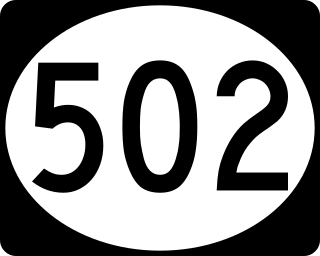
Puerto Rico Highway 502 (PR-502) is a tertiary state highway in Ponce, Puerto Rico. The road runs north to south through barrio Quebrada Limón. Its southern terminus is at an intersection with PR-132. Its northern terminus is at its intersection with PR-501.

<span class="mw-page-title-main">Puerto Rico Highway 505</span> Highway in Puerto Rico

Puerto Rico Highway 505 (PR-505) is a tertiary state highway in Ponce, Puerto Rico.

<span class="mw-page-title-main">Puerto Rico Highway 504</span> Highway in Puerto Rico

Puerto Rico Highway 504 (PR-504) is a tertiary state highway in the municipality of Ponce in Puerto Rico. With a length of 6.9 km (4.3 mi), the road runs south to north, and mostly along the Río Chiquito in barrio Portugués Rural. Its southern terminus is at an intersection with PR-503, near PR-10 at the southern edge of Barrio Portugués, and the northern terminus is located at PR-505 on the Machuelo Arriba–Portugués–Montes Llanos tripoint.

<span class="mw-page-title-main">Puerto Rico Highway 516</span> Highway in Puerto Rico

Puerto Rico Highway 516 (PR-516) is a tertiary state highway in the northern area of barrio Guaraguao in Ponce, Puerto Rico, near Ponce's border with Adjuntas's barrio Portugués. The road travels east to west. It starts at its intersection with PR-123 and heads west to end at Ponce's border with Peñuelas, from where PR-391 picks up into the municipality of Peñuelas. The road runs through dense mountain vegetation into the interior regions of barrio Guaraguao.

<span class="mw-page-title-main">Puerto Rico Highway 549</span> Highway in Puerto Rico

Puerto Rico Highway 549 (PR-549) is a tertiary state road in Ponce, Puerto Rico. The road has both of its endpoints, as well as all of its length, entirely within Barrio Canas in the municipality of Ponce. The road is a country road that runs north to south, entirely in the western portion of Barrio Canas. Its southern terminus is at a dirt path that leads to the westernmost endpoint of PR-500 in Barrio Canas and its northern end is at PR-132 also in Barrio Canas.

<span class="mw-page-title-main">Puerto Rico Highway 588</span> Highway in Puerto Rico

Puerto Rico Highway 588 (PR-588) is a tertiary mountainous state highway in Ponce, Puerto Rico. The road is approximately 1.5 km (0.93 mi) long and is a spur of Puerto Rico Highway 504.

References

  1. 1 2 3 An ACT to designate PR Road 503, which extends from Ponce to Adjuntas as the David Medina-Feliciano Road. H.B. 2885. Oficina de Servicios Legislativos de Puerto Rico. Gobierno de Puerto Rico. Approved 12 July 2011. Published (English version) 30 September 2014. Accessed 8 April 2016.
  2. 1 2 Google (1 March 2020). "PR-503 south" (Map). Google Maps . Google. Retrieved 1 March 2020.
  3. 1 2 Google (1 March 2020). "PR-503 north" (Map). Google Maps . Google. Retrieved 1 March 2020.
  4. Acme Map for the Barrio Portugues area. ACME Mapper 2.1. ACME Labs. Accessed 3 February 2018.
  5. PRHTA Design Manual: Chapter 1, General Design Criteria. Departamento de Transportación y Obras Publicas de Puerto Rico. page 1-2. Accessed 9 May 2019.
  6. ¿Una avenida o zona de combate? Primera Hora. 19 June 2014. Retrieved 24 June 2014.
  7. "Ponce, Memoria Núm. 27" (PDF). Puerto Rico Planning Board (in Spanish). 1953. Retrieved 24 August 2023.