Puerto Rico Highway 165 (PR-165) is the road that goes from Naranjito to Guaynabo. The highway passes by Toa Alta, Toa Baja, Dorado, Levittown, Cataño and Guaynabo.

Puerto Rico Highway 142 (PR-142) is a north–south road that connects the northern region of Puerto Rico with the municipality of Corozal. With a length of about 8.2 kilometers (5.1 mi), PR-142 crosses the municipalities of Dorado, Toa Alta and Corozal, extending from PR-2 in Dorado to PR-159 near downtown Corozal.
Puerto Rico Highway 164 (PR-164) is the main road from Naranjito to Corozal. It begins at the intersection of PR-167 and PR-148, to reach the center of Naranjito. Then it goes to Corozal across the PR-5, PR-152 and PR-165 to finish in the PR-159 in Corozal. This road is 16.4 km (10.2 mi) in length.

Puerto Rico Highway 891 (PR-891) is the road that goes to downtown Corozal, Puerto Rico. This road can be seen as the Alt 159, since this road was the PR-159 through the area from the town center.

Puerto Rico Highway 139 (PR-139) is a two-way secondary highway in the municipality of Ponce, Puerto Rico.

Puerto Rico Highway 866 (PR-866) is a main highway in the city of Toa Baja, Puerto Rico. It begins at its intersection with PR-2 in Candelaria and ends at PR-167 in Levittown.
Puerto Rico Highway 693 (PR-693) is a road located between the municipalities of Dorado, Puerto Rico and Vega Alta, passing through downtown Dorado. It begins at its intersection with PR-2 and PR-165 in Río Lajas and ends at PR-690 in Sabana. It is a short divided highway in southern Dorado, which serves as an alternate route for PR-165 west of Río de la Plata.

Puerto Rico Highway 155 (PR-155) is a rural road that goes from Coamo, Puerto Rico to Vega Baja through Orocovis and Morovis. It extends from PR-14 in downtown Coamo to PR-2 east of downtown Vega Baja.

Puerto Rico Highway 157 (PR-157) is a rural road that travels from Ciales, Puerto Rico to Orocovis. It begins at its intersection with PR-149 in Toro Negro and ends at its junction with PR-155 near downtown Orocovis.

Puerto Rico Highway 145 (PR-145) is a rural road that travels from Ciales, Puerto Rico to Morovis. This road extends from its junction with PR-146 and PR-149 in downtown Ciales and ends at PR-155 between Morovis Norte, Torrecillas and Fránquez barrios.

Puerto Rico Highway 805 (PR-805) is an east–west road located in Corozal, Puerto Rico. It extends from its intersection with PR-568 near the Cuchillas boundary, passing through Negros barrio until its junction with PR-803 in Palos Blancos area.

Puerto Rico Highway 807 (PR-807) is a north–south road located in Corozal, Puerto Rico. It begins at Calle San Manuel in downtown Corozal, passing through Dos Bocas barrio until its southern terminus at its junction with PR-805 on the Palos Blancos–Negros line.

Puerto Rico Highway 818 (PR-818) is a road located in Corozal, Puerto Rico. It begins at its junction with PR-159 near downtown Corozal, and ends at Baja del Palo sector in Cibuco barrio.

Puerto Rico Highway 821 (PR-821) is a road located in Corozal, Puerto Rico. It begins at its intersection with PR-891 in downtown Corozal, passing through Abras barrio until its terminus at PR-630 near Mavilla barrio of Vega Alta municipality.

Puerto Rico Highway 869 (PR-869) is a north–south road located in Cataño, Puerto Rico. It begins at its intersection with PR-5 and PR-22 near Bayamón municipal limit and ends at its junction with PR-165 near Toa Baja municipal limit.

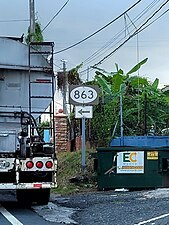
Puerto Rico Highway 819 (PR-819) is a north–south rural road located between the municipalities of Toa Alta and Toa Baja, Puerto Rico. It begins at PR-861 on the Ortiz–Mucarabones line in Toa Alta, and ends at PR-863 in Candelaria barrio in Toa Baja.

Puerto Rico Highway 862 (PR-862) is a north–south road located between the municipalities of Bayamón and Toa Alta, Puerto Rico.

Puerto Rico Highway 864 (PR-864) is an east–west road located in Bayamón, Puerto Rico. Located south of PR-2, the entire road is located in Hato Tejas barrio. This route intersects with PR-2 at its eastern and western terminus, and bring access to several neighborhoods of the western area of Bayamón.

Puerto Rico Highway 567 (PR-567) is a north–south rural road located between the municipalities of Orocovis and Morovis, Puerto Rico. It extends from its junction with PR-157 on the Barros–Damián Arriba line in Orocovis, passing through Vaga, Pasto and San Lorenzo barrios until its end at its intersection with PR-145 and PR-6622 in the Torrecillas–Morovis Norte line in Morovis.

Puerto Rico Highway 647 (PR-647) is a north–south road located between the municipalities of Corozal and Vega Alta, Puerto Rico. It extends from its junction with PR-159 and PR-5568 on the Cibuco–Padilla line in western Corozal, passing through Cienegueta, Candelaria and Bajura barrios until its end at PR-676 in downtown Vega Alta.