Lake Nicaragua or Cocibolca or Granada is a freshwater lake in Nicaragua. Of tectonic origin and with an area of 8,264 km2 (3,191 sq mi), it is the largest lake in Central America, the 19th largest lake in the world and the tenth largest in the Americas, slightly smaller than Lake Titicaca. With an elevation of 32.7 metres (107 ft) above sea level, the lake reaches a depth of 26 metres (85 ft). It is intermittently joined by the Tipitapa River to Lake Managua.

The Nicaragua Canal, formally the Nicaraguan Canal and Development Project was a proposed shipping route through Nicaragua to connect the Caribbean Sea with the Pacific Ocean. Scientists were concerned about the project's environmental impact, as Lake Nicaragua is Central America's key freshwater reservoir while the project's viability was questioned by shipping experts and engineers.

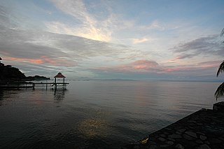
Punta Gorda, known locally as P.G., is the capital and largest town of Toledo District in southern Belize. Punta Gorda is the southernmost sizable town in the nation, with a population of about 5,000 people. Although the town bears a Spanish name, its inhabitants are mostly Kriol/English-speaking and are primarily of Garifuna, East Indian, Kriol, and Maya descent.

Toledo District is the southernmost and least populated district in Belize. Punta Gorda is the District capital. According to the Human Development Index (HDI), it is the second most developed region in the country. The district has a diverse topography which features rainforests, extensive cave networks, coastal lowland plains, and offshore cays. Toledo is home to a wide range of cultures such as Mopan, Kekchi Maya, Creole, Garifuna, East Indians, Mennonites, Mestizos, and descendants of US Confederate settlers.

The Mosquito Coast is the area along the eastern coast of present-day Nicaragua and Honduras. It was named after the local Miskito Nation and was long dominated by British interests and known as the Mosquito Kingdom. From 1860 suzerainty of the area was transferred to Nicaragua with the name Mosquito Reserve, and in November 1894 the Mosquito Coast was militarily incorporated into Nicaragua. However, in 1960, the northern part was granted to Honduras by the International Court of Justice.
Punta Gorda may refer to several places:

Bluefields is the capital of the South Caribbean Autonomous Region in Nicaragua. It was also the capital of the former Kingdom of Mosquitia, and later the Zelaya Department, which was divided into North and South Caribbean Coast Autonomous Regions. It is located on Bluefields Bay at the mouth of the Bluefields River in the municipality of the same name.
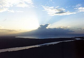
The San Juan River, also known as El Desaguadero, is a 192-kilometre (119 mi) river that flows east out of Lake Nicaragua into the Caribbean Sea. A large section of the border between Nicaragua and Costa Rica runs on the southern bank of the river. It was part, with the lake, of a proposed route for a Nicaragua Canal in the 19th century. The idea of the project has been revived in the last decade, including the possibility of other routes within the country. The Ecocanal project has obtained a Concession from the National Assembly of Nicaragua to re-open the San Juan River to commercial barge traffic.
San Juan de Nicaragua, formerly known as San Juan del Norte or Greytown, is a town and municipality in the Río San Juan Department of Nicaragua.

Nueva Guinea is a town and a municipality in the South Caribbean Coast Autonomous Region of Nicaragua.

The Bone Valley is a region of central Florida, encompassing portions of present-day Hardee, Hillsborough, Manatee, and Polk counties, in which phosphate is mined for use in the production of agricultural fertilizer. Florida currently contains the largest known deposits of phosphate in the United States.

Amatique Bay is a large bay in the Gulf of Honduras, along the eastern coast of Guatemala and Belize. It stretches from Santo Tomás de Castilla in the south to Punta Gorda in the north, where it opens to the Caribbean Sea. Its south-eastern limits are marked by a small peninsula known as Punta de Manabique where a $27 million gas terminal is planned

The Rama are an indigenous people living on the eastern coast of Nicaragua. Since the start of European colonization, the Rama population has declined as a result of disease, conflict, and loss of territory. In recent years, however, the Rama population has increased to around 2,000 individuals. A majority of the population lives on the island of Rama Cay, which is located in the Bluefields Lagoon. Additional small Rama communities are dispersed on the mainland from Bluefields to Greytown. The Rama are one of three main indigenous groups on Nicaragua’s Caribbean coast.

Belizeans are people associated with the country of Belize through citizenship or descent. Belize is a multiethnic country with residents of Ethnic groups of Amerindian, African, European, Asian and Middle-eastern descent or mixed race with any combination of those groups.
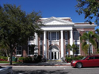
Punta Gorda is a city located in Southwest Florida and is the county seat of Charlotte County, Florida, United States. As of the 2020 U.S. Census the city had a population of 19,471. Punta Gorda is part of the Sarasota-Bradenton-Punta Gorda Combined Statistical Area.
Rio Brito or Brito River is a river in the southwestern part of Nicaragua that drains into the Pacific Ocean near Punta Brito, a promontory. The river valley was planned to be transformed by the Nicaraguan Canal and Development Project to serve as the conduit for the western part of the Nicaragua Canal. About 14.5 km upstream the triple-chambered Brito Lock would have been constructed by HK Nicaragua Canal Development Investment (HKND) to raise ships to the level of Lake Nicaragua.

There is a long history of attempts to build a canal across Nicaragua to connect the Atlantic Ocean with the Pacific Ocean. Construction of such a shipping route—using the San Juan River as an access route to Lake Nicaragua—was first proposed in the early colonial era. Napoleon III wrote an article about its feasibility in the middle of the 19th century. The United States abandoned plans to construct a waterway in Nicaragua in the early 20th century after it purchased the French interests in the Panama Canal. The Panama Canal was built and that is now the main connecting route across Central America.

Medardo Mairena Sequeira is a Nicaraguan farmer and coordinator of the peasant (campesino) movement. Mairena has worked in the peasant anti-canal movement since 2013 and has been an active opposition leader since the national protests broke out in late April 2018, participating in the National Dialogue between protestors and the government of Daniel Ortega, mediated by the Catholic Church. Two months later he became one of a large number of dissidents arrested and prosecuted for terrorism; Mairena was sentenced to 261 years in prison, serving one year before he was released under a negotiated Amnesty Law.
