Related Research Articles

Rockefeller State Park Preserve is a state park in Mount Pleasant, New York in the eastern foothills of the Hudson River in Westchester County. Common activities in the park include horse-riding, walking, jogging, running, bird-watching, and fishing. The park has a rich history and was donated to the State of New York over time by the Rockefeller Family beginning in 1983. A section of the park, the Rockwood Hall property, fronts the Hudson River. It was formerly the private residence of William Rockefeller, and began use as a New York state park in the early 1970s. In 2018, the park was added to New York's State Register of Historic Places.

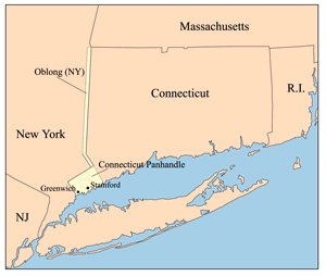
The Connecticut panhandle is the southwestern appendage of Connecticut, where it abuts New York State. It is contained entirely in Fairfield County and includes all of Greenwich, Stamford, New Canaan, and Darien, as well as parts of Norwalk and Wilton. It has some of the most expensive residential real estate in the United States.

Pleasure Beach is the Bridgeport portion of a Connecticut barrier beach that extends 2.5 miles (4 km) westerly from Point No Point. Prior to June, 2014, when Pleasure Beach re-opened, the area was Connecticut's largest and most recent ghost town after it was abandoned in the late 1990s due to a fire on the bridge connecting it to the mainland. It is surrounded on three sides by water.

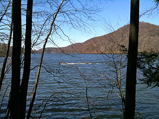
The Still River is a 25.4-mile-long (40.9 km) tributary to the Housatonic River in western Connecticut.

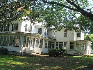
Boothe Memorial Park and Museum sits on a 32-acre (130,000 m2) site in the Putney section of Stratford, Connecticut. Built about 1840 and remodeled in 1914, it is said to be "The Oldest Homestead in America," since it sits on the foundations of a 1663 house, and has been continuously occupied. Circa 1914 two brothers, David Beach Boothe and Stephen Nichols Boothe, created the Boothe Memorial Museum which maintains a collection of twenty architecturally unique buildings. Some of the structures include a carriage house, Americana Museum, miniature lighthouse, windmill, a clock tower museum, trolley station, chapel, and a blacksmith shop. The property became a public park owned by the town of Stratford in 1949.
The Lucius Pond Ordway Devil's Den Preserve in Weston and Redding, Connecticut, encompassing 1,746 acres (7.07 km2), is the largest preserve in Fairfield County, Connecticut and one of the larger preserves in the metropolitan New York area. The preserve's name derives from local lore: charcoal makers in the hilly, rocky area would say that a hoof-like mark made in a boulder was the footprint of the Devil.
The Central or Midtown section of Norwalk, Connecticut is an urbanized area in roughly the geographic center of the city, north of the South Norwalk neighborhood and the Connecticut Turnpike. Wall Street, West Avenue and Belden Avenue are the main thoroughfares. It has also been called "Norwalk Center" or "Downtown Norwalk".
The village of Devon is a neighborhood of the city of Milford, Connecticut, United States. It lies on the southwest corner of the city bordering Long Island Sound and the mouth of the Housatonic River. The village generally corresponds to the Third Voting District of Milford.
Ash Creek is a tidal creek and intertidal wetland in Fairfield County, Connecticut that serves as a border between the city of Bridgeport and the town of Fairfield. It is the last salt water estuary in the area, extending from Long Island Sound and up the Rooster River.

The Aspetuck River is a 17.0-mile-long (27.4 km) river in the U.S. state of Connecticut. The river rises in the hills located in Huntington State Park in Bethel, with a watershed of approximately 430 acres (170 ha). The river flows generally southerly through Redding, Connecticut to the Aspetuck Reservoir, the Hemlock Reservoir in Easton and Fairfield and finally into the Saugatuck River in Westport, Connecticut and then into the Long Island Sound. It flows through the village of Aspetuck at an average depth of 2.5 feet (0.76 m). The word Aspetuck can be translated as "river originating at the high place" in an Algonquian language.

The Pequonnock River is a 16.7-mile-long (26.9 km) waterway in eastern Fairfield County, Connecticut. Its watershed is located in five communities, with the majority of it located within Monroe, Trumbull, and Bridgeport. The river has a penchant for flooding, particularly in spring since the removal of a retention dam in Trumbull in the 1950s. There seems to be a sharp difference of opinion among historians as to just what the Indian word Pequonnock signifies. Some insist it meant cleared field or open ground; others are sure it meant broken ground; while a third group is certain it meant place of slaughter or place of destruction.
The Naugatuck Trail is a 6.8-mile (10.9 km) Blue-Blazed hiking trail "system" in the eastern central-lower Naugatuck River Valley in New Haven County, Connecticut, USA. It is almost entirely contained in the Naugatuck State Forest. The mainline trail is primarily east to west with three short side or spur trails. Composed of four trails, at its western end the trail ends with a section alongside Route 8 and the Naugatuck River. Duringthe 1930s and 1940s, it was much larger. But post–World War II housing developments of the Connecticut Blue-Blazed Trails, led to its drastic reduction.

The Lillinonah Trail is a 5.9-mile (9.5 km) Blue-Blazed hiking trail "system" in the lower Housatonic River valley in Fairfield County and, today, is entirely in Newtown. Most of the trail is in the upper block of Paugussett State Forest.

The Jericho trail is a 3.4-mile (5.5 km) Blue-Blazed hiking trail in the Oakville section of Watertown, near the border with Thomaston and Plymouth, Litchfield County, Connecticut. The trail is contained almost entirely in a section of the Mattatuck State Forest. The mainline trail is a linear north–south "hike-through" trail with one east–west connector trail to the Whitestone Cliffs Blue-Blazed Trail.
Carting Island is the largest of the four islands owned by Stratford, Connecticut in the Housatonic River between I-95 and the Merritt Parkway. The island is north of the Moses Wheeler Bridge, east of Peacock Island (Connecticut), and southwest of Long Island (Connecticut), and Pope's Flat, it is also south of Fowler Island in Milford and the Igor I. Sikorsky Memorial Bridge. The island is uninhabited except for occasional visits by anglers, bird watchers and duck hunters. All transportation to and from the island is by boat.
Goose Island is the sole island owned by Stratford, Connecticut below I-95 in the Housatonic River. The island is currently a set of three islets due to erosion running north–south very near the Stratford bank of the river. The island is south-southwest of the Washington Bridge, roughly parallel to Housatonic Avenue.
Nells Island is the larger of two islands in the Charles E. Wheeler Wildlife Management Area at the mouth of the Housatonic River. It is directly across the river from the American Shakespeare Theatre in Stratford, Connecticut. The island is uninhabited but is designated as a "miscellaneous open space" by the City of Milford. It is about 3 feet (0.91 m) above sea level.

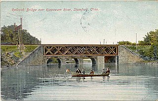
The Rippowam River is a river in Fairfield County, Connecticut, United States. It drains a watershed area of 37.5 square miles (97 km2) and flows for 17 miles (27 km) from Ridgefield to Long Island Sound, which it enters in Stamford's harbor.

Treetops is the former estate of torch singer and actress Libby Holman. It forms the southernmost part of Mianus River Park and is overseen by the Connecticut Department of Environmental Protection as the Mianus River State Park.
Dana is a populated place located in Shasta County, California along County Road A-19. It was established in 1881 and named for Loren Dana.
References
- ↑ "Archived copy". Archived from the original on 2011-07-27. Retrieved 2010-09-01.CS1 maint: archived copy as title (link)
Coordinates: 41°14′06″N73°06′42″W / 41.23500°N 73.11167°W