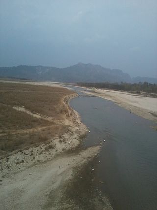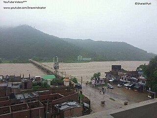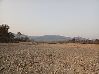
The Ghaghara River, called Karnali River in Nepal and Mapcha Tsangpo in Tibet, is a perennial trans-boundary river that originates in the northern slopes of the Himalayas in the Tibetan Plateau, cuts through the Himalayas in Nepal and joins the Sharda River at Brahmaghat in India. Together they form the Ghaghara River, a major left bank tributary of the Ganges. With a length of 507 km (315 mi) it is the longest river in Nepal. The total length of Ghaghara River up to its confluence with the Ganges at Revelganj in Bihar is 1,080 km (670 mi). It is the largest tributary of the Ganges by volume and the second largest by length after Yamuna.

The Kosi or Koshi is a transboundary river which flows through China, Nepal and India. It drains the northern slopes of the Himalayas in Tibet and the southern slopes in Nepal. From a major confluence of tributaries north of the Chatra Gorge onwards, the Kosi River is also known as Saptakoshi for its seven upper tributaries. These include the Tamor River originating from the Kanchenjunga area in the east and Arun River and Sun Kosi from Tibet. The Sun Koshi's tributaries from east to west are Dudh Koshi, Bhote Koshi, Tamakoshi River, Likhu Khola and Indravati. The Saptakoshi crosses into northern Bihar, India where it branches into distributaries before joining the Ganges near Kursela in Katihar district.
Phakphok is a town and Village Development Committee (VDC) in Ilam District in the Province No. 1 of eastern Nepal. At the time of the 1991 Nepal census it had a population of 4,233 persons living in 734 individual households.

The Sunkoshi, also spelt Sunkosi, is a river of Nepal that is part of the Koshi or Saptkoshi River system in Nepal. Sunkoshi has two source streams, one that arises within Nepal in Choukati, and the other more significant stream that flows in from Nyalam County in the Tibet region of China. The latter is called Bhote Koshi in Nepal and Matsang Tsangpo in Tibet. Due to the significant flows from Bhote Koshi, the Sun Koshi river basin is often regarded as a trans-border river basin.

The Kankai River is a trans-boundary river flowing through the hills of Ilam and the plains of the Jhapa District in Nepal. A holy river for many Hindus living nearby, the Kotihom river bank is a common site for death rituals. Kankai Irrigation Project, launched by the Nepalese government irrigates southern Jhapa, including Shivganj, Pachgachi and Mahavara.

West Rapti, also known as the Kuwano drains Rapti Zone in Mid-Western Region, Nepal, then Awadh and Purvanchal regions of Uttar Pradesh state, India before joining the Ghaghara—a major left bank tributary of the Ganges known as the Karnali inside Nepal.

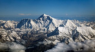
The Imja Khola is a tributary of the Dudh Kosi in Nepal. It drains the slopes of Mount Everest. The Khumbu Glacier melts into the Lobujya (Lobuche) River, which flows southward as the Imja Khola to its confluence with the Dudh Kosi at Tengboche.

Koshi Province is the easternmost of the seven provinces established by the Constitution of Nepal, which was adopted on 20 September 2015. The province covers an area of 25,905 km2, about 17.5% of the country's total area. With the industrial city of Biratnagar as its capital, the province covers other major eastern towns including Birtamod, Birat Chowk, Damak, Dharan, Itahari, Triyuga and Mechinagar and includes several mountains including the Everest, Kangchenjunga, and Ama Dablam. Koshi River, the largest river of the nation, circumvents the province's western boundary. Adhering to the first-past-the-post voting system issued by the Constituency Delimitation Commission, Nepal, the province hosts 28 parliamentary seats and 56 provincial seats.

Bauraha khola, sometimes Baulaha khola is a stream in Gadhawa Rural Municipality ward number 1 Dang Deukhuri District Nepal. It irrigates the land of Banghushree 12 months. The water level rises in monsoon season. It runs from south to north between Banghushree and Badahara village, originating from southern Chure hills of Banghushree Dang Deukhuri District Nepal; near 'Bauraha Kapilvastu' such as Saani Bauraha, Thulo Bauraha, Kalyankot, Domai, Gangare, and Gogan paani. Chureni khola, Sota, Bhutaiya khola and Bagaiya khola are tributaries of Bauraha khola. Sanghuri ।सॉघुरी।, an area of vertical slope with a narrow opening, is a place where stream accumulates its strength. In the monsoon season, it causes a huge loss of property. The upper large catchment area where high precipitation in monsoon season results devastating flash floods each year, impacting the locals of Banghushree. Bauraha khola, which generally carries mud, boulders and much debris due to steep slope, sweeps the fertile land of Banghushree each year. It ends its presence by mixing with West Rapti River near at Banghushree. Both Damodar road and Dulaiya road cross Bauraha khola to connect Banghushree with Badahara village. There is no solid infrastructure built to cross the stream Bauraha khola.

Modi River or Modi Khola is a tributary of Gandaki River in Parbat district of Nepal. It is a snow-fed perennial river originating from Annapurna Mountains and has a catchment area of 675 km2. It meets the Kali Gandaki River at Modi Beni of Parbat District. The total length of the river is approximately 50km. The main tributaries of Modi river are Bhurangdi Khola, Rati Khola, Pati Khola, Malyangdi Khola, Ghandruk Khola and Ambote Khola. The mean annual precipitation in the basin is approximately 2700mm and 80% of the total annual rainfall occurs during the monsoon.
Puwa Khola Hydropower Station is a run-of-river hydro-electric plant located in Ilam District of Nepal. The flow from Puwa River, a tributary of Mai Khola, is used to generate 6.2 MW electricity. The plant is owned and developed by Nepal Electricity Authority, a government owned public company. The plant started generating electricity since 2060-12-22 BS. The generation licence will expire in 2101-12-30 BS, after which the plant will be handed over to the government. The power station is connected to the national grid.
Daraundi A Hydropower Station is a 6 MW run-of-river hydro-electric plant located on the Daraundi River in the Gorkha District of Nepal.
Daram Khola-A Hydropower Station is a run-of-the-river hydroelectricity plant located in Baglung District of Nepal. The flow from Daram River is used to generate 2.5 MW electricity.
Upper Puwa-1 Hydropower Station is a run-of-river hydro-electric plant located in Ilam District of Nepal. The flow from Puwa River, a tributary of Mai River, is used to generate 3 MW electricity. The design flow is 4.46 m3 (158 cu ft) per second and design head is 125 m (410 ft).
Upper Mai-C Hydropower Station is a 6.1 MW run-of-river hydro-electric plant located in the Ilam District of Nepal. It is powered by water from the Mai Khola.
Puwa Khola-1 Hydropower Station is a run-of-river hydro-electric plant located in Ilam District of Nepal. The flow from Puwa River,a tributary of Mai River is used to generate 4 MW electricity.
Rudi A Hydropower Station is a run-of-river hydro-electric plant located in the Kaski District of Nepal that came into operation in 2019. The flow from the Rudi River is used to generate 8.8 MW electricity.
The Chhandi River, or Chhandi Khola is a river in Nepal, a tributary of the Dordi River.
The Daraudi River is a river in Nepal. It is a left tributary of the Marshyangdi river, which in turn joins the Trishuli River.
The Mai Khola is a river in eastern Nepal, the headwater of the Kankai River. Its water is used for irrigation and also powers several hydroelectric plants.


