Sveta Nedelja or, until 1991, Sveta Nedjelja is a town in Zagreb County, Croatia. It is one of the provincial satellite towns in Zagreb's metropolitan region.

Kutina is a town in central Croatia, the largest settlement in the hilly region of Moslavina, in the Sisak-Moslavina County. The town proper has a population of 13,735 (2011), while the total municipal population is 22,760.

Čepin is a village and a municipality in Osijek-Baranja County, Croatia. It is located in northeast Slavonia, 10 kilometers southwest from Osijek.
Kotlina is a settlement in the region of Baranja, Croatia. Administratively, it is located in the Kneževi Vinogradi municipality within the Osijek-Baranja County. The population is 334 people.
Bolman is a settlement in the region of Baranja, Croatia. Administratively, it is located in the Jagodnjak municipality within the Osijek-Baranja County. Population is 450 people.
Donje Stative is a village in Croatia. It is connected by the D6 highway.
Ladina is a village in Croatia. It is connected by the D26 highway.

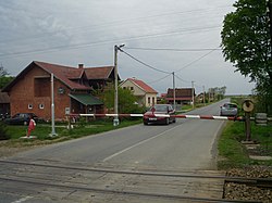
Šišljavić is a village in Croatia. It is connected by the D36 highway. As of 2001 there were 714 inhabitants.
Šartovac is a village in Croatia. It is connected by the D45 highway.
Noskovci is a village in Croatia.

Škrljevo is a village in Primorje, Croatia, located north of Bakar. The population is 1,344. Škrljevo was mentioned by name for the first time during the reign of Petar Zrinski, in a document from 1667. Near the railway station are the remains of the church of St. Ambroza, demolished in 1907.
Mala Ostrna is a settlement in the Dugo Selo town of Zagreb County, Croatia. As of 2011 it had a population of 325 people.
Velika Ostrna is a settlement in the Dugo Selo town of Zagreb County, Croatia. As of 2011 it had a population of 1,271 people.
Budinjak is a settlement (naselje) in the Samobor administrative territory of Zagreb County, Croatia. As of 2011 it had a population of 11 people.
Gregurić Breg is a settlement (naselje) in the Samobor administrative territory of Zagreb County, Croatia. As of 2011 it had a population of 118 people.
Kladje is a settlement (naselje) in the Samobor administrative territory of Zagreb County, Croatia. As of 2011 it had a population of 829 people.
Mala Rakovica is a settlement (naselje) in the Samobor administrative territory of Zagreb County, Croatia. As of 2011, it had a population of 745 people.
Slani Dol is a settlement (naselje) in the Samobor administrative territory of Zagreb County, Croatia. As of 2011 it had a population of 208 people.
Šimraki is a settlement (naselje) in the Samobor administrative territory of Zagreb County, Croatia. As of 2011 it had a population of 5 people.
Kalinovica is a settlement (naselje) in the Sveta Nedelja administrative territory of Zagreb County, Croatia. As of 2011 it had a population of 385 people.