Qaan Dhoole | |
|---|---|
Town | |
| Coordinates: 2°41′36″N44°53′44″E / 2.69333°N 44.89556°E | |
| Country | |
| Region | Lower Shabelle |
| Time zone | UTC+3 (EAT) |
Qaan Dhoole is a town in the southeastern Lower Shabelle (Shabeellaha Hoose) region of Somalia.
Qaan Dhoole | |
|---|---|
Town | |
| Coordinates: 2°41′36″N44°53′44″E / 2.69333°N 44.89556°E | |
| Country | |
| Region | Lower Shabelle |
| Time zone | UTC+3 (EAT) |
Qaan Dhoole is a town in the southeastern Lower Shabelle (Shabeellaha Hoose) region of Somalia.

Lyons is a village in Fulton County, Ohio, United States. The population was 562 at the 2010 census.

The arrondissement of Briançon is an arrondissement of France in the Hautes-Alpes department in the Provence-Alpes-Côte d'Azur region. It has 36 communes. Its population is 35,266 (2016), and its area is 2,138.1 km2 (825.5 sq mi).
Babine Lake Marine Provincial Park is a provincial park in British Columbia, Canada. The park was established by Order-in-Council in 1993, comprising two sites at Pendleton Bay totalling 36.9 hectares. Another was established in the same year at Smithers Landing, comprising approximately 157.8 hectares. Three more sites were added in 2001, Hook (Deep) Bay, Pierre Creek, Pinkut Creek and Sandpoint. All sites combined comprise approximately 492 hectares.
Boundary Creek Provincial Park is a provincial park in British Columbia, Canada located south of Greenwood BC in that province's Boundary Country, adjacent to BC Highway 3. The eponymous Boundary Creek flows through the park.
Cornwall Hills Provincial Park is a provincial park in British Columbia, Canada, immediately west of Cache Creek, protecting part of the Cornwall Hills including their highest summit which features an old fire lookout.
Kluskoil Lake Provincial Park is a provincial park in British Columbia, Canada, located on the West Road River downstream from the Euchiniko Lakes.

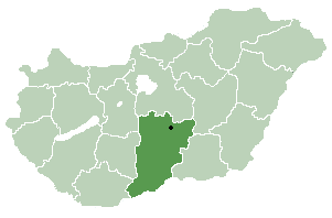
Bugacpusztaháza is a village and municipality in Bács-Kiskun county, in the Southern Great Plain region of southern Hungary.

The Gwa'Sala-Nakwaxda'xw Nations are a union of two Kwakwaka'wakw peoples in a band government based on northern Vancouver Island in British Columbia, Canada, whose main reserve community is near the town of Port Hardy in the Queen Charlotte Strait region of the Central Coast region of British Columbia, Canada. The band government is a member of the Kwakiutl District Council and, for treaty negotiation purposes, the Winalagalis Treaty Group which includes three other members of the Kwakiutl District Council.
Ḵwiḵwa̱sut'inux̱w Ha̱xwa'mis, formerly the Kwicksutaineuk-ah-kwa-mish First Nation is a First Nations band government based on northern Vancouver Island in British Columbia, Canada, in the Queen Charlotte Strait region. It is a member of the Musgamagw Tsawataineuk Tribal Council, along with the ‘Namgis First Nation and the Tsawataineuk First Nation. The Kwikwasut'inuxw and Haxwa'mis are two of the many subgroups of the peoples known as Kwakwaka'wakw, which means "speakers of Kwak'wala", their language, and were combined into one band by the Department of Indian and Northern Affairs.

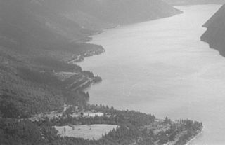
The Seton Lake First Nation, a.k.a. the Seton Lake Indian Band, is a First Nations government located in the Central Interior-Fraser Canyon region of the Canadian province of British Columbia. It is a member of the Lillooet Tribal Council, which is the largest grouping of band governments of the St'at'imc people. Other St'at'imc governments include the smaller In-SHUCK-ch Nation on the lower Lillooet River to the southwest, and the independent N'quatqua First Nation at the farther end of Anderson Lake from Seton Portage, which is the location of three of the band's reserve communities.

Jhando Mari is a town and union council of Tando Allahyar District in the Sindh Province of Pakistan. It is part of Jhando Mari Taluka and is located in the north of the district at 25°39′00″N68°54′0″E. The union council has a population of 30,384.
Borki Prusinowskie is a village in the administrative district of Gmina Szadek, within Zduńska Wola County, Łódź Voivodeship, in central Poland. It lies approximately 8 kilometres (5 mi) north-west of Szadek, 18 km (11 mi) north of Zduńska Wola, and 40 km (25 mi) west of the regional capital Łódź.

HLM is a commune d'arrondissement of the city of Dakar, Senegal. As of 2013 it had a population of 39,126. HLM stands for Habitations à Loyer Modéré.

The Katzie First Nation or Katzie Nation is the band government of the Katzie people of the Lower Fraser Valley region of British Columbia, Canada.
The Torpy River is a tributary of the Fraser River, rising in the Northern Rockies and the McGregor Range, a subdivision of the McGregor Plateau, and forming the boundary between the Rockies and the McGregor Plateau.
Matamec Ecological Reserve is an ecological reserve in Sept-Îles, in Sept-Rivières Regional County Municipality, in Quebec, Canada. It was established in 1995 and is located within the new boundaries of the recently amalgamated city of Sept-Îles.
Mure is a village in the municipality of Raška, Serbia. According to the 2002 census, the village has a population of 148 people.
Cordes-Vindrac is a railway station in Vindrac-Alayrac, Occitanie, France. The station is on the Brive-Toulouse railway line. The station is served by TER (local) services operated by SNCF.
De Camp is an extinct town in eastern Phelps County, in the U.S. state of Missouri. The community was located on the Elliott Branch of Norman Creek, approximately three-quarters of one mile east of Missouri Route F and about six miles south of St. James.
Coordinates: 02°42′00″N044°54′00″E / 2.70000°N 44.90000°E