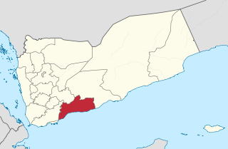
Abyan is a governorate of Yemen. The Abyan region was historically part of the Fadhli Sultanate. It was a base to the Aden-Abyan Islamic Army militant group. Its capital is the city of Zinjibar. This governorate is noted for its agriculture, in particular the cultivation of date palms and animal husbandry.

M'Bahiakro Department is a department of Iffou Region in Lacs District, Ivory Coast. In 2021, its population was 78,369 and its seat is the settlement of M'Bahiakro. The sub-prefectures of the department are Bonguéra, Kondossou, and M'Bahiakro.
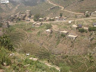
Village Alotna / Attna is a village in Yemen.
Al Qaflah District is a district of the 'Amran Governorate, Yemen. As of 2003, the district had a population of 36,722 inhabitants.

Sarar District is a district of the Abyan Governorate, Yemen. As of 2003, the district had a population of 15,093 inhabitants.
Sibah District is a district of the Abyan Governorate, Yemen. As of 2003, the district had a population of 15,996 inhabitants.
Al Mansuriyah District is a district of the Al Hudaydah Governorate, Yemen. As of 2003, the district had a population of 44,744 inhabitants.
Bajil District is a district of the Al Hudaydah Governorate, Yemen. As of 2003, the district had a population of 169,884 inhabitants.
Bayt al-Faqih District is a district of the Al Hudaydah Governorate, Yemen. As of 2003, the district had a population of 241,300 inhabitants.
Bura District is a district of the Al Hudaydah Governorate, Yemen. As of 2003, the district had a population of 45,116 inhabitants.
Hays District is a district of the Al Hudaydah Governorate, Yemen. As of 2003, the district had a population of 45,436 inhabitants.
Jabal Ra's District is a district of the Al Hudaydah Governorate, Yemen. As of 2003, the district had a population of 44,674 inhabitants.
Shahan District is a district of the Al Mahrah Governorate, Yemen. As of 2003, the district had a population of 3,152 inhabitants.
Hufash District is a district of the Al Mahwit Governorate, Yemen. As of 2003, the district had a population of 37,884 inhabitants.
Washhah District is a district of the Hajjah Governorate, Yemen. As of 2003, the district had a population of 62,617 people.

Rumah District is a district of the Hadhramaut Governorate, Yemen. As of 2021, the district had a population of 10,080 inhabitants.
Baqim District is a district of the Sa'dah Governorate, Yemen. As of 2003, the district had a population of 22,965 people.
Kitaf wa Al Boqe'e District is a district of the Sa'dah Governorate, Yemen. As of 2003, the district had a population of 43,034 inhabitants.
Shada'a District is a district of the Sa'dah Governorate, Yemen. As of 2003, the district had a population of 11,202 inhabitants.

Arhab District is a district of the Sana'a Governorate, Yemen. As of 2003, the district had a population of 90,038 inhabitants.
