Qori Kalis Glacier

Last updated
Qori Kalis Glacier
Quelccaya Ice Cap indicating Qori Kalis Glacier.jpg
Quelccaya Ice Cap indicating Qori Kalis Glacier and lake on 2010 25 09
Peru physical map.svg
Red pog.svg
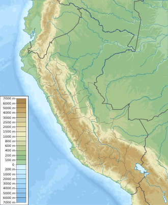
Location of Qori Kalis Glacier within Peru
TypeMountain glacier
Location Peru
Coordinates 13°54′19″S70°50′05″W / 13.905332°S 70.834809°W / -13.905332; -70.834809 Coordinates: 13°54′19″S70°50′05″W / 13.905332°S 70.834809°W / -13.905332; -70.834809
StatusRetreating

The Qori Kalis Glacier is a tropical glacier located in the Cordillera Oriental section of the Andes mountains of Peru. It is one of the few tropical glaciers left in the world, and is the main outlet of the Quelccaya Ice Cap. [1]

This glacier has lost nearly half of its length since measurements began in 1963 by the Peruvian hydro-electric company Electroperú. Around 2007, the glacier had been retreating at a rate of 600 feet per year. [2]

From 1963 to 1978 it retreated at a rate of approximately 6 metres per year. Between 1991 and 2005, it has retreated at around 60 metres per year. It is the largest of all of the tongues of the Quelccaya Ice Cap, many of which are in retreat. [3]

Testing shows that the Qori Kalis Glacier advanced to its greatest length around 520 years ago and then began to retreat. It has advanced to small degrees from time to time since then. [4]
Lake

Qori Kalis Glacier at left centre in this 1975-2000 Landsat false-colour animation Qori Kalis Glacier animation.gif
Qori Kalis Glacier at left centre in this 1975-2000 Landsat false-colour animation

Beginning in 1991, a proglacial lake started to form where the glacier once existed. The lake is extremely deep, and is contained in a natural valley which acts as a dam. [5] In 2004, the lake had reached a depth of 80 meters. [6]

In March 2006, a large portion of the glacier detached and fell into the lake. [7] This resulted in a large wave of water surging into the valley below. The risk of such events are monitored because of the risk of flash flooding towns and even cities below. [8]

Related Research Articles

<span class="mw-page-title-main">Glacier</span> Persistent body of ice that is moving under its own weight

A glacier is a persistent body of dense ice that is constantly moving under its own weight. A glacier forms where the accumulation of snow exceeds its ablation over many years, often centuries. It acquires distinguishing features, such as crevasses and seracs, as it slowly flows and deforms under stresses induced by its weight. As it moves, it abrades rock and debris from its substrate to create landforms such as cirques, moraines, or fjords. Although a glacier may flow into a body of water, it forms only on land and is distinct from the much thinner sea ice and lake ice that form on the surface of bodies of water.

<span class="mw-page-title-main">Aletsch Glacier</span> Largest glacier in the Alps

The Aletsch Glacier or Great Aletsch Glacier is the largest glacier in the Alps. It has a length of about 23 km (14 mi) (2014), has about a volume of 15.4 km3 (3.7 cu mi) (2011), and covers about 81.7 km2 (2011) in the eastern Bernese Alps in the Swiss canton of Valais. The Aletsch Glacier is composed of four smaller glaciers converging at Konkordiaplatz, where its thickness was measured by the ETH to be still near 1 km (3,300 ft). It then continues towards the Rhône valley before giving birth to the Massa. The Aletsch Glacier is – like most glaciers in the world today – a retreating glacier. As of 2016, since 1980 it lost 1.3 kilometres (0.81 mi) of its length, since 1870 3.2 kilometres (2.0 mi), and lost also more than 300 metres (980 ft) of its thickness.

<span class="mw-page-title-main">Geography of Tibet</span> Geographical aspects of historical Tibet

The geography of Tibet consists of the high mountains, lakes and rivers lying between Central, East and South Asia. Traditionally, Western sources have regarded Tibet as being in Central Asia, though today's maps show a trend toward considering all of modern China, including Tibet, to be part of East Asia. Tibet is often called "the roof of the world," comprising tablelands averaging over 4,950 metres above the sea with peaks at 6,000 to 7,500 m, including Mount Everest, on the border with Nepal.

<span class="mw-page-title-main">Fox Glacier</span>

Fox Glacier is a 13-kilometre-long (8.1 mi) temperate maritime glacier located in Westland Tai Poutini National Park on the West Coast of New Zealand's South Island. Like nearby Franz Josef Glacier, Fox Glacier is one of the most accessible glaciers in the world, with a terminal face as low as 300 m above sea level, close to the village of Fox Glacier. It is a major tourist attraction and about 1000 people daily visit it during high tourist season.

<span class="mw-page-title-main">Franz Josef Glacier</span> Glacier in New Zealand

The Franz Josef Glacier is a 12-kilometre-long (7.5 mi) temperate maritime glacier in Westland Tai Poutini National Park on the West Coast of New Zealand's South Island. Together with the Fox Glacier 20 kilometres (12 mi) to the south, and a third glacier, it descends from the Southern Alps to less than 300 metres (980 ft) above sea level.

<span class="mw-page-title-main">Byrd Polar and Climate Research Center</span>

The Byrd Polar and Climate Research Center (BPCRC) is a polar, alpine, and climate research center at The Ohio State University founded in 1960.

<span class="mw-page-title-main">Cordillera Blanca</span> Mountain range in Peru that is part of the larger Andes range

The Cordillera Blanca is a mountain range in Peru that is part of the larger Andes range and extends for 200 kilometres (124 mi) between 8°08' and 9°58'S and 77°00' and 77°52'W, in a northwesterly direction. It includes several peaks over 6,000 metres (19,690 ft) high and 722 individual glaciers. The highest mountain in Peru, Huascarán, at 6,768 metres (22,205 ft) high, is located there.

<span class="mw-page-title-main">Glacial motion</span> Geological phenomenon

Glacial motion is the motion of glaciers, which can be likened to rivers of ice. It has played an important role in sculpting many landscapes. Most lakes in the world occupy basins scoured out by glaciers. Glacial motion can be fast or slow, but is typically around 25 centimetres per day (9.8 in/d).

<span class="mw-page-title-main">Tronador</span> Mountain in Argentina and Chile

Tronador is an extinct stratovolcano in the southern Andes, located along the border between Argentina and Chile, near the Argentine city of Bariloche. The mountain was named Tronador by locals in reference to the sound of falling seracs. With an altitude of 3,470 metres (11,380 ft), Tronador stands more than 1,000 m above nearby mountains in the Andean massif, making it a popular mountaineering destination. Located inside two national parks, Nahuel Huapi in Argentina and Vicente Pérez Rosales in Chile, Tronador hosts a total of eight glaciers, which are currently retreating due to warming of the upper troposphere.

<span class="mw-page-title-main">Lake Palcacocha</span> Body of water

Palcacocha is a glacier lake in the Andes mountain range of South America in northwestern Peru located in the Ancash Region, Huaraz Province.

<span class="mw-page-title-main">Lonnie Thompson</span> American paleoclimatologist

Lonnie Thompson, is an American paleoclimatologist and university professor in the School of Earth Sciences at Ohio State University. He has achieved global recognition for his drilling and analysis of ice cores from ice caps and mountain glaciers in the tropical and sub-tropical regions of the world. He and his wife, Ellen Mosley-Thompson, run the ice core paleoclimatology research group at the Byrd Polar Research Center.

<span class="mw-page-title-main">Glacial lake outburst flood</span> Type of outburst flood that occurs when the dam containing a glacial lake fails

A glacial lake outburst flood (GLOF) is a type of outburst flood caused by the failure of a dam containing a glacial lake. An event similar to a GLOF, where a body of water contained by a glacier melts or overflows the glacier, is called a jökulhlaup. The dam can consist of glacier ice or a terminal moraine. Failure can happen due to erosion, a buildup of water pressure, an avalanche of rock or heavy snow, an earthquake or cryoseism, volcanic eruptions under the ice, or massive displacement of water in a glacial lake when a large portion of an adjacent glacier collapses into it.

<span class="mw-page-title-main">Retreat of glaciers since 1850</span> Shortening of glaciers by melting

The retreat of glaciers since 1850 affects the availability of fresh water for irrigation and domestic use, mountain recreation, animals and plants that depend on glacier-melt, and, in the longer term, the level of the oceans. Deglaciation occurs naturally at the end of ice ages, but glaciologists find the current glacier retreat is accelerated by the measured increase of atmospheric greenhouse gases—an effect of climate change. Mid-latitude mountain ranges such as the Himalayas, Rockies, Alps, Cascades, Southern Alps, and the southern Andes, as well as isolated tropical summits such as Mount Kilimanjaro in Africa, are showing some of the largest proportionate glacial losses. Excluding peripheral glaciers of ice sheets, the total cumulated global glacial losses over the 26 year period from 1993–2018 were likely 5500 gigatons, or 210 gigatons per yr.

<span class="mw-page-title-main">Upper Fremont Glacier</span>

Upper Fremont Glacier is in the Fitzpatrick Wilderness of Shoshone National Forest in the U.S. state of Wyoming. This Wind River Range alpine glacier is associated with the largest grouping of glaciers in the U.S. Rocky Mountains and lies on the north slope of Fremont Peak, the third tallest mountain in Wyoming. Upper Fremont Glacier is at an average altitude of 13,450 ft (4,100 m) and is one of the highest altitude glaciers in the American Rockies.

<span class="mw-page-title-main">Furtwängler Glacier</span>

Furtwangler Glacier is located near the summit of Mount Kilimanjaro in Tanzania. The glacier is named after Walter Furtwängler who, with Siegfried König, formed the fourth party to ascend to the summit of Kilimanjaro in 1912.

<span class="mw-page-title-main">Subantarctic</span> Term describing the parts of the three largest oceans nearest the Southern Ocean

The sub-Antarctic zone is a region in the Southern Hemisphere, located immediately north of the Antarctic region. This translates roughly to a latitude of between 46° and 60° south of the Equator. The subantarctic region includes many islands in the southern parts of the Atlantic, Indian, and Pacific oceans, especially those situated north of the Antarctic Convergence. Sub-Antarctic glaciers are, by definition, located on islands within the sub-Antarctic region. All glaciers located on the continent of Antarctica are by definition considered to be Antarctic glaciers.

<span class="mw-page-title-main">Hoffellsjökull</span>

Hoffellsjökull is an outlet glacier which flows from the ice cap of Vatnajökull. It is located in the municipality of Hornafjörður, southeast Iceland. Hoffellsjökull takes its name from Hoffell; a mountainous area and a farmland. Hoffellsjökull and the Hoffell area are a part of Vatnajökull National Park.

<span class="mw-page-title-main">Vashon Glaciation</span>

The Vashon Glaciation, Vashon Stadial or Vashon Stade is a local term for the most recent period of very cold climate in which during its peak, glaciers covered the entire Salish Sea as well as present day Seattle, Tacoma, Olympia and other surrounding areas in the western part of present-day Washington (state) of the United States of America. This occurred during a cold period around the world known as the last glacial period. This was the most recent cold period of the Quaternary glaciation, the time period in which the arctic ice sheets have existed. The Quaternary Glaciation is part of the Late Cenozoic Ice Age, which began 33.9 million years ago and is ongoing. It is the time period in which the Antarctic ice cap has existed.

<span class="mw-page-title-main">Coropuna</span> Volcano in Peru

Coropuna is a dormant compound volcano located in the Andes mountains of southeast-central Peru. The upper reaches of Coropuna consist of several perennially snowbound conical summits, lending it the name Nevado Coropuna in Spanish. The complex extends over an area of 240 square kilometres (93 sq mi) and its highest summit reaches an altitude of 6,377 metres (20,922 ft) above sea level. This makes the Coropuna complex the third-highest of Peru. Its thick ice cap is the most extensive in Earth's tropical zone, with several outlet glaciers stretching out to lower altitudes. Below an elevation of 5,000 metres (16,000 ft), there are various vegetation belts which include trees, peat bogs, grasses and also agricultural areas and pastures.

<span class="mw-page-title-main">Quelccaya Ice Cap</span> Glacier in Peru

The Quelccaya Ice Cap is the second largest glaciated area in the tropics, after Coropuna. Located in the Cordillera Oriental section of the Andes mountains in Peru, the cap covers an area of 42.8 square kilometres (16.5 sq mi) with ice up to 200 metres (660 ft) thick. It is surrounded by tall ice cliffs and a number of outlet glaciers, the largest of which is known as Qori Kalis Glacier; lakes, moraines, peat bogs and wetlands are also present. There is a rich flora and fauna, including birds that nest on the ice cap. Quelccaya is an important source of water, eventually melting and flowing into the Inambari and Vilcanota Rivers.

References

  1. "Geotimes - April 2007 - Ancient glaciers melting quickly". geotimes.org. Retrieved 12 December 2014.
  2. "As a glacier melts, so does a Peruvian water supply". Los Angeles Times. Retrieved 12 December 2014.
  3. "Peruvian Glacier May Vanish In Five Years". osu.edu. Retrieved 12 December 2014.
  4. "Research shows temperature, not snowfall, driving tropical glacier size". phys.org. Retrieved 12 December 2014.
  5. "ARC: Adopt A Glacier - Qori Kalis Glacier". nsidc.org. Retrieved 12 December 2014.
  6. "Ice and Climate". acs.org. Retrieved 12 December 2014.
  7. "Tropical glaciers, recorders and indicators of climate change, are disappearing globally". Annals of Glaciology. 2011. pp. 23–34. Retrieved 20 October 2022.
  8. "Tropical Climate History...Shrinking : Image of the Day". nasa.gov. Retrieved 12 December 2014.