
Queensland is a state situated in northeastern Australia, and is the second-largest and third-most populous Australian state. It is bordered by the Northern Territory, South Australia and New South Wales to the west, south-west and south respectively. To the east, Queensland is bordered by the Coral Sea and the Pacific Ocean. To its north is the Torres Strait, separating the Australian mainland from Papua New Guinea. With an area of 1,852,642 square kilometres (715,309 sq mi), Queensland is the world's sixth-largest sub-national entity, and is larger than all but 15 countries. Due to its size, Queensland's geographical features and climates are diverse, including tropical rainforests, rivers, coral reefs, mountain ranges and sandy beaches in its tropical and sub-tropical coastal regions, as well as deserts and savanna in the semi-arid and desert climatic regions of its interior.

The Gold Coast is a coastal city in the Australian state of Queensland, approximately 66 kilometres (41 mi) south-southeast of the centre of the state capital Brisbane and immediately north of the border with New South Wales. The traditional owners of this region of south-east Queensland are the Yugambeh language people. The demonym for the Gold Coast is Gold Coaster. With an estimated population of 679,127, at June 2019, the Gold Coast is the sixth-largest city in Australia, making it the largest non-capital city, and Queensland's second-largest city.

Brisbane is the capital and most populous city of the Australian state of Queensland, and the third-most populous city in Australia. Brisbane's metropolitan area has a population of around 2.6 million, and it lies at the centre of the South East Queensland metropolitan region, which encompasses a population of around 3.8 million. The Brisbane central business district is situated within a peninsula of the Brisbane River about 15 km (9 mi) from its mouth at Moreton Bay, a bay of the Coral Sea. The metropolitan area extends in all directions along the hilly floodplain of the Brisbane River Valley between Moreton Bay and the Taylor and D'Aguilar mountain ranges. It sprawls across several of Australia's most populous local government areas (LGAs) — most centrally the City of Brisbane, the most populous LGA in the nation. The demonym of Brisbane is "Brisbanite", while common nicknames include "Brissie" and the "River City".
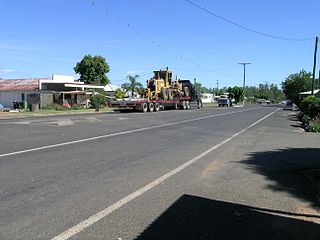
Rolleston is a small town and locality in the Central Highlands Region, Queensland, Australia.

Nanango is a town and locality in the South Burnett Region of Queensland, Australia. In the 2016 census, Nanango had a population of 3,599 people.
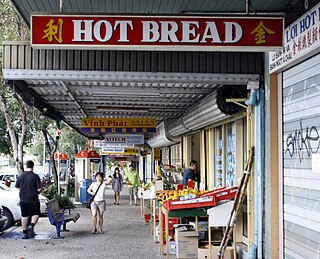
Darra is a suburb in the City of Brisbane, Queensland, Australia. In the 2016 census, Darra had a population of 4,343 people.

South East Queensland (SEQ) is a bio-geographical, metropolitan, political, and administrative region of the state of Queensland in Australia, with a population of approximately 3.8 million people out of the state's population of 5.1 million. The area covered by South East Queensland varies, depending on the definition of the region, though it tends to include Queensland's three largest cities: the capital city Brisbane; the Gold Coast; and the Sunshine Coast. Its most common use is for political purposes, and covers 22,420 square kilometres (8,660 sq mi) and incorporates 11 local government areas, extending 240 kilometres (150 mi) from Noosa in the north to the Gold Coast and New South Wales border in the south, and 140 kilometres (87 mi) west to Toowoomba.
The Regions of Queensland refer to the geographic areas of the Australian state of Queensland. Due to its large size and decentralised population, the state is often divided into regions for statistical and administrative purposes. Each region varies somewhat in terms of its economy, population, climate, geography, flora and fauna. Cultural and official perceptions and definitions of the various regions differ somewhat depending on the government agency or popular group by which they are being applied.

Brisbane City is the central suburb and central business district of Brisbane, the state capital of Queensland, Australia. It is colloquially referred to as the "Brisbane CBD" or "the city". It is located on a point on the northern bank of the Brisbane River, historically known as Meanjin, Mianjin or Meeanjin in the local Aboriginal Australian dialect. The triangular shaped area is bounded by the median of the Brisbane River to the east, south and west. The point, known at its tip as Gardens Point, slopes upward to the north-west where the city is bounded by parkland and the inner city suburb of Spring Hill to the north. The CBD is bounded to the north-east by the suburb of Fortitude Valley. To the west the CBD is bounded by Petrie Terrace, which in 2010 was reinstated as a suburb.
TransLink is the public transit agency for Queensland, and is part of the Department of Transport and Main Roads. TransLink was first introduced by the Queensland Government in June 2003 to orchestrate bus, ferry, rail and light rail services. TransLink works with Brisbane Airtrain, Transport for Brisbane, Transdev, Queensland Rail and other operators to provide services. TransLink operates an integrated ticketing system and the go card system to allow the use of one ticket on multiple services.

Fig Tree Pocket is a riverside western suburb in the City of Brisbane, Queensland, Australia. In the 2016 census, Fig Tree Pocket had a population of 4,045 people.

Moggill is a suburb in the west of the City of Brisbane, Queensland, Australia. It is about 19 kilometres (12 mi) from the Brisbane CBD. It comprises a mixture of small-lot and acreage residential homes along with a small number of remaining farms. Moggill is located in the Parish of Moggill within the County of Stanley, Queensland.

Tennyson is a southern riverside suburb in the City of Brisbane, Queensland, Australia. In the 2016 census, Tennyson had a population of 1,019 people.

Anstead is an outer western suburb in the City of Brisbane, Queensland, Australia. In the 2016 census, Anstead had a population of 1,509 people.

Coopers Plains is a southern suburb in the City of Brisbane, Queensland, Australia. In the 2016 census, Coopers Plains had a population of 5,483 people.

Chuwar is a town and suburb of Ipswich in the City of Ipswich and a locality of the City of Brisbane in South East Queensland, Australia. In the 2016 census, Chuwar had a population of 2,244 people.
The Kenmore Bypass is a proposal for a major road linking Moggill Road, Pinjarra Hills, with the Centenary Motorway, Kenmore, in Brisbane, Australia. The Proposed Bypass will be 3.3 kilometres (2.1 mi) in length. Since the 1960s a corridor of land has been set aside for a bypass. This is where the Kenmore bypass will be located if the plans go ahead. The Bypass is stage 1 of the planned Moggill Pocket Arterial Road corridor.

Wivenhoe Pocket is a rural locality in the Somerset Region, Queensland, Australia. In the 2016 census, Wivenhoe Pocket had a population of 440 people.
Wilsons Pocket is a rural locality in the Gympie Region, Queensland, Australia. In the 2016 census Wilsons Pocket had a population of 197 people.

Percival Albert Trompf (1902-1964), was an Australian commercial artist, best known for his travel posters, books, advertising hoardings and pamphlets promoting the nation's tourist industry and Australian and international corporations and companies. His colour lithography was recognised as distinctive during his career and since, Art Deco in style, and innovative in its use of flat colour. Some of his designs depicted historical events, including the construction of the Sydney Harbour Bridge and Captain Cook's landing at Botany Bay, and advanced the iconic value of Australian destinations including the 'Outback', The Great Barrier Reef, and national identity and activities of sun-worship, surfing and bushwalking, using a visual language of modernity, promotion and consumerism. In turn his imagery has since become valued for its nostalgic evocation of the early mid-century and his posters have become collectible 'national treasures' that are frequently exhibited.
