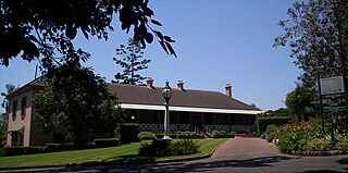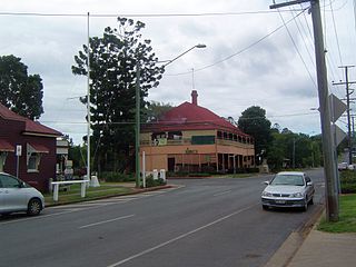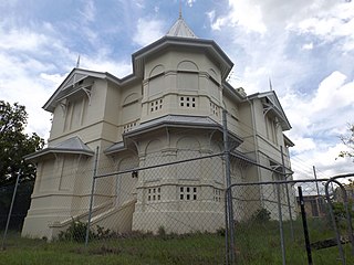
Beaudesert is a town and locality in the Scenic Rim Region, Queensland, Australia.

Fortitude Valley is a suburb of central Brisbane, the state capital of Queensland, Australia. The suburb lies immediately northeast of the Brisbane central business district, and is one of the hubs of Brisbane's nightlife, renowned for its nightclubs, bars and adult entertainment. At the 2016 Australian Census Fortitude Valley recorded a population of 6,978. In the 1950s, the suburb was the largest shopping precinct outside a central business district in Australia.

Redland City, better known as the Redlands and formerly known as Redland Shire, is a local government area located in the southeast of the Brisbane metropolitan area in South East Queensland. With a population just under 150,000, the City is spread along the southern coast of Moreton Bay, covering 537.1 square kilometres (207.4 sq mi). Its mainland borders the City of Brisbane to the west and north-west, and Logan City to the south-west and south, while its islands are situated north of the City of Gold Coast.

Newstead House is Brisbane's oldest surviving residence and is located on the Breakfast Creek bank of the Brisbane River, in the northern Brisbane suburb of Newstead, in Queensland, Australia. Built as a small cottage in the Colonial-Georgian style in 1846, the cottage was extended and today is painted and furnished in a late Victorian style.

Marburg is a small township of 536 inhabitants located 60 kilometres (37 mi) west of Brisbane, the capital of the State of Queensland, Australia. It is split between the City of Ipswich and Somerset Region local government areas. At the 2011 Australian Census the town recorded a population of 567.

The Brisbane central business district (CBD), officially gazetted as the suburb of Brisbane City and colloquially referred to as 'the city', is the heart of the state capital of Queensland, Australia. It is located on a point on the northern bank of the Brisbane River. The triangular shaped area is bounded by the Brisbane River to the east, south and west. The point, known at its tip as Gardens Point, slopes upward to the north-west where the city is bounded by parkland and the inner city suburb of Spring Hill to the north. The CBD is bounded to the north-east by the suburb of Fortitude Valley. To the west the CBD is bounded by Petrie Terrace, which in 2010 was reinstated as a suburb.

Yeronga is a residential suburb of Brisbane, Queensland, Australia located on the Brisbane River 7 kilometres (4.3 mi) south of the Brisbane central business district.

The Environment Protection and Biodiversity Conservation Act 1999 is an Act of the Parliament of Australia that provides a framework for protection of the Australian environment, including its biodiversity and its natural and culturally significant places. Enacted on 17 July 2000, it established a range of processes to help protect and promote the recovery of threatened species and ecological communities, and preserve significant places from decline. The EPBC Act replaced the National Parks and Wildlife Conservation Act 1975.

The Queensland Parks and Wildlife Service (QPWS) is a business division of the Department of Environment and Science within the Government of Queensland. The division’s primary concern is with the management and maintenance of protected areas within Queensland, to protect and manage Queensland’s parks, forests and the Great Barrier Reef for current and future generations.

The Shire of Mareeba is a local government area at the base of Cape York Peninsula in Far North Queensland, inland from Cairns. The shire, administered from the town of Mareeba, covered an area of 53,610.8 square kilometres (20,699.2 sq mi), and existed as a local government entity from 1879 until 2008, when it amalgamated with several councils in the Atherton Tableland area to become the Tablelands Region.

The City of Redcliffe is a former local government area in South East Queensland, Australia. In 2008 it was amalgamated with the Shires of Pine Rivers and Caboolture to create Moreton Bay Region. It is in the northern part of the County of Stanley, with a total area of 38.1 km² and a population of 51,174.

The City of Ipswich is a local government area in Queensland, Australia, located in the southwest of the Brisbane metropolitan area, including the urban area surrounding the city of Ipswich and surrounding rural areas.

Jennings is a town on the Northern Tablelands region of New South Wales, Australia. The town is located in the Tenterfield Shire local government area, 718 kilometres (446 mi) from the state capital, Sydney and 256 kilometres (159 mi) from Brisbane. It is separated by the state border from its neighbouring town of Wallangarra in Queensland. At the 2011 census, Jennings had a population of 211. The New England Highway and the Main North railway line cross the state border at Jennings. The town was named for Sir Patrick Jennings, the first Roman Catholic Premier of New South Wales.
Australian heritage laws exist at the National (Commonwealth) level, and at each of Australian Capital Territory, New South Wales, Northern Territory, Queensland, South Australia, Tasmania, Victoria, Western Australia State and Territory levels. Generally there are separate laws governing Aboriginal cultural heritage and historical heritage. State laws also allow heritage to be protected through Local Government regulations, such as planning schemes, as well.

Local government in the Australian state of Queensland describes the institutions and processes by which towns and districts can manage their own affairs to the extent permitted by the Local Government Act 1993–2007. Queensland is divided into 77 local government areas which may be called Cities, Towns, Shires or Regions. Each area has a council which is responsible for providing a range of public services and utilities, and derives its income from both rates and charges on resident ratepayers, and grants and subsidies from the State and Commonwealth governments.

Acland is a small town north of Oakey, on the Darling Downs, 160 kilometres (100 mi) west of Queensland's state capital, Brisbane. It is within the local government area of Toowoomba Region. At the 2016 census, Acland had a population of 32.
The Department of Environment and Heritage Protection is a department of the Queensland Government which is responsible for protecting the state's natural environment and historic buildings. The minister responsible for the department is Steven Miles. The department's head office is at 400 George Street in the Brisbane CBD.


