
Froland is a municipality in Aust-Agder county, Norway. It is part of the traditional region of Sørlandet. The administrative center is the village of Blakstad, which along with Osedalen form the main population center of the municipality. Other villages in Froland include Bøylefoss, Bøylestad, Froland, Frolands verk, Heldalsmo, Hinnebu, Hynnekleiv, Jomås, Lauvrak, Libru, Løvjomås, Mjåvatn, Mjølhus, Mykland, and Risdal.

Southern Norway is the geographical region (landsdel) along the Skagerrak coast of southern Norway. The region is an informal description since it does not have any governmental function. It roughly corresponds to the old petty kingdom of Agder as well as the two present-day counties of Vest-Agder and Aust-Agder. The total combined area of Vest-Agder and Aust-Agder counties is 16,493 square kilometres (6,368 sq mi). The name is relatively new, having first been used in Norway around 1900.

Nidelva is the main river in the Arendal drainage basin in Aust-Agder county, Norway. The 221.7-kilometre (137.8 mi) long river begins at the confluence of two rivers: Nisserelva and Fyreselv. The confluence is located by the village of Haugsjåsund in Nissedal municipality in southern Telemark county. The river flows south into the Skagerrak at the city of Arendal. The watershed covers 4,011 square kilometres (1,549 sq mi) and has an average waterflow of 114.4 cubic metres per second (4,040 cu ft/s) at Rykene near the mouth. The highest waterflow ever recorded on the river was 1,200 cubic metres per second (42,000 cu ft/s) in the autumn of 1987.

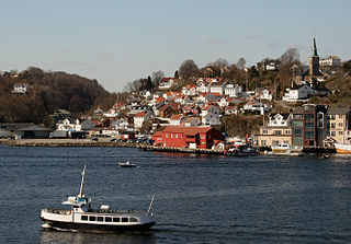
Rykene or Rygene is a village located along the river Nidelva in Aust-Agder county, Norway. The village is primarily located in Arendal municipality, but a small portion of the village lies across the river in the neighboring municipality of Grimstad. Rykene is located about 10 kilometres (6.2 mi) north of the town of Grimstad and about the same distance south of the city of Arendal. Historically, the village grew up due to its close proximity to forests as the timber was floated down river to the sawmills in Rykene. The village of Lindtveit lies about 2 kilometres (1.2 mi) to the northwest, the village of Løddesøl lies about 4 kilometres (2.5 mi) to the north, the village of Gjennestad lies about 3 kilometres (1.9 mi) to the northeast. The village sits at the junction of Norwegian County Road 407 and Norwegian County Road 408.
Barbu is part of the town of Arendal in Aust-Agder county, Norway. It is also a former municipality which existed from 1878 until 1902 when it was merged into Arendal. The 15.7-square-kilometre (6.1 sq mi) municipality was located just to the north of the 0.34-square-kilometre (84-acre) town of Arendal. The administrative centre of the small, urban municipality was called Barbu as well. Barbu Church was the church for the municipality. Today, the name Barbu refers to the village-like place located in head of the Galtesundet strait. Barbu is also a parish (sogn) in the Arendal prosti (deanery) within the Diocese of Agder og Telemark.

Strengereid is a village in the municipality of Arendal in Aust-Agder county, Norway. It is located along the Norwegian County Road 410, about 3 kilometres (1.9 mi) northeast of the village of Eydehavn and just west of the island of Flostaøya. The village of Sagene lies about 2 kilometres (1.2 mi) to the northwest.

Asdal is a village in Arendal municipality in Aust-Agder county, Norway. The village is located along Norwegian National Road 407 between the European route E18 highway and the river Nidelva. The village sits between the village of Fevik to the south and the town of Arendal to the northeast. The village of Vrengen lies immediately north of Asdal and the village of Rød lies across the river to the southeast.
Gjennestad or Ginnestad is a village in Arendal municipality in Aust-Agder county, Norway. The village is located a short distance north of the river Nidelva, just off Norwegian County Road 407. The village of Rykene sits about 3 kilometres (1.9 mi) to the southwest of Gjennestad.
Lindtveit is a village in Arendal municipality in Aust-Agder county, Norway. The village is located just east of the river Nidelva along the Norwegian County Road 408. The village of Rykene is located about 1.5 kilometres (0.93 mi) to the southeast of Lindtveit.
Løddesøl is a village in Arendal municipality in Aust-Agder county, Norway. The village is located along the Norwegian County Road 408 on the eastern shore of the river Nidelva. The village lies about 2.5 kilometres (1.6 mi) south of the village of Rise, about 3 kilometres (1.9 mi) east of the village of Nævesdal, about 3 kilometres (1.9 mi) north of the village of Lindtveit, and about 7 kilometres (4.3 mi) west of the town of Arendal. The village has an elementary school and preschool as well as a sawmill and some small stores.
Nedenes is a village in Arendal municipality in Aust-Agder county, Norway. The village is located in the southern part of Arendal, just north of the municipal border with Grimstad. The Norwegian County Road 420 runs through the village heading north to the village of Rød and onwards to the island of Hisøya to the north. Engene Church is located in Nedenes.
Rise is a village in Arendal municipality in Aust-Agder county, Norway. The village is located on the eastern short of the river Nidelva, along the Arendalsbanen railway line. The Norwegian County Road 408 runs through the village. The village of Libru lies about 3 kilometres (1.9 mi) to the northeast and the village of Løddesøl lies about 2.5 kilometres (1.6 mi) to the south.

Saltrød is a village in Arendal municipality in Aust-Agder county, Norway. The village is located along the Norwegian County Road 410, about 5 kilometres (3.1 mi) northeast of the town of Arendal and about 2 kilometres (1.2 mi) southwest of the village of Eydehavn. The village lies along the Tromøysundet strait, looking across the water towards the island of Tromøy. Stokken Church is located in Saltrød.

Vrengen is a village in Arendal municipality in Aust-Agder county, Norway. The village is located in the Bjorbekk area of Arendal, along the Norwegian County Road 407, just north of the mouth of the river Nidelva. The Bjorbekk Church lies just northwest of Vrengen and the village of Asdal lies just to the south.

Østre Agder is a district or region in Aust-Agder county in southern Norway. The district covers the eastern, coastal areas of the county including the eight municipalities of Arendal, Tvedestrand, Risør, Grimstad, Gjerstad, Vegårshei, Åmli, and Froland. The city of Arendal is the largest city in the region. Other cities in the district include Tvedestrand, Grimstad, and Risør. This region is bounded by Telemark county to the north, by the Setesdal region to the northwest, and by the Kristiansand Region to the southwest.
Rød is the Norwegian and Danish word for the color "red". It is also a shortened version of the Norwegian dialect word røddning, meaning a cleared place.

Øyestad Church is a parish church in Arendal municipality in Aust-Agder county, Norway. It is located in the village of Rykene, on the north side of the river Nidelva. It is the church for the Øyestad parish which is part of the Arendal prosti (deanery) in the Diocese of Agder og Telemark. The white, stone church was built around the year 1200 by an unknown architect. The church seats about 250 people. The main body of the church is whitewashed stone, but the main entrance and tower are wooden and painted red.


