The N1 is a national route in South Africa that runs from Cape Town through Bloemfontein, Johannesburg, Pretoria and Polokwane to Beit Bridge on the border with Zimbabwe. It forms the first section of the famed Cape to Cairo Road.
Route 62 is a tourist route in South Africa that meanders between Cape Town, Oudtshoorn, the Garden Route, and Gqeberha, offering the scenic alternative to the N2 highway. Route 62 is named for the R62 provincial route, which it follows from Montagu to Humansdorp, but the tourist route extends further along other highways to Cape Town and Gqeberha.

The R61 is a long provincial route in South Africa that connects Beaufort West with Port Shepstone via Graaff-Reinet, Komani, Mthatha and Port Edward.

The R63 is a tarred provincial route in South Africa that connects Calvinia with Komga via Carnarvon, Victoria West, Graaff-Reinet, Somerset East and King William's Town. It is cosigned with the N10 between Eastpoort and Cookhouse for 24 kilometres.

The R75 is a provincial route in Eastern Cape, South Africa that connects Graaff-Reinet with Gqeberha via Despatch, Kariega and Jansenville.

The R102 is a Regional Route in South Africa. It is the route designation for all old sections of the N2, thus it is a discontinuous road that resumes in areas where a new N2 has been constructed.
The R322 is a Regional Route in South Africa. Its northern origin is a t-junction with the R324 between Suurbraak and Barrydale. The northern and western routes are signed the R324, with R322 heading just south of east. It reaches Heidelberg where it meets the N2. It becomes co-signed with this route, heading just south of west. After a short distance, it diverges from the N2 and heads south-south-west. The route ends at Port Beaufort where it rejoins the R324.
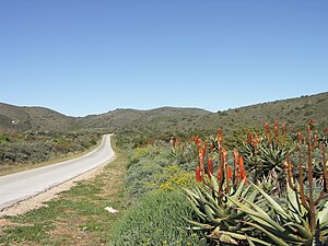
The R327 is a Regional Route in South Africa. Its a regional route in the Western Cape and connects Mossel Bay to Ladismith and part of the northern route is a gravel road.
The R331 is a Regional Route in South Africa that connects the R102 and N2 near Thornhill in the east with the R332 near Baviaanskloof Nature Reserve in the west via Hankey and Patensie.
The R332 is a Regional Route in South Africa that connects Willowmore with the R330 and the N2 near Humansdorp.

The R339 is a Regional Route in South Africa that connects Knysna with Uniondale via Avontuur. It is primarily a gravel road and crosses the Langkloof Mountains at Prince Alfred's pass.
The R346 is a Regional Route in Eastern Cape, South Africa that connects Kidd's Beach with Stutterheim via King William’s Town.

The R402 is a Regional Route in South Africa that connects the N2 between Stormsrivier and Humansdorp with the R62 between Humansdorp and Joubertina.

The N2 is a national route in South Africa that runs from Cape Town through George, Gqeberha, East London, Mthatha, Port Shepstone and Durban to Ermelo. It is the main highway along the Indian Ocean coast of the country. Its current length of 2,255 kilometres (1,401 mi) makes it the longest numbered route in South Africa.

The R62 is a provincial route in South Africa that connects Ashton with Humansdorp. The R62 runs through the Little Karoo and the Langkloof, passing through Montagu, Ladismith, Calitzdorp, Oudtshoorn, and Joubertina.

Kouga Municipality is a local municipality in the Eastern Cape of South Africa, approximately 80 km west of Gqebera. It forms part of the Sarah Baartman District Municipality. Its territory includes the coastal zone between the Van Stadens River in the east and the Tsitsikamma River in the west, and stretches inland towards the Baviaanskloof Mountains in the north.
Hankey Pass, is situated in the Eastern Cape, province of South Africa, on the regional road R330, between Humansdorp and Hankey.

The M4 is a long metropolitan route in the City of Cape Town Metropolitan Municipality in South Africa. It connects the Cape Town CBD with the Cape of Good Hope via Wynberg, Muizenberg and Fish Hoek. Originally, it was the main route connecting the Cape Town CBD with the Southern Suburbs and is thus named Main Road for much of its length. From the CBD to Kirstenhof, it is parallel to the M3 Freeway.

The M9 is a long metropolitan route in the City of Cape Town, South Africa. It connects Sir Lowry's Pass Village with Wynberg via Somerset West, Firgrove, Macassar, Khayelitsha and Nyanga.