Cape St. Francis | |
|---|---|
 View of Cape St. Francis from the Seal Point Lighthouse | |
 Cape St. Francis  Cape St. Francis | |
| Coordinates: 34°11′49″S24°50′17″E / 34.19694°S 24.83806°E | |
| Country | South Africa |
| Province | Eastern Cape |
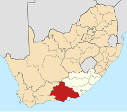
| District | Sarah Baartman |
| Municipality | Kouga |
| Area | |
• Total | 4.38 km2 (1.69 sq mi) |
| Population (2011) [1] | |
• Total | 342 |
| • Density | 78/km2 (200/sq mi) |
| Racial makeup (2011) | |
| • Black African | 3.5% |
| • Coloured | 1.8% |
| • White | 94.7% |
| First languages (2011) | |
| • English | 55.6% |
| • Afrikaans | 42.1% |
| • Xhosa | 1.8% |
| • Other | 0.6% |
| Time zone | UTC+2 (SAST) |
Cape St. Francis (Afrikaans : Kaap St Francis) is a village in South Africa, situated on a headland in the Eastern Cape Province. It is popular for its clean beaches and as a surfing location.
Contents
The village is home to the Seal Point Lighthouse. [2]
The Irma Booysen Floral Reserve is home to many species of flowers and plants.[ citation needed ]
Cape St. Francis is now known as one of the best surfing locations. Given its geological location, it is susceptible to swell year round from large low pressure systems that form between Antarctica and the southern tip of Africa.[ citation needed ]
It is also featured in the 2014 film The Perfect Wave, starring Scott Eastwood.[ citation needed ]
Bartolomeu Dias originally named the cape Ponta das Queimadas because of the fires he spotted there while sailing past. [3]