Kasouga | |
|---|---|
 Kasouga  Kasouga | |
| Coordinates: 33°38′49″S26°44′10″E / 33.647°S 26.736°E | |
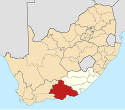
| Country | South Africa |
| Province | Eastern Cape |
| District | Sarah Baartman |
| Municipality | Ndlambe |
| Area | |
• Total | 1.51 km2 (0.58 sq mi) |
| Population (2011) [1] | |
• Total | 39 |
| • Density | 26/km2 (67/sq mi) |
| Racial makeup (2011) | |
| • Black African | 5.1% |
| • White | 94.9% |
| First languages (2011) | |
| • English | 92.3% |
| • Afrikaans | 5.1% |
| • Other | 2.6% |
| Time zone | UTC+2 (SAST) |
Kasouga or Kasuka is a small village in Sarah Baartman District Municipality in the Eastern Cape province of South Africa.
Settlement some 10 km north-east of Kenton-on-Sea, near the mouth of the Kasuka River. The name is derived from Khoekhoen and means 'place of many leopards'. The river name "Kasuka" is a Xhosa adaptation of the word, and has the same meaning. [2]