This article needs additional citations for verification .(September 2013) |
Misgund | |
|---|---|
 Misgund  Misgund | |
| Coordinates: 33°45′18″S23°29′53″E / 33.755°S 23.498°E | |
| Country | South Africa |
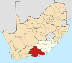
| Province | Eastern Cape |
| District | Sarah Baartman |
| Municipality | Kou-Kamma |
| Area | |
• Total | 0.78 km2 (0.30 sq mi) |
| Population (2011) [1] | |
• Total | 415 |
| • Density | 530/km2 (1,400/sq mi) |
| Racial makeup (2011) | |
| • Black African | 40.2% |
| • Coloured | 57.3% |
| • Indian/Asian | 0.2% |
| • White | 0.7% |
| • Other | 1.4% |
| First languages (2011) | |
| • Afrikaans | 65.5% |
| • Xhosa | 29.2% |
| • S. Ndebele | 1.4% |
| • Tswana | 1.2% |
| • Other | 2.7% |
| Time zone | UTC+2 (SAST) |
| PO box | 6440 |
| Area code | 042 |
Misgund is a town in Kou-Kamma Local Municipality in the Eastern Cape province of South Africa. The name is Afrikaans and means "begrudged". [2]