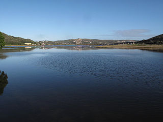
Krakeel River Krakeelrivier | |
---|---|
Coordinates: 33°48′50″S23°43′55″E / 33.814°S 23.732°E Coordinates: 33°48′50″S23°43′55″E / 33.814°S 23.732°E | |
Country | South Africa |
Province | Eastern Cape |
District | Sarah Baartman |
Municipality | Kou-Kamma |
Area | |
• Total | 1.06 km2 (0.41 sq mi) |
Population (2011) [1] | |
• Total | 1,931 |
• Density | 1,800/km2 (4,700/sq mi) |
Racial makeup (2011) | |
• Black African | 13.2% |
• Coloured | 78.1% |
• Indian/Asian | 1.1% |
• White | 6.7% |
• Other | 0.8% |
First languages (2011) | |
• Afrikaans | 89.5% |
• Xhosa | 6.3% |
• English | 2.3% |
• Other | 1.8% |
Time zone | UTC+2 (SAST) |
PO box | 6430 |
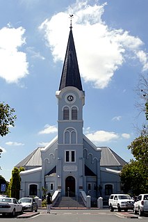
Krakeel River is a town in Sarah Baartman District Municipality in the Eastern Cape province of South Africa.
Sarah Baartman District Municipality is situated in the western part of the Eastern Cape province, covering an area of 58 242 square kilometres. The area of the district municipality includes nine local municipalities. The seat of Sarah Baartman is the city of Port Elizabeth, although Port Elizabeth is not itself in the district. The largest languages among the 388,201 people are Xhosa and Afrikaans.. The district code is DC10.
The Eastern Cape is a province of South Africa. Its capital is Bhisho, but its two largest cities are Port Elizabeth and East London. It was formed in 1994 out of the Xhosa homelands or bantustans of Transkei and Ciskei, together with the eastern portion of the Cape Province. It is the landing place and home of the 1820 Settlers. The central and eastern part of the province is the traditional home of the Xhosa people.
South Africa, officially the Republic of South Africa (RSA), is the southernmost country in Africa. It is bounded to the south by 2,798 kilometres (1,739 mi) of coastline of Southern Africa stretching along the South Atlantic and Indian Oceans; to the north by the neighbouring countries of Namibia, Botswana, and Zimbabwe; and to the east and northeast by Mozambique and Eswatini (Swaziland); and it surrounds the enclaved country of Lesotho. South Africa is the largest country in Southern Africa and the 25th-largest country in the world by land area and, with over 57 million people, is the world's 24th-most populous nation. It is the southernmost country on the mainland of the Old World or the Eastern Hemisphere. About 80 percent of South Africans are of Sub-Saharan African ancestry, divided among a variety of ethnic groups speaking different African languages, nine of which have official status. The remaining population consists of Africa's largest communities of European (White), Asian (Indian), and multiracial (Coloured) ancestry.
Village in the Langkloof, east of Avontuur and some 200 km from Port Elizabeth. The name is taken from that of the river. The form Krakeelrivier is preferred for official purposes. [2]
The Langkloof is a 160 km long valley in South Africa, lying between Herold, a small village northeast of George, and The Heights - just beyond Twee Riviere. The kloof was given its name by Isaq Schrijver in 1689, and more thoroughly explored by a later expedition under ensign August Frederik Beutler in 1752.
Avontuur is a town situated in the Garden Route District Municipality in the Western Cape province of South Africa. The town is located 13km south-east of Uniondale on an intersection of the R339 and R62 regional routes. The name is Afrikaans for adventure; its origin, however, remains uncertain. The river from which the town takes its name was known in 1778.
Port Elizabeth or The Bay is one of the major cities in South Africa; it is situated in the Eastern Cape Province, 770 km (478 mi) east of Cape Town. The city, often shortened to PE and nicknamed "The Windy City", stretches for 16 km along Algoa Bay, and is one of the major seaports in South Africa. Port Elizabeth is the southernmost large city on the African continent, just farther south than Cape Town. Port Elizabeth was founded as a town in 1820 to house British settlers as a way of strengthening the border region between the Cape Colony and the Xhosa. It now forms part of the Nelson Mandela Bay Metropolitan Municipality, which has a population of over 1.3 million.
The Nile is a major north-flowing river in northeastern Africa, and is the longest river in Africa and in the world, though some sources cite the Amazon River as the longest. The Nile, which is about 6,650 km (4,130 mi) long, is an "international" river as its drainage basin covers eleven countries, namely, Tanzania, Uganda, Rwanda, Burundi, the Democratic Republic of the Congo, Kenya, Ethiopia, Eritrea, South Sudan, Republic of the Sudan and Egypt. In particular, the Nile is the primary water source of Egypt and Sudan.
Zambia, officially the Republic of Zambia, is a landlocked country in south-central Africa. It neighbours the Democratic Republic of the Congo to the north, Tanzania to the north-east, Malawi to the east, Mozambique to the southeast, Zimbabwe and Botswana to the south, Namibia to the southwest, and Angola to the west. The capital city is Lusaka, located in the south-central part of Zambia. The population is concentrated mainly around Lusaka in the south and the Copperbelt Province to the northwest, the core economic hubs of the country.
The great Congo River, formerly known as the Zaire River under the Mobutu regime, is the second longest river in Africa, shorter only than the Nile, as well as the second largest river in the world by discharge volume, following only the Amazon. It is also the world's deepest recorded river, with measured depths in excess of 220 m (720 ft). The Congo-Lualaba-Chambeshi River system has an overall length of 4,700 km (2,920 mi), which makes it the world's ninth-longest river. The Chambeshi is a tributary of the Lualaba River, and Lualaba is the name of the Congo River upstream of Boyoma Falls, extending for 1,800 km (1,120 mi).
The Democratic Republic of the Congo, also known as DR Congo, the DRC, DROC, Congo-Kinshasa, or simply the Congo, is a country located in Central Africa. It is sometimes anachronistically referred to by its former name of Zaire, which was its official name between 1971 and 1997. It is, by area, the largest country in Sub-Saharan Africa, the second-largest in all of Africa, and the 11th-largest in the world. With a population of over 78 million, the Democratic Republic of the Congo is the most populated officially Francophone country, the fourth-most-populated country in Africa, and the 16th-most-populated country in the world. Currently, eastern DR Congo is the scene of ongoing military conflict in Kivu, since 2015.
The Zambezi is the fourth-longest river in Africa, the longest east-flowing river in Africa and the largest flowing into the Indian Ocean from Africa. The area of its basin is 1,390,000 square kilometres (540,000 sq mi), slightly less than half of the Nile's. The 2,574-kilometre-long river (1,599 mi) rises in Zambia and flows through eastern Angola, along the north-eastern border of Namibia and the northern border of Botswana, then along the border between Zambia and Zimbabwe to Mozambique, where it crosses the country to empty into the Indian Ocean.
The Orange Free State was an independent Boer sovereign republic in southern Africa during the second half of the 19th century, which ceased to exist after it was defeated and surrendered to the British Empire at the end of the Second Boer War in 1902. It is the historical precursor to the present-day Free State province. Extending between the Orange and Vaal rivers, its borders were determined by the United Kingdom of Great Britain and Ireland in 1848 when the region was proclaimed as the Orange River Sovereignty, with a seat of a British Resident in Bloemfontein.
The Orange River is the longest river in South Africa and the Orange River Basin extends extensively into Namibia and Botswana to the north. It rises in the Drakensberg mountains in Lesotho, flowing westwards through South Africa to the Atlantic Ocean. The river forms part of the international borders between South Africa and Namibia and between South Africa and Lesotho, as well as several provincial borders within South Africa. Except for Upington, it does not pass through any major cities. The Orange River plays an important role in the South African economy by providing water for irrigation and hydroelectric power. The river was named the Orange River in honour of the Dutch ruling family, the House of Orange, by the Dutch explorer Robert Jacob Gordon. Other names include Gariep River, Groote River or Senqu River.
Modimolle, formerly Nylstroom, is a town located near the southern edge of the Waterberg Massif in Limpopo province, South Africa. It is a medium-sized town that focuses primarily on agriculture and farming as well as wildlife and tourism. Modimolle is also located approximately 135 kilometres north of Pretoria, South Africa's capital city.
Komatipoort is a town situated at the confluence of the Crocodile and Komati Rivers in Mpumalanga province, South Africa. The town is 8 km from the Crocodile Bridge Gate into the Kruger Park, and just 5 km from the Mozambique border and 65 km from the Eswatini border.
Koster is a small farming town situated on the watershed between the Orange and Limpopo Rivers in North West Province of South Africa.
The Olifants River, Lepelle or Obalule is a river in South Africa and Mozambique, a tributary of the Limpopo River. It falls into the Drainage Area B of the Drainage basins of South Africa. The historical area of the Pedi people, Sekhukhuneland, is located between the Olifants River and one of its largest tributaries, the Steelpoort River.
The Kingdom of Mapungubwe (c.1075–1220) was a pre-colonial state in Southern Africa located at the confluence of the Shashe and Limpopo rivers, south of Great Zimbabwe. The name is derived from either TjiKalanga and Tshivenda. The name means "Hill of Jackals". The kingdom was the first stage in a development that would culminate in the creation of the Kingdom of Zimbabwe in the 13th century, and with gold trading links to Rhapta and Kilwa Kisiwani on the African east coast. The Kingdom of Mapungubwe lasted about 80 years, and at its height its population was about 5000 people. The Mapungubwe Collection is a museum collection of artifacts found at the archaeological site and is housed in the Mapungubwe Museum in Pretoria.
Mthatha , or Umtata, is the main town of the King Sabata Dalindyebo Local Municipality in Eastern Cape province of South Africa and the capital of OR Tambo District Municipality. The town has an airport, previously known by the name K. D. Matanzima Airport after former leader Kaiser Matanzima. Mthatha derives its name from the nearby Mthatha River which was named after the Sneezewood (umtati) trees, famous for their wood and medicinal properties.
Kuils River is a town in the Western Cape, South Africa, 25 km east of Cape Town.
Port Alfred is a small town with a population of just under 26,000 in the Eastern Cape province of South Africa. It is situated on the eastern seaboard of the country at the mouth of the Kowie River, almost exactly halfway between the larger cities of Port Elizabeth and East London and 30 kilometres (19 mi) West of Cannon Rocks.
Prieska is a town on the south bank of the Orange River, in the province of the Northern Cape, in western South Africa.
Joubertina is a small town in the Kou-Kamma Local Municipality, Sarah Baartman District of the Eastern Cape province of South Africa.
Little Brak River is a settlement in Garden Route District Municipality in the Western Cape province of South Africa.
A ford is a shallow place with good footing where a river or stream may be crossed by wading, or inside a vehicle getting its wheels wet. A ford may occur naturally or be constructed. Fords may be impassable during high water. A low water crossing is a low bridge that allows crossing over a river or stream when water is low but may be covered by deep water when the river is high.
This Eastern Cape location article is a stub. You can help Wikipedia by expanding it. |