
Route 27 is a state highway in New Jersey, United States. It runs 38.5 mi (61.96 km) from US 206 in Princeton, Mercer County northeast to an interchange with McCarter Highway and Broad Street in Newark, Essex County. The route passes through many communities along the way, including New Brunswick, Highland Park, Edison, Metuchen, Rahway, and Elizabeth. Route 27 is a two- to four-lane undivided highway for most of its length, passing through a variety of urban and suburban environments. It intersects and interchanges many roads along the way, including Route 18 in New Brunswick, I-287 in Edison, the Garden State Parkway in Woodbridge, Route 35 in Rahway, Route 28 in Elizabeth, and U.S. Route 22 in Newark. Route 27 crosses the Raritan River on the Albany Street Bridge, which connects Highland Park on the east with New Brunswick on the west.

The N1 is a national route in South Africa that runs from Cape Town through Bloemfontein, Johannesburg, Pretoria and Polokwane to Beit Bridge on the border with Zimbabwe. It forms the first section of the famed Cape to Cairo Road.

The R23 is a provincial route in South Africa that links Benoni with Volksrust via Brakpan, Heidelberg and Standerton.

The R25 is a provincial route in South Africa that connects Johannesburg with Groblersdal via Kempton Park, Bapsfontein and Bronkhorstspruit.

The R50 is a provincial route in South Africa that connects Pretoria with Standerton via Delmas and Leandra.

The R59 is a provincial route in South Africa that connects Hertzogville with Alberton via Bothaville, Parys and Vereeniging. The R59 is a freeway from the R57 Junction in Sasolburg until the N12 Reading Interchange in Alberton, signposted as the Sybrand van Niekerk Freeway.

The R75 is a provincial route in Eastern Cape, South Africa that connects Graaff-Reinet with Gqeberha via Despatch, Kariega and Jansenville.

The R102 is a Regional Route in South Africa. It is the route designation for all old sections of the N2, thus it is a discontinuous road that resumes in areas where a new N2 has been constructed.
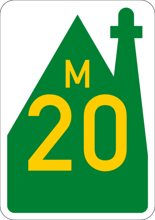
The R334 is a Regional Route in the Nelson Mandela Bay Metropolitan Municipality of South Africa that connects the N2 west of Port Elizabeth to the N2 at Coega north of Port Elizabeth via Uitenhage. The middle section of the route is also designated as the M20 metropolitan route.

The N2 is a national route in South Africa that runs from Cape Town through George, Gqeberha, East London, Mthatha, Port Shepstone and Durban to Ermelo. It is the main highway along the Indian Ocean coast of the country. Its current length of 2,255 kilometres (1,401 mi) makes it the longest numbered route in South Africa.

County Route 523 is a county highway in the U.S. state of New Jersey. The highway extends 29.55 miles (47.56 km) from Route 29 in Stockton to U.S. Route 202 (US 202) in Bedminster Township.

County Route 514 is a county highway in the U.S. state of New Jersey. The highway extends 42.86 miles (68.98 km) from its western terminus U.S. Route 202 (US 202) and Route 31 in East Amwell Township to its eastern terminus Edgar Road in Elizabeth. West of its western terminus, CR 514 continues as Route 179.

County Route 512 is a county highway in the U.S. state of New Jersey. The highway extends 32.96 miles (53.04 km) from High Bridge Road in Califon to Springfield Avenue / Route 24 in Summit.

National Cycle Route 1 is a route of the United Kingdom National Cycle Network, running from Dover to Tain. The 1,264 mi-long (2,034-kilometre) cycle-path is located in the United Kingdom.

U.S. Route 219 (US 219) is a part of the U.S. Highway System that runs from Rich Creek, Virginia, to West Seneca, New York. From near Grantsville, Maryland north to Ebensburg, Pennsylvania, US 219 is Corridor N of the Appalachian Development Highway System. From Meyersdale, Pennsylvania to just south of Carrolltown, Pennsylvania, US 219 is a limited-access highway. From Carrolltown US 219 runs largely as a two-lane road to DuBois, Pennsylvania, through which it runs as Brady Street, and then returns to a two-lane road after a junction with Interstate 80. US 219 runs directly through the towns of Brockway, Ridgway, and Johnsonburg before reaching Wilcox, where PA Route 321 splits and heads for the town of Kane. US 219 continues north as a two-lane road until reaching Bradford, where it becomes a limited-access highway and remains so until reaching the New York border. On August 9, 2007, Pennsylvania State Transportation Secretary Allen D. Biehler unveiled four signs along US Route 219 that dedicated the portion of the route in Somerset County, Pennsylvania as the Flight 93 Memorial Highway.

U.S. Route 22 (US 22) is a United States Numbered Highway stretching from Cincinnati, Ohio, in the west to Newark, New Jersey, in the east. In New Jersey, the route runs for 60.53 miles (97.41 km) from the Easton–Phillipsburg Toll Bridge over the Delaware River in Phillipsburg, Warren County, to Interstate 78 (I-78), US 1/9, and Route 21 at the Newark Airport Interchange in Newark, Essex County. The road first heads through the Phillipsburg–Alpha area as an arterial road before running concurrent with I-78 through mountainous and agricultural sections of western New Jersey between Alpha and east of Clinton in Hunterdon County. For the remainder of the route, US 22 runs to the south of I-78 through mostly suburban areas as a four- to six-lane arterial road, passing through Hunterdon, Somerset, Union, and Essex counties. Along this portion, it intersects US 202 and US 206 in Somerville, I-287 in Bridgewater Township, and the Garden State Parkway in Union.

The R62 is a provincial route in South Africa that connects Ashton with Humansdorp. The R62 runs through the Little Karoo and the Langkloof, passing through Montagu, Ladismith, Calitzdorp, Oudtshoorn, and Joubertina.

The N14 is a national route in South Africa which runs from Springbok in the Northern Cape to Pretoria in Gauteng. It passes through Upington, Kuruman, Vryburg, Krugersdorp and Centurion. The section between Pretoria and Krugersdorp is maintained by the Gauteng Provincial government and is also designated the P158.
M16 is a metropolitan route in the Greater Johannesburg metropolitan area, South Africa. It begins in the north-western suburb of Greenside and heads eastwards through some of Johannesburg's northern suburbs and through Edenvale to end at the East Rand town of Kempton Park.
St Georges Strand is a coastal village located along the Algoa Bay in the Eastern Cape, South Africa and is approximately 20 kilometres north of Port Elizabeth.
