
Carnarvon Highway is a state highway in Queensland and New South Wales, Australia, linking the township of Rolleston in Queensland's Central Highlands Region, via the town of St George, eventually to Moree in northern New South Wales. It is the main access road to the Carnarvon National Park, and serves as a strategic route to take B-doubles and other large vehicles to the Queensland ports north of Rockhampton.

The R23 is a provincial route in South Africa that links Benoni with Volksrust via Brakpan, Heidelberg and Standerton.

The R27 is a provincial route in South Africa that consists of two disjoint segments. The first segment, also known as the West Coast Highway, connects Cape Town with Velddrif along the West Coast. The second runs from Vredendal via Vanrhynsdorp, Calvinia, Brandvlei and Kenhardt to Keimoes on the N14 near Upington. The connection between Velddrif and Vredendal has never been built, although it can be driven on various gravel roads.

The R37 is a provincial route in South Africa that connects Polokwane with Mbombela via Burgersfort and Lydenburg (Mashishing).

The R63 is a tarred provincial route in South Africa that connects Calvinia with Komga via Carnarvon, Victoria West, Graaff-Reinet, Somerset East and King William's Town. It is cosigned with the N10 between Eastpoort and Cookhouse for 24 kilometres.
The R319 is a Regional Route in South Africa that connects L'Agulhas and Struisbaai in the south with the N2 near Swellendam via Bredasdorp.

The R353 is a Regional Route in South Africa that connects Leeu-Gamka with Brandvlei via Fraserburg and Williston.

The R357 is a Regional Route in South Africa that connects Nieuwoudtville and Kimberley via Loeriesfontein and Prieska.
The R358 is a Regional Route in South Africa that connects the N7 north of Bitterfontein with the Namibian border at Onseepkans via Pofadder.
The R362 is a Regional Route in South Africa that connects Strandfontein with the N7 at Klawer.
The R364 is a Regional Route in South Africa that connects Lamberts Bay to the R27 between Calvinia and Nieuwoudtville via Clanwilliam.
The R365 is a Regional Route in South Africa that connects Piketberg and Lamberts Bay.
The R383 is a Regional Route in South Africa that connects Kenhardt with the N8 between Groblershoop and Griekwastad.
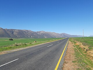
The R384 is a Regional Route in South Africa that connects Carnarvon with Britstown.
King's Highway 118, commonly referred to as Highway 118, is a provincially maintained highway in the Canadian province of Ontario. The route travels across South-Central Ontario between Highway 11 near Bracebridge and Highway 28 near Bancroft. Several communities are served by the route, including Uffington, Vankoughnet, Carnarvon, West Guilford, Haliburton Village, Tory Hill, Cardiff and Paudash.

Carnarvon is a small town in the Northern Cape Province of South Africa.
The N5 is a national route in South Africa that connects the N1 at Winburg with the N3 at Harrismith, via Senekal, Paul Roux and Bethlehem.

The N14 is a national route in South Africa which runs from Springbok in the Northern Cape to Pretoria in Gauteng. It passes through Upington, Kuruman, Vryburg, Krugersdorp and Centurion. The section between Pretoria and Krugersdorp is maintained by the Gauteng Provincial government and is also designated the P158.

Kenhardt is a small town in the Northern Cape province of South Africa. This little town is about 120 km from Upington, the largest town in the area.
The R708 is a Regional Route in South Africa that connects Jan Kempdorp in the Northern Cape with Clocolan in the Free State via Christiana, Hertzogville, Bultfontein, Theunissen, Winburg and Marquard.
